
Detroit Lake is a reservoir impounded by the Detroit Dam on the North Santiam River 46 miles (74 km) southeast of Salem, Oregon, United States. The lake is adjacent to Oregon Route 22 near the city of Detroit. This mesotrophic lake stores water for use by the city of Salem and other nearby communities.

Lake Gordon is a man-made reservoir created by the Gordon Dam, located on the upper reaches of the Gordon River in the south-west region of Tasmania, Australia.

The Vaal Dam in South Africa was constructed in 1938 and lies 77 km south of OR Tambo International Airport, Johannesburg. The lake behind the dam wall has a surface area of about 320 square kilometres (120 sq mi) and is 47 meters deep. The Vaal Dam lies on the Vaal River, which is one of South Africa's strongest-flowing rivers. Other rivers flowing into the dam are the Wilge River, Klip River, Molspruit and Grootspruit. It has over 800 kilometres (500 mi) of shoreline and is South Africa's second biggest dam by area and the fourth largest by volume.

Lake Isabella also called Isabella Lake, is a reservoir in Kern County, California, United States created by the earthen Isabella Dam. At 11,000 acres (4,500 ha), it is one of the larger reservoirs in California. Lake Isabella is located about 40 miles (64 km) northeast of Bakersfield, and is the main water supply for that city. It was formed in 1953 when the U.S. Army Corps of Engineers dammed the Kern River at the junction of its two forks. The area is in the southern end of the Sierra Nevada range and the lake itself is located in low mountains at an elevation of approximately 2,500 ft (760 m) where summer temperatures reach over 100 °F (38 °C) but low enough to avoid winter snows on the surrounding ridges. The former towns of Isabella and Kernville were flooded when the reservoir was created.

A reservoir is an enlarged lake behind a dam. Such a dam may be either artificial, usually built to store fresh water, or it may be a natural formation.

The Whiskeytown–Shasta–Trinity National Recreation Area is a United States National Recreation Area in northern California. The recreation area was authorized in 1965 by the United States Congress. Recreational activities available include swimming, fishing, boating, camping, and hiking.
The William Hovell Dam is a rock and earth-fill embankment dam with a flip bucket chute spillway across the King River, operated by Pacific Blue and located in the Hume region of Victoria, Australia. The purposes of the dam are for irrigation and the generation of hydroelectricity. The impounded reservoir is called Lake William Hovell.
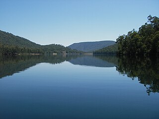
Lake Mackintosh is a 17.5-kilometre-long (10.9 mi) reservoir with a surface area of 3,100-hectare (7,700-acre) that forms part of the Pieman power development running north–south past Mount Farrell, adjacent to the town of Tullah in Tasmania.

Mary Kathleen was a mining settlement in north-western Queensland, Australia. It is located in the Selwyn Range between Mount Isa and Cloncurry.

Cressbrook Dam is one of the three water storages used to supply Toowoomba and the surrounding region in Queensland, Australia. The dam is 33 km (21 mi) north-east of Toowoomba in the locality of Biarra in the Somerset Region. It was constructed in 1983 for the former Toowoomba City Council. The other two storages used for Toowoomba are Perseverance Dam and Cooby Dam.
The Fred Haigh Dam is a dam in the Bundaberg Region, Queensland, Australia. It was constructed across the Kolan River in 1978 creating Lake Monduran. The dam's catchment area, north of Bundaberg in Queensland, covers 1308 km2. It is named after Frederick Haigh who was Queensland's Commissioner of Irrigation and Water Supply from 1955 to 1974. The Monduran Dam, under construction at the time of his death, was named after him upon completion.

The E.J. Beardmore Dam, an earth-fill embankment dam with a concrete gravity wall across the Balonne River, is located in South West Queensland, Australia. The main purpose of the dam is for irrigation. The resultant reservoir is called Lake Kajarabie.
East Leichhardt Dam is a dam built in 1961 on the East Leichhardt River which impounds Lake Mary Kathleen, Queensland. The dam is located 25 km east of Mount Isa, Queensland, and 9 km south of the Barkly Highway.
The Lake Clarendon Dam is a rock and earth-fill embankment dam with an un-gated spillway located off-stream in the locality of Lake Clarendon in the Lockyer Valley Region, South East Queensland, Australia. The main purpose of the dam is for irrigation of the Lockyer Valley. The resultant impounded reservoir is called Lake Clarendon.
Lake Manchester Dam is a concrete gravity dam with an un-gated spillway across Cabbage Tree Creek. It is also known as Cabbage Tree Creek Dam. It is in the locality of Lake Manchester, City of Brisbane, Queensland, Australia. The main purpose of the dam is for potable water supply of Brisbane. The impounded reservoir is called Lake Manchester.

The Southedge Dam, also known as the Lake Mitchell Dam, is an earth filled embankment dam across the Mitchell River located in Southedge, in Far North Queensland, Australia. Opened in 1987 as an ornamental lake, the impoundment created by the dam is called Lake Mitchell and at full supply level has an active capacity of 129,000 megalitres.
Langavatnet is a lake in Ullensvang Municipality in Vestland county, Norway. The 6.19-square-kilometre (2.39 sq mi) lake lies about 10 kilometres (6.2 mi) straight east of the town of Odda. The lake has a dam at the north end to regulate the water level for the purposes of hydroelectric power generation. The water of the lake previously flowed north to create the large Ringedalsfossen waterfall which now only flows when the lake gets too full. The water flows over the falls into the lake Ringedalsvatnet before flowing through the short river Tysso which empties into the Sørfjorden.

The Uryu Dam (雨竜ダム) is a dam complex in Hokkaidō, Japan on the Uryu River. It consists of two dams. It is a power generation dam managed by Hokkaido Electric Power Co., Inc., and is a gravity-type concrete dam with a bank height of 45.5 meters. Lake Shumarinai, which is an artificial lake, is more famous than a dam, but this lake is the largest artificial lake in Japan with a flooded area. This record has not yet been broken since it was completed in 1943 during the war.
Cherokee State Park is a 43-acre (170,000 m2) Oklahoma state park located in Mayes County, Oklahoma. It is located near the city of Disney, Oklahoma. Cherokee State Park is located in northeastern Oklahoma on the west shore of Grand Lake o' the Cherokees, one of Oklahoma's largest lakes with over 59,000 acres (240 km2) and 1,300 miles (2,100 km) of shoreline. The park consists of several smaller parks that are located near the Pensacola Dam and around the lake. The area is known for great fishing and a variety of water sports. Amenities include picnic sites, a group shelter, campsites, playgrounds, comfort stations, lighted boat ramp and a 9-hole golf course.
Grahamstown Dam is a major off-stream earthfill Embankment dam with a controlled labyrinth spillway and baffle chute that stores water from the Williams River. The dam is located north of Newcastle, New South Wales, Australia. The dam's main purpose is water supply; it provides about 40 per cent of the potable water for the Hunter Region; and is its largest drinking water supply dam.
