Bowen is a coastal town and locality in the Whitsunday Region, Queensland, Australia. In the 2016 census the locality of Bowen had a population of 10,377 people.

The Burdekin River is a river located in North and Far North Queensland, Australia. The river rises on the northern slopes of Boulder Mountain at Valley of Lagoons, part of the western slope of the Seaview Range, and flows into the Coral Sea at Upstart Bay over 200 kilometres (124 mi) to the southeast of the source, with a catchment area of approximately 130,000 square kilometres (50,000 sq mi). The Burdekin River is Australia's largest river by (peak) discharge volume.

The Pioneer River is a river located in North Queensland, Australia. The 120-kilometre (75 mi) long river flows through the city of Mackay.

Collinsville is a rural town and locality in the Whitsunday Region, Queensland, Australia. In the 2016 census, Collinsville had a population of 1,248 people.

Scottville is a rural town and locality in the Whitsunday Region, Queensland, Australia. In the 2016 census the locality of Scottville had a population of 259 people.

The Fairbairn Dam is an earth-filled embankment dam across the Nogoa River, located southwest of Emerald in Central Queensland, Australia. Constructed in 1972 for the primary purpose of irrigation, the impoundment created by the dam serves as one of the major potable water supplies for the region and assists with some flood mitigation. Lake Maraboon with an active capacity of 1,301,000 ML (2.86×10¹¹ imp gal; 3.44×10¹¹ US gal) was formed by damming of the Nogoa River, and, in 2008, was Queensland's second largest dam. Its capacity is approximately three times larger than Sydney Harbour. Maraboon is the Aboriginal for "where the black ducks fly".

Wuruma Dam was constructed across the Nogo River in the upper Burnett River Catchment 48km north-west of Eidsvold for irrigation & town water supply for Eidsvold, Mundubbera and Gayndah. The dam wall is of mass concrete gravity construction which cost $5.3m to build and was completed in 1968. It has a surface area when full of 1,639 hectares, and a capacity of 165,400 ML. The dam takes its name from a local indigenous word meaning brahminy kite.

Eungella Dam is an earth and rockfill dam in the locality of Eungella Dam, Mackay Region, Queensland, Australia. It is one of Queensland's freshwater fisheries. Eungella has made a name for producing extra oversized sooty grunter and more recently barramundi.

Lake Julius was formed following the construction of Julius Dam in 1976 for irrigation and town water storage. The dam wall is located just below the junction of the Leichhardt River and Paroo Creek some 70 kilometres (43 mi) North East of Mount Isa. With a catchment area of 4,845 square kilometres it has a full supply capacity of 107,500 megalitres, a surface area of 1,255 hectares with an average depth of 8.9 metres (29 ft).

Cania Dam is a dam in central Queensland, Australia, 37 kilometres (23 mi) north west of Monto, in the locality of Cania. The dam is situated on Three Moon Creek, a tributary of the Burnett River. The dam wall is an earth and rock-fill embankment type. It has a surface area of 7.6 square kilometres, an average depth of 12 metres (39 ft) and a capacity of 88,580 ML. The dam is named after the abandoned gold mining town of Cania, which was inundated by the lake as it filled.

The Bromelton Dam is an earth-fill embankment dam located off-stream at Gleneagle in the South East region of Queensland, Australia. The main purpose of the dam is for potable water supply of the Beaudesert area. The resultant reservoir is called Bromelton Offstream Storage.

The Cedar Grove Weir is a weir located across the Logan River in the South East region of Queensland, Australia. The main purpose of the weir is for potable water storage.

The Callide Dam is an earth and rock-fill dam which was constructed in 1965 to supply water for a nearby power station in Biloela in the state of Queensland, Australia. Callide Dam holds 136,370 megalitres (3.603×10¹⁰ US gal) at an average depth of 10.5 metres (34 ft) and a surface area of 1,240 hectares (3,100 acres) at full capacity.

Kinchant Dam is a dam in the locality of Kinchant Dam in the Mackay Region, Queensland, Australia. It created the reservoir Lake Kinchant. It has a storage capacity of 72,235 megalitres.

The Paradise Dam, also known as the Burnett River Dam, is a roller compacted concrete (RCC) gravity dam across the Burnett River, located northwest Biggenden and 80 kilometres (50 mi) southwest of Bundaberg in the Wide Bay-Burnett region of Queensland, Australia. Built for irrigation, the impoundment created by the dam is called Lake Paradise.

The Mount Crosby Weir is a heritage-listed weir on the Brisbane River at Mount Crosby and Chuwar, both in City of Brisbane, Queensland, Australia. The project was instigated by John Petrie at the end of the 19th century. The town of Brisbane was expanding and seeking more reliable sources of drinking water than Enoggera Dam and Gold Creek Dam could provide. In conjunction with the Mount Crosby Pumping Station, it was listed on the Queensland Heritage Register on 25 October 2019.

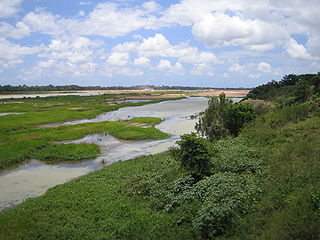
The Bowen River is a river located in North Queensland, Australia.

Bingegang is a rural locality in the Central Highlands Region, Queensland, Australia. In the 2016 census Bingegang had a population of 18 people.

Bogie is a rural locality in the Whitsunday Region, Queensland, Australia. In the 2016 census, Bogie had a population of 161 people.


