Goodedulla is a national park in Queensland, Australia, 573 km (356 mi) northwest of Brisbane. The park is located in the centre of the Brigalow Belt.

Palm Island is a locality consisting of an island group of 16 islands, split between the Shire of Hinchinbrook and the Aboriginal Shire of Palm Island, in Queensland, Australia. The locality coincides with the geographical entity known as the Palm Island group, also known as the Greater Palm group, originally named the Palm Isles.
Lake Wivenhoe is the name both an artificial lake formed by the Wivenhoe Dam and the locality which contains it in the Somerset Region, Queensland, Australia. In the 2016 census, Lake Wivenhoe had a population of three people.
The Mona Mona Aboriginal Mission is a former Seventh-day Adventist mission for Aboriginal people established around 1913 near Kuranda, Queensland, Australia.
Palm Island Airport is an airport in Palm Island, on Great Palm Island, Queensland, Australia.
The Fred Haigh Dam is a dam in the Bundaberg Region, Queensland, Australia. It was constructed across the Kolan River in 1978 creating Lake Monduran. The dam's catchment area, north of Bundaberg in Queensland, covers 1308 km2. It is named after Frederick Haigh who was Queensland's Commissioner of Irrigation and Water Supply from 1955 to 1974. The Monduran Dam, under construction at the time of his death, was named after him upon completion.
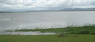
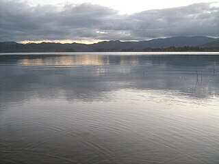
Bamboo Dam is one of three man-made bodies of fresh water on Great Palm Island, Queensland, Australia, and is located near the peak of Mount Bentley.
The Poona Dam is an earth-fill embankment dam with a toe drain with an un-gated spillway across a tributary of the South Maroochy River in Kureelpa, Sunshine Coast Region, Queensland, Australia. The main purpose of the dam is for storage of potable water for the Sunshine Coast region. The impounded reservoir is also called Poona Dam.
The Lake Clarendon Dam is a rock and earth-fill embankment dam with an un-gated spillway located off-stream in the locality of Lake Clarendon in the Lockyer Valley Region, South East Queensland, Australia. The main purpose of the dam is for irrigation of the Lockyer Valley. The resultant impounded reservoir is called Lake Clarendon.
The Bromelton Dam is an earth-fill embankment dam located off-stream at Gleneagle in the South East region of Queensland, Australia. The main purpose of the dam is for potable water supply of the Beaudesert area. The resultant reservoir is called Bromelton Offstream Storage.
The Cedar Grove Weir is a weir located across the Logan River in the South East region of Queensland, Australia. The main purpose of the weir is for potable water storage.
Kinchant Dam is a dam in the locality of Kinchant Dam in the Mackay Region, Queensland, Australia. It created the reservoir Lake Kinchant. It has a storage capacity of 72,235 megalitres.
Teemburra Dam was constructed in 1997 for town water storage and irrigation purposes. It is located approximately 50 km west of Mackay, Queensland. It has a surface area of 1,040 hectares, an average depth of 14.2 metres and holds 147,500 Ml.
The Biggera Creek Dam, or formally the Biggera Creek Flood Mitigation Dam, is a dam established for flood mitigation purposes over the Biggera Creek, located in the South East region of Queensland, Australia. The dam is situated approximately 3 kilometres (1.9 mi) northwest of Southport in the suburb of Arundel. It is operated by the Gold Coast City Council.

The Tallebudgera Creek Dam, or colloquially Tally Dam, is a decommissioned embankment dam across the upper reaches of the Tallebudgera Creek, located in the South East region of Queensland, Australia. The initial purpose of the dam from its establishment until its decommissioning during the 1970s was for the supply of potable water to the Gold Coast region. There is no public access to the dam.

The Southedge Dam, also known as the Lake Mitchell Dam, is an earth filled embankment dam across the Mitchell River located in Southedge, in Far North Queensland, Australia. Opened in 1987 as an ornamental lake, the impoundment created by the dam is called Lake Mitchell and at full supply level has an active capacity of 129,000 megalitres.

The Maroochy River is a river in South East Queensland, Australia. The river rises from the eastern slopes of the Blackall Range and flows east through Eumundi, before entering the sea at Cotton Tree, Maroochydore. Other populated centres in the catchment include Nambour, Eudlo, Yandina and Coolum.
The Mount Crosby Weir is a heritage-listed weir on the Brisbane River at Mount Crosby and Chuwar, both in City of Brisbane, Queensland, Australia. The project was instigated by John Petrie at the end of the 19th century. The town of Brisbane was expanding and seeking more reliable sources of drinking water than Enoggera Dam and Gold Creek Dam could provide. In conjunction with the Mount Crosby Pumping Station, it was listed on the Queensland Heritage Register on 25 October 2019.
Great Palm Island, usually known as Palm Island, is the largest island in the Palm Islands group off Northern Queensland, Australia. It is known for its Aboriginal community, the legacy of an Aboriginal reserve, the Palm Island Aboriginal Settlement. The original inhabitants of the island were the Manbarra people, also known as the Wulgurukaba, who were removed to the mainland by the Queensland Government in the 1890s. The island is also sometimes referred to as Bwgcolman, which is the name given to the Aboriginal and Torres Strait Islander people from disparate groups who were deported from many areas of Queensland to the reserve in 1918, and their descendants.

The Nindooinbah Dam is a decommissioned earth-fill embankment dam with an un-gated spillway located off-stream in the South East region of Queensland, Australia. The sole purpose of the dam is for recreation.
