
Roma is a town, locality and the administrative centre in the Maranoa Region, Queensland, Australia. The town was incorporated in 1867 and is named after Lady Diamantina Bowen, the wife of Sir George Bowen, the Governor of Queensland at the time. At the 2016 census, Roma had a population of 6,848.
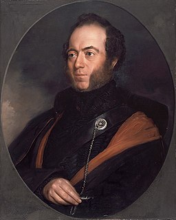
Sir Thomas Livingstone Mitchell, surveyor and explorer of Southeastern Australia, was born at Grangemouth in Stirlingshire, Scotland. In 1827 he took up an appointment as Assistant Surveyor General of New South Wales. The following year he became Surveyor General and remained in this position until his death. Mitchell was knighted in 1839 for his contribution to the surveying of Australia.
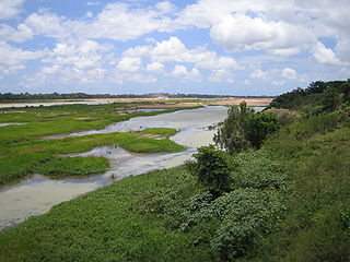
The Burdekin River is a river located in North and Far North Queensland, Australia. The river rises on the northern slopes of Boulder Mountain at Valley of Lagoons, part of the western slope of the Seaview Range, and flows into the Coral Sea at Upstart Bay over 200 kilometres (124 mi) to the southeast of the source, with a catchment area of approximately 130,000 square kilometres (50,000 sq mi). The Burdekin River is Australia's largest river by (peak) discharge volume.

The Balonne River, part of the Murray-Darling Basin system, is a short yet significant part of the inland river group of South West Queensland, Australia.
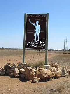
Blackwater is a rural town and locality in the Central Highlands Region, Queensland, Australia. In the 2016 census, Blackwater had a population of 4,749 people.
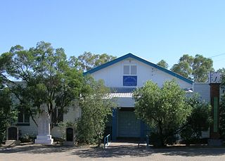
Augathella is a rural town and locality in the Shire of Murweh, Queensland, Australia. In the 2016 census, Augathella had a population of 449 people.

The Mitchell River is a river located in Far North Queensland, Australia. The river rises on the Atherton Tableland about 50 kilometres (31 mi) northwest of Cairns and flows about 750 kilometres (470 mi) northwest across Cape York Peninsula from Mareeba to the Gulf of Carpentaria.

Surat is a rural town and locality in the Maranoa Region, Queensland, Australia. In the 2016 census, the locality had a population of 407 people.

The Shire of Balonne is a local government area in South West Queensland, Australia, over 500 kilometres (310 mi) from the state capital, Brisbane. It covers an area of 31,104 square kilometres (12,009.3 sq mi), and has existed as a local government entity since 1879. It is headquartered in its main town, St George.

Mitchell is a town and locality in the Western Downs district of the Maranoa Region, Queensland, Australia. The town services the local area, a cattle and sheep farming district. In the 2016 census, Mitchell had a population of 1031 people.
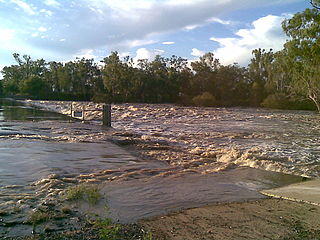
The Dawson River is a river located in Central Queensland, Australia.

The Mary River is a major river system located in the South East and Wide Bay–Burnett regions of Queensland, Australia.

The Ross River is a river located in northern Queensland, Australia. The 49-kilometre (30 mi) long river flows through the city of Townsville and empties into the Coral Sea. It is the major waterway flowing through Townsville and the city's main source of drinking water.

The Shire of Booringa was a local government area in the Maranoa region of Queensland, Australia. The largest town and home of the shire administration was Mitchell. It existed from 1879 to 2008. The shire is now part of the Maranoa Region.

Yuleba is a rural town and locality in the Maranoa Region, in the south-west of Queensland, Australia. In the 2016 census, Yuleba had a population of 207 people.

Maranoa Region is a local government area in South West Queensland, Australia. The town of Roma is the administrative headquarters of the region.

The Maranoa River, part of the Murray-Darling basin, is a river situated in South West Queensland, Australia.

The Moonie River is a river in Shire of Balonne, Queensland and Walgett Shire, New South Wales, both in Australia. It is a perennial river of the Barwon catchment within the Murray–Darling basin.

South West Queensland is a remote region in the Australian state of Queensland which covers 319,808 km2 (123,479 sq mi). The region lies to the south of Central West Queensland and west of the Darling Downs and includes the Maranoa district and parts of the Channel Country. The area is noted for its cattle grazing, cotton farming, opal mining and oil and gas deposits.

Mungallala is a town and a locality in the Maranoa Region, Queensland, Australia. In the 2016 census, Mungallala had a population of 136 people.


