
The Hinze Dam is a rock and earth-fill embankment dam with an un-gated spillway across the Nerang River in the Gold Coast hinterland of South East, Queensland, Australia. The main purpose of the dam is for potable water supply of the Gold Coast region. The impounded reservoir is called Advancetown Lake.

The Wivenhoe Dam is a rock and earth-fill embankment dam with a concrete spillway across the Brisbane River in South East Queensland, Australia. The dam wall is located about 80 kilometres (50 mi) by road from the centre of Brisbane. The primary purpose of the dam is the supply of potable water for the Brisbane and Ipswich regions. In addition, the dam also provides for flood mitigation control, hydroelectricity and for recreation. The impounded reservoir is called Lake Wivenhoe and the dam, the lake and a narrow strip of surrounding land forms a locality also called Lake Wivenhoe.

The Maroon Dam is a rock and earth-fill embankment dam with an un-gated spillway across the Burnett Creek that is located in the South East region of Queensland, Australia. The main purpose of the dam is for irrigation of the Scenic Rim Regional Council region. The impounded reservoir is also called Maroon Dam.

The North Pine Dam is a mass concrete gravity dam with earth-fill embankments on abutments with a gated spillway across the North Pine River that is located in the South East region of Queensland, Australia. The main purpose of the dam is for supply of potable water for the Moreton Bay region and Brisbane's northern suburbs. The impounded reservoir is called Lake Samsonvale.

The Burdekin Dam, officially the Burdekin Falls Dam, is a concrete gravity dam with an uncontrolled spillway across the Burdekin River, located south west of Ayr, and Home Hill in North Queensland, Australia. Built for the purpose of irrigation, the reservoir, called Lake Dalrymple. Burdekin Dam is managed by SunWater. Water from the reservoir is also used to replenish downstream aquifers.

Cressbrook Dam is one of the three water storages used to supply Toowoomba and the surrounding region in Queensland, Australia. The dam is 33 km (21 mi) north-east of Toowoomba in the locality of Biarra in the Somerset Region. It was constructed in 1983 for the former Toowoomba City Council. The other two storages used for Toowoomba are Perseverance Dam and Cooby Dam.

The Cooby Dam is a rock–fill embankment dam with an un–gated spillway across the Cooby Creek, a tributary of Condamine River, at Groomsville in the Darling Downs region of Queensland, Australia. The main purpose of the dam is for potable water supply of the Toowoomba region. The impounded reservoir is called the Cooby Creek Reservoir.
The Fred Haigh Dam is a dam in the Bundaberg Region, Queensland, Australia. It was constructed across the Kolan River in 1978 creating Lake Monduran. The dam's catchment area, north of Bundaberg in Queensland, covers 1308 km2. It is named after Frederick Haigh who was Queensland's Commissioner of Irrigation and Water Supply from 1955 to 1974. The Monduran Dam, under construction at the time of his death, was named after him upon completion.

The Bjelke-Petersen Dam is a dam in Moffatdale near Cherbourg in the South Burnett Region, Queensland, Australia. The dam impounds Barker Creek and creates Lake Barambah. It is named after the Queensland Premier Joh Bjelke-Petersen. It is operated by Sunwater.

Boondooma Dam is a dam on the Boyne River on the boundary of Boondooma and Proston in the South Burnett Region of Queensland, Australia. In 1983, the dam was constructed across the Boyne River below its confluence with the Stuart River.

The Bill Gunn Dam is an earth-fill embankment dam with an un-gated spillway located off-stream in Laidley Heights in the South East region of Queensland, Australia. The main purpose of the dam is for irrigation of the Lockyer Valley. The resultant reservoir is called Lake Dyer.
Lake Proserpine, which is also known as Peter Faust Dam is situated 26 kilometres inland from Proserpine, in North Queensland, Australia. Free 72hr camping is now available from October 4th, 2019.
The Lake Clarendon Dam is a rock and earth-fill embankment dam with an un-gated spillway located off-stream in the locality of Lake Clarendon in the Lockyer Valley Region, South East Queensland, Australia. The main purpose of the dam is for irrigation of the Lockyer Valley. The resultant impounded reservoir is called Lake Clarendon.
Cania Dam is a dam in central Queensland, Australia, 37 kilometres (23 mi) north west of Monto, in the locality of Cania. The dam is situated on Three Moon Creek, a tributary of the Burnett River. The dam wall is an earth and rock-fill embankment type. It has a surface area of 7.6 square kilometres, an average depth of 12 metres (39 ft) and a capacity of 88,580 ML. The dam is named after the abandoned gold mining town of Cania, which was inundated by the lake as it filled.
Kinchant Dam is a dam in the locality of Kinchant Dam in the Mackay Region, Queensland, Australia. It created the reservoir Lake Kinchant. It has a storage capacity of 72,235 megalitres.
Teemburra Dam was constructed in 1997 for town water storage and irrigation purposes. It is located approximately 50 km west of Mackay, Queensland. It has a surface area of 1,040 hectares, an average depth of 14.2 metres and holds 147,500 Ml.

The Coolmunda Dam is an earth–fill embankment dam with a gated spillway across the Macintrye Brook, a tributary of the Dumaresq River, that is located on Darling Downs in Queensland, Australia. The main purposes of the dam are for irrigation and potable water supply. The impounded reservoir is called the Lake Coolmunda.

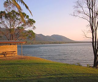
The Six Mile Creek Dam is a rock and earth-fill embankment dam with an un-gated spillway across the Six Mile Creek that is located in the South East region of Queensland, Australia. The main purposes of the dam are for potable water supply of the Sunshine Coast region and for recreation. The impounded reservoir is called Lake Macdonald, named in memory of former Noosa Shire Council Chairman Ian MacDonald.
Lake Lenthall is a lake created by the Lenthalls Dam in Duckinwilla, Fraser Coast Region, Queensland, Australia. As a result of a 518 square kilometres (200 sq mi) catchment, it takes a short time in moderate rain events to fill Lake Lenthall to 100% capacity.
Lake Monduran is a rural locality in the Bundaberg Region, Queensland, Australia. In the 2016 census Lake Monduran had a population of 3 people.
