The Canberra District wine region is located around Canberra in the Capital city of Australia. It covers the northern part of the Australian Capital Territory and an area of New South Wales to the east and north of that, including towns of Bungendore, Murrumbateman and Yass, New South Wales.

The Southern Highlands, also locally referred to as the Highlands, is a geographical region and district in New South Wales, Australia and is 110 km south-west of Sydney. The region comprises the local government area of the Wingecarribee Shire and also towns of the Mulwaree Shire. The region is also considered a wine region.

Bundanoon is a town in the Southern Highlands of New South Wales, Australia, in Wingecarribee Shire, on Gandangarra and Dharawal Country. It is an Aboriginal name meaning "place of deep gullies" and was formerly known as Jordan's Crossing. Bundanoon is colloquially known as Bundy/Bundi.

Bowral is the largest town in the Southern Highlands of New South Wales, Australia, about ninety minutes southwest of Sydney. It is the main business and entertainment precinct of the Wingecarribee Shire and Highlands.

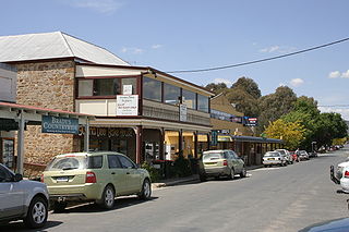
Mittagong is a town located in the Southern Highlands of New South Wales, Australia, in Wingecarribee Shire. The town acts as the gateway to the Southern Highlands when coming from Sydney. Mittagong is situated at an elevation of 635 metres (2,083 ft). The town is close to Bowral, Berrima, Moss Vale and the Northern Villages such as Yerrinbool and Colo Vale. Moreover, Mittagong is home to many wineries of the Southern Highlands which has been a recent growing wine and cellar door region.

The Southern Highlands Line (SHL) is an intercity rail service that services the Macarthur, Southern Highlands and Southern Tablelands regions of New South Wales. First operating in 1869, the service runs from Campbelltown across the Main Southern railway line through to Goulburn, with peak hour services extending the route to Central. The railway service operates alongside a bus route from Picton to Bowral, operating on the route of the Picton – Mittagong loop railway line, and a regional coach service from Bundanoon to Wollongong on the South Coast Line, operating on the corridor of the Unanderra–Moss Vale railway line.

Mittagong railway station is a heritage-listed railway station on the Main Southern line in New South Wales, Australia. It serves the town of Mittagong in the Southern Highlands. It was added to the New South Wales State Heritage Register on 2 April 1999.

Bowral railway station is a heritage-listed railway station located on the Main Southern line in New South Wales, Australia. It serves the town of Bowral opening on 1 March 1867.

The Palerang Council was a local government area located in the Southern Tablelands region of New South Wales, Australia. On 12 May 2016 the Minister for Local Government announced dissolution of the Palerang Council with immediate effect. Together with Queanbeyan City the combined council areas were merged to establish the Queanbeyan-Palerang Regional Council. Both councils had opposed the amalgamation. Elections for the new Council area were held in September 2017. The former mayor of Queanbeyan City Council was appointed by the New South Wales Government as administrator until that date.

Bungendore is a town in the Queanbeyan Region of New South Wales, Australia, in Queanbeyan-Palerang Regional Council. It is on the Kings Highway near Lake George, the Molonglo River Valley and the Australian Capital Territory border. It has become a major tourist centre in recent years, popular with visitors from Canberra and some of it has heritage protection. It has expanded rapidly in recent years as a dormitory town of Canberra.

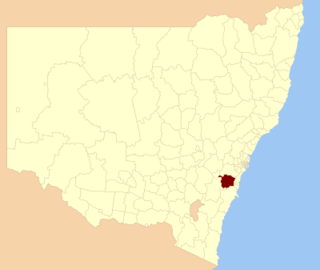
Wingecarribee Shire is the local government area of the Southern Highlands in the state of New South Wales, Australia. The Wingecarribee Shire is around 110 kilometres (70 mi) southwest of Sydney and is part of regional Capital Country and to some extent can be considered part of the Southern Tablelands.

Wombeyan Caves Road is a New South Wales country road linking Mittagong near Hume Highway in the east to Goulburn-Oberon Road at the locality of Richlands in the west.
Balmoral is a Northern Village of the Southern Highlands area of New South Wales, Australia. It is the northernmost village in Wingecarribee Shire.
The Parish of Mittagong is a parish of the County of Camden in the Southern Highlands region of New South Wales. It includes the town of Bowral and the southern parts of Mittagong.
Bowral is a town in the Southern Highlands of New South Wales, Australia. It has a history spanning nearly 200 years.
Gibraltar Hill may refer to:

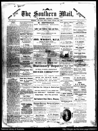
The Southern Highland News is a newspaper published since 1958 in Bowral, New South Wales, Australia. It has incorporated a number of other newspapers including The Southern Mail, The Robertson Mail, The Moss Vale Mail, The Mittagong Mail and The Mittagong Star.

The Chalybeate Spring at Mittagong, New South Wales was a perennial, carbonated, chalybeate (iron-rich) mineral spring.
Mittagong Shire was a local government area in the Southern Highlands region of New South Wales, Australia.

The Macarthur Conference Rugby League is a senior Rugby league competition in New South Wales, Australia, administered by the New South Wales Rugby League. Formerly known as Group 6 Rugby League, the competition was, until 2019, run under the auspices of the Country Rugby League. The geographical area covered by the former CRL Group 6 takes in much of the Southern Highlands and southern Macarthur regions of New South Wales, extending from Marulan, New South Wales in the south, to Mount Annan/ the M5 in the north and Warragamba in the west.


