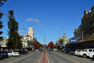
Goulburn is a regional city in the Southern Tablelands of New South Wales, Australia, approximately 195 kilometres (121 mi) south-west of Sydney and 90 kilometres (56 mi) north-east of Canberra. It was proclaimed as Australia's first inland city through letters patent by Queen Victoria in 1863. Goulburn had a population of 24,565 at June 2021. Goulburn is the seat of Goulburn Mulwaree Council.

Taralga is the traditional land of the Gundungurra people. Today it is a small village in the Southern Tablelands of New South Wales, Australia, in Upper Lachlan Shire. It is located at the intersection of the Goulburn-Oberon Road and the Laggan-Taralga Road. It is accessible from Oberon to the north, Mittagong to the east, Goulburn to the south, and Crookwell to the west. At the 2016 census, Taralga had a population of 467. Taralga is located relatively close to the famous Wombeyan Caves. The town experiences a volatile climate and is sometimes affected by snow in the winter months.

The Division of Hume is an Australian electoral division in the state of New South Wales.
The Chatsbury/Bungonia bushfires of 1965 was a series of bushfires that burned from 5 to 14 March 1965 in the Southern Highlands region of New South Wales, Australia. The fires destroyed the villages of Tallong, Wingello, and most of the surrounding orchards.
Tallong Public School is a co-educational government primary school located in Tallong, New South Wales, Australia. Established in 1865 in what was then Barber's Creek, it is the oldest surviving single-teacher schoolhouse in Australia. Workers on the Great Southern Railway were engaged in building a viaduct at Barber's Creek, and since the nearest government school was five miles away at Marulan, they built the schoolhouse. In July 1865, 75 persons signed a petition to the National Board of Education, requesting that the board pay the salary of a teacher whom they had already hired; the parents paid fees to the teacher but could not afford an adequate salary.
Towrang is a village in the Southern Tablelands of New South Wales, Australia, in Goulburn Mulwaree Council. It is approximately 13 kilometres (8.1 mi) north of Goulburn on the Hume Highway 180 kilometres (110 mi) south from Sydney. At the 2016 census, Towrang had a population of 171.

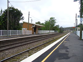
Marulan railway station is a heritage-listed railway station located on the Main Southern line in New South Wales, Australia. It serves the town of Marulan. It opened on 6 August 1868. It was added to the New South Wales State Heritage Register on 2 April 1999.
Marulan is a small town east of the Great Dividing Range and is located in the Southern Highlands of New South Wales, Australia. It is in the Goulburn Mulwaree Council local government area and the traditional lands of the Gundungurra people. It is located south-west of Sydney on the Hume Highway, although it bypasses the town proper. Marulan lies on the 150th meridian east. It has a railway station on the Main Southern railway line. Marulan was previously known as Mooroowoolen.

Goulburn is an electoral district of the Legislative Assembly in the Australian state of New South Wales. It is represented by Wendy Tuckerman of the Liberal Party.

Bungonia is a small town in the Southern Tablelands in New South Wales, Australia in Goulburn Mulwaree. At the 2016 census, Bungonia had a population of 367. The name of the town derives from an Aboriginal word meaning 'sandy creek'.

The Parish of Marulan is a parish of Argyle County located with the Goulburn Mulwaree local government area, which includes the towns of Marulan and Marulan South. The parish is bounded by Barbers Creek to the east, a small part of the Shoalhaven River to the south-east, and Jerrara Creek to the south. The Hume Highway and the Southern Highlands railway line run through the parish. Jerrara Road and Marulan South Road are other main roads in the area.
The Parish of Wingello is a parish of the County of Camden in the Southern Highlands region of New South Wales. It includes the area around the village of Wingello, and also includes the village of Tallong. The parish is located at the western end of the County of Camden, with Uringalla Creek the boundary to the west. The Southern Highlands railway line passes through the parish, including the stations of Tallong and Wingello. The Hume Highway passes through a small part of the parish in the north-west. Other roads in the area include Murrimba Road, Garbutts Road, and parts of Highland Way and Bumballa Road. Joarimma creek forms a small portion of the boundary in the south-west, with the parish including some of the land to the south of this creek.

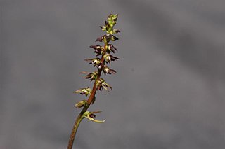
Genoplesium plumosum, commonly known as the Tallong midge-orchid or plumed midge-orchid, is a species of orchid endemic to New South Wales. It is a small orchid only known from a few sites near the towns of Tallong and Wingello on the Southern Tablelands and is only relatively easy to find for about a month, when it flowers. It has been classified as "Endangered" under the EPBC Act.

Genoplesium commonly known as midge orchids, is a genus of about 50 species of flowering plants in the orchid family, Orchidaceae and is found in Australia, New Zealand and New Caledonia. Midge orchids are terrestrial herbs with a single leaf at the base of the plant. They are similar to orchids in the genus Prasophyllum in that plants without flowers have a hollow, onion-like leaf. The flowers are small but often scented and attractive to their insect pollinators. There is disagreement about which species belong to this genus and some taxonomists suggest that most belong in the genus Corunastylis.

Goulburn Mulwaree Council is a local government area located in the Southern Tablelands region of New South Wales, Australia. The area is located adjacent to the Hume Highway and the Southern Highlands railway line. The estimated resident population of the area stood at 32,053 on 2021 census.

Larbert is a locality in the Queanbeyan-Palerang Region of the Southern Tablelands region of New South Wales. It lies mostly north of the Kings Highway between Bungendore and Braidwood where it crosses the Shoalhaven River. At the 2021 census, it had a population of 34.

Old Marulan Town is a heritage-listed former townscape at Marulan, New South Wales, Australia. It is the site of the original Marulan township prior to the moving of the village in the 1860s in the wake of the Main Southern railway bypassing the original town. It is also known as Mooroowoolen. It was built from 1835 to 1867. It was added to the New South Wales State Heritage Register on 2 April 1999.

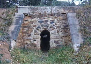
Towrang Convict Stockade is a heritage-listed former convict stockade on the Old Hume Highway at Towrang, Goulburn Mulwaree Council, New South Wales, Australia. It was built from 1838 to 1843 by convict gangs. It was added to the New South Wales State Heritage Register on 1 February 2013.
The Goulburn Viaduct is a heritage-listed railway bridge that carries the Main Southern railway line across the Mulwaree River at Goulburn, in the Goulburn Mulwaree Council local government area of New South Wales, Australia. It was built in 1915. It is also known as Mulwaree River Railway Viaduct. The property is owned by Transport Asset Holding Entity, an agency of the Government of New South Wales. It was added to the New South Wales State Heritage Register on 2 April 1999.
Mulwaree Shire was a local government area in the Southern Tablelands region of New South Wales, Australia.


