Queanbeyan is a city in the south-eastern region of New South Wales, Australia, located adjacent to the Australian Capital Territory in the Southern Tablelands region. Located on the Queanbeyan River, the city is the council seat of the Queanbeyan-Palerang Regional Council. At the 2016 census, the Queanbeyan part of the Canberra–Queanbeyan built-up area had a population of 36,348.
Queanbeyan City was a local government area located in south eastern New South Wales, Australia. The former area is located adjacent to Canberra and the Australian Capital Territory, the Queanbeyan River, the Molonglo River, the Kings Highway and the Sydney-Canberra railway.

Hume is a suburb of Canberra in the District of Jerrabomberra. The suburb is named after the explorer Hamilton Hume and streets are named after Australian industrialists and businessmen. Hume is a light-industrial suburb and there is no significant housing development. At the 2021 census, Hume had a population of 395, up from six in 2006, as a result of the construction of the Alexander Maconochie Centre. The location of the prison has also given Hume a highly unusual gender ratio with 92.7% of the permanent population being male.
Oaks Estate is a township situated immediately on the northern side of the Australian Capital Territory border abutting the township of Queanbeyan in south-eastern New South Wales, Australia. The estate covers an area of approximately 40 hectares and is bound by the Molonglo River to the north, the Queanbeyan River to the east, 'The Oaks' to the west, and the Queanbeyan-Cooma railway to the south. Oaks Estate is located 12 kilometres from the centre of Canberra. The village is also noteworthy as the nucleus of Queanbeyan's industrial development during the second half of the 19th century. Oaks Estate takes its name from 'The Oaks', which was part of Duntroon, Robert Campbell's farming estate. This makes Oaks Estate one of only a few place names in the ACT with significant connections to early colonial times.
Jerrabomberra is a suburb of Queanbeyan in south eastern New South Wales, Australia. Jerrabomberra consists of three sections, The Park, The Heights, and Lakeview. The Park and the Heights are divided by Edwin Land Parkway. At the 2021 census, it had 9,601 people, up from 9,508 in 2016, 9,420 in 2011, and 8,747 in 2006. Jerrabomberra is derived from the local Aboriginal place name meaning "boy frightened by storm".

Monaro, also known as Maneroo (1856–58), Monara (1858-1879) and Manaro (1894-1904) is an electoral district of the Legislative Assembly in the Australian state of New South Wales. It is currently represented by Nichole Overall of the National Party.
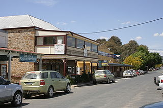
Bungendore is a town in the Queanbeyan Region of New South Wales, Australia, in Queanbeyan-Palerang Regional Council. It is on the Kings Highway near Lake George, the Molonglo River Valley and the Australian Capital Territory border. It has become a major tourist centre in recent years, popular with visitors from Canberra and some of it has heritage protection. It has expanded rapidly in recent years as a dormitory town of Canberra.

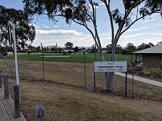
Karabar is a suburb of Queanbeyan, New South Wales. It is at the southern part of the developed area of Queanbeyan—-bordering the suburbs of Queanbeyan East, Jerrabomberra, Googong and Queanbeyan. The eastern border of the suburb is defined by the Queanbeyan River. As well as a shopping centre it contains netball courts, several ovals and public high and primary schools. It is dominated by Mount Jerrabomberra, which overlooks the suburb. At the 2021 census, Karabar had a population of 8,517 people.
Greenleigh is an acreage estate to the east of the City of Queanbeyan in New South Wales, Australia. It was formerly known as Dodsworth. At the 2021 census, Greenleigh had a population of 676.

Queanbeyan East is a suburb of Queanbeyan in New South Wales, Australia. It is on the north eastern side of the Queanbeyan River, with the river forming its western boundary. At the 2021 census, it had a population of 4,240.
Environa is a suburb and locality of Queanbeyan, located in the Queanbeyan–Palerang Regional Council, in New South Wales, Australia, west of Jerrabomberra Creek and nearby the New South Wales and Australian Capital Territory border. The suburb was historically designated as a planned community that subsequently did not come to fruition, however, Environa has since been allocated as part of the South Jerrabomerra development of Queanbeyan for proposed development, including the proposed developments of Tralee and Poplars.

Queanbeyan West is a suburb of Queanbeyan, New South Wales, Australia. Queanbeyan West is located west of the central business district (CBD) and also borders the Australian Capital Territory, it is located south of Crestwood and Canberra Avenue and west of Tharwa Road. At the 2021 census, it had a population of 3,146.
Crestwood is a suburb of Queanbeyan, New South Wales, Australia. Crestwood is located west of the central business district (CBD) to the west of Ross Road and the north of Canberra Avenue and also borders the Australian Capital Territory. At the 2021 census, it had a population of 4,936.

Hoskinstown is a locality in Queanbeyan-Palerang Regional Council, New South Wales, Australia. The locality, and what remains of the cluster of settlement of the same name, is 38 km southeast of Canberra the Capital city of Australia, and 299 km southwest of Sydney. At the 2016 census, it had a population of 189.

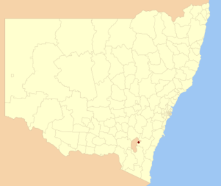
Queanbeyan–Palerang Regional Council is a local government area located in the Southern Tablelands region of New South Wales, Australia. The council was formed on 12 May 2016 through a merger of the City of Queanbeyan and Palerang Council.
Mulloon is a locality in the Queanbeyan-Palerang Region, Southern Tablelands, New South Wales, Australia. At the 2016 census, it had a population of 144.

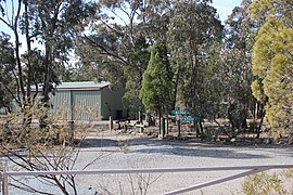
Ballalaba is a locality in the Queanbeyan–Palerang Regional Council, New South Wales, Australia. It is located about 30 km southwest of Braidwood on the road to Cooma and on the Shoalhaven River. At the 2021 census, it had a population of 29. It had a "half-time" school from 1867 to 1870; from 1879 to 1940, it operated either as a "provisional" or a "half-time" school".
Queanbeyan, an electoral district of the Legislative Assembly in the Australian state of New South Wales was created in 1859 and abolished in 1913.
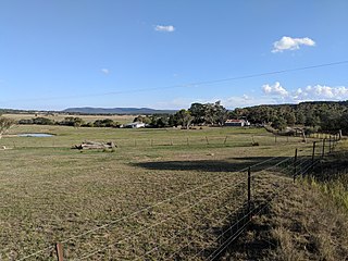
Back Creek is a small rural locality in the Queanbeyan–Palerang Regional Council, part of the Southern Tablelands region of New South Wales, Australia.
Bumbalong is a rural locality in the Snowy Monaro Region, New South Wales, Australia. Although it lies in the valley of the Murrumbidgee River, it is sometimes referred to by its residents as Bumbalong Valley. At the 2016 census, it had a population of 24.