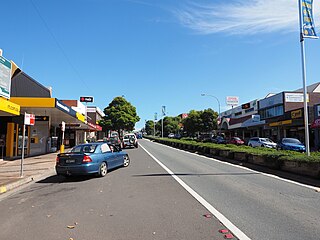
Ulladulla is a coastal town in New South Wales, Australia in the City of Shoalhaven local government area. It is on the Princes Highway about 230 kilometres (140 mi) south of Sydney, halfway between Batemans Bay to the south and Nowra to the north. Ulladulla has close links with the nearby historic settlement of Milton and many services are shared between these towns.

Boro is a rural locality of New South Wales, Australia in the Queanbeyan-Palerang Region, near the village of Tarago, about 50 km south of Goulburn. The name is a variation of the Aboriginal bora ring. At the 2021 census, it had a population of 97.

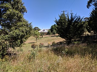
Wee Jasper is a hamlet in the Goodradigbee valley at the western foot of the Brindabella Ranges, near Burrinjuck Dam in New South Wales, Australia in Yass Valley Shire. It is located about 90 km north-west of Canberra and 60 km south-west of Yass. At the 2021 census, Wee Jasper and the surrounding area had a population of 127.

Mooney Mooney Creek is a suburb of the Central Coast region of New South Wales, Australia, located 60 kilometres (37 mi) north of Sydney along both sides of the river after which it is named. It is part of the Central Coast Council local government area.

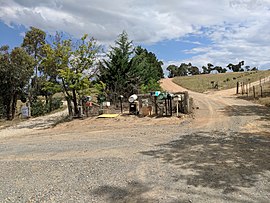
Araluen is a small town near Braidwood in the Southern Tablelands of New South Wales, Australia, in Queanbeyan-Palerang Regional Council. It lies in the valley of Araluen Creek, that joins the Deua River at roughly the midpoint in its course. At the 2021 census, Araluen had a population of 209 people.

Adjungbilly is a rural community in the central east part of the Riverina and on the north-western edge of the Snowy Mountains. It is situated about 29 kilometres south-east of Gobarralong and 35 kilometres north-east of Tumut.
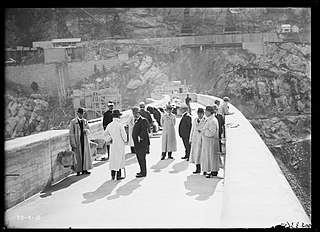
Burrinjuck is a village community in the far eastern part of the Riverina. It is situated by road, about 15 kilometres southwest from Woolgarlo and 28 kilometres south from Bookham. The name of the town is derived from an Aboriginal word meaning 'mountain with a rugged top'. At the 2016 census, the Burrinjuck area had a population of 19.

Jugiong is a locality and town on the banks of the Murrumbidgee River near its confluence with Jugiong Creek. in the Hilltops Council Local Government area, New South Wales, Australia. It is situated just off the Hume Highway, by road, about 30 kilometres southwest from Bookham and 40 kilometres northeast from Gundagai.

Fitzroy Falls is a village in the Wingecarribee Shire, located within the Southern Highlands region of New South Wales, Australia. The locality was known as Yarrunga, but was renamed after the 81-metre (266 ft) waterfall.

Collector is a small village on the Federal Highway in New South Wales, Australia halfway between Goulburn and the Australian Capital Territory. It is seven kilometres north of Lake George. At the 2021 census, Collector and the surrounding district had a population of 376 people.

Majors Creek is a small village in the Southern Tablelands region of New South Wales, Australia. The nearest major town is Braidwood, 16 km (9.9 mi) to the north. At the 2021 census, the population of Majors Creek was 290. A former gold mining town, the settlement is today associated with the operational Dargues Reef gold mine.
Watagan is a locality in the City of Cessnock, in the Hunter Region of New South Wales, Australia. It is located east of Laguna.
Bribbaree is a small village in the South West Slopes region of New South Wales, Australia spanning the boundary of Weddin Shire and Hilltops Council.

Queanbeyan–Palerang Regional Council is a local government area located in the Southern Tablelands region of New South Wales, Australia. The council was formed on 12 May 2016 through a merger of the City of Queanbeyan and Palerang Council.
Bishops Bridge is a locality in the cities of Cessnock and Maitland in the Hunter Region of New South Wales, Australia. At the 2021 Census, the population was 218, the median age was 43 and 92% born in Australia.
Harolds Cross is a locality in the Queanbeyan–Palerang Regional Council, New South Wales, Australia. It is located about 11 km northeast of Captains Flat and 35 km southwest of Braidwood. At the 2021 census, it had a population of 79. It had a "half-time" school from 1868 and 1915; from 1949 to 1957, it operated as a "provisional school".

Ballalaba is a locality in the Queanbeyan–Palerang Regional Council, New South Wales, Australia. It is located about 30 km southwest of Braidwood on the road to Cooma and on the Shoalhaven River. At the 2021 census, it had a population of 29. It had a "half-time" school from 1867 to 1870; from 1879 to 1940, it operated either as a "provisional" or a "half-time" school".

Bombay is a locality in the Queanbeyan–Palerang Regional Council, New South Wales, Australia. It is located about 14 km southwest of Braidwood on the western bank of the Shoalhaven River. At the 2021 census, it had a population of 142. It has two areas of somewhat denser settlement described as "Bombay" and "Little Bombay". It had a school in 1871 and from 1873 to 1928, normally described as "Bombay Half-Time School" but sometimes as "Bombay Provisional School".

Merricumbene is a locality in the Eurobodalla Shire, New South Wales, Australia. It is located about 43 km south of Braidwood and 40 km northwest of Moruya in the valley of the Deua River. At the 2016 census, it had a population of 19.
Stotts Creek is a locality in the Tweed Shire of New South Wales, Australia. It had a population of 10 as of the 2021 census.