The City of Lake Macquarie is a local government area in the Hunter Region of New South Wales, Australia and was proclaimed a city from 7 September 1984. The area is situated adjacent to the city of Newcastle and is part of the Greater Newcastle Area. The city is approximately 150 km (93 mi) north of Sydney. One of its major tourist attractions is its lake, also named Lake Macquarie.

Ku-ring-gai Council is a local government area in Northern Sydney, in the state of New South Wales, Australia. The region is named after the Kuringgai tribe who once inhabited the area.

City of Cessnock is a local government area in the Hunter region of New South Wales, Australia. The area under administration is located to the west of Newcastle. The largest population centre and council seat is the city of Cessnock.

Blacktown City Council is a local government area in Western Sydney, situated on the Cumberland Plain, approximately 35 kilometres (22 mi) west of the Sydney central business district, in the state of New South Wales, Australia. Established in 1906 as the Blacktown Shire and becoming the Municipality of Blacktown in 1961 before gaining city status in 1979, the City occupies an area of 246.9 square kilometres (95.3 sq mi) and has a population of 366,534, making it the second most populous local government area in Sydney.

Camden Council is a local government area in the Macarthur region of Sydney, in the state of New South Wales, Australia. The area is located south west of the Sydney central business district and comprises 201 square kilometres (78 sq mi) with an estimated population at the 2016 census of 78,218. The Mayor of Camden is Cr. Theresa Fedeli, a member of the Liberal Party.

The Fairfield City Council is a local government area in the west of Sydney, in the state of New South Wales, Australia. The council was first incorporated as the "Municipal District of Smithfield and Fairfield" on 8 December 1888, and the council's name was changed to the "Municipality of Fairfield" in 1920, before being proclaimed a city in 1979. The City of Fairfield comprises an area of 102 square kilometres (39 sq mi) and as of the 2016 census had a population of 198,817. The Mayor of the City of Fairfield is Cr. Frank Carbone, the first popularly-elected independent mayor of Fairfield.

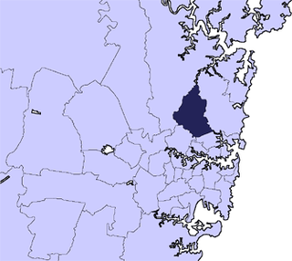
The Lane Cove Council is a local government area located on the Lower North Shore of Sydney, New South Wales, Australia. The administrative seat of Lane Cove is located 10 kilometres (6.2 mi) north-west of the Sydney central business district.

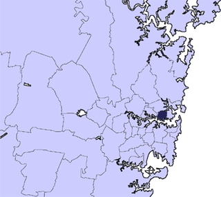
North Sydney Council is a local government area on the Lower North Shore of Sydney, New South Wales, Australia, established on 29 July 1890 through the amalgamation of three boroughs.

The City of Ryde is a local government area that services certain suburbs located within the Northern Sydney region, in the state of New South Wales, Australia. It was first established as the Municipal District of Ryde in 1870, became a municipality in 1906 and was proclaimed as the City of Ryde in 1992.

The states and territories of Australia are the second level of government division in Australia, between the federal government and local governments. States and territories are self-administered regions with a local legislature, police force and certain civil authorities, and are represented in the Parliament of Australia. Territories though, unlike states, rely on federal legislation and additional financial contributions to operate, and have less representation in the Senate.

Central Darling Shire is a local government area in the Far West region of New South Wales, Australia. The Shire is located adjacent to the Barrier Highway. Central Darling Shire was constituted in 1959 and at 53,511 square kilometres (20,661 sq mi), it is the largest incorporated local government area in New South Wales.

Glenworth Valley is a suburb of the Central Coast Council local government area in the Central Coast region of New South Wales, Australia. About 73 km (45 mi) north of Sydney and 20 km (12 mi) west of Gosford, at the 2016 census it had a population of 10 people. Popran Creek runs through the entire valley and rises in the locality of Central Mangrove and then flows for approximately 24 km in a mostly southern direction till it reaches Mangrove Creek.

Berrigan Shire is a local government area in the southern Riverina region of New South Wales, Australia. The Shire lies on the New South Wales State border with Victoria formed by the Murray River. The Shire is adjacent to the Newell and Riverina Highways. The Shire is a mainly agricultural region, with dairying, cattle raising, woolgrowing and cropping the main activities. The vast majority of the Shire is irrigated. Tourism is another major activity, concentrated on the river towns of Tocumwal and Barooga.

The City of Newcastle is a local government area in the Hunter region of New South Wales, Australia. The City of Newcastle incorporates much of the area of the Newcastle metropolitan area.

Tamworth Regional Council is a local government area in the New England region of New South Wales, Australia. The area under administration is located adjacent to the New England Highway and the Main North railway line. It was established in March 2004 through the amalgamation of the former City of Tamworth with surrounding shires of Barraba, Manilla, Nundle and Parry.

Muswellbrook Shire is a local government area in the Upper Hunter region of New South Wales, Australia. The Shire is situated adjacent to the New England Highway and the Hunter railway line.

Dungog Shire is a local government area in the Hunter region of New South Wales, Australia. The Shire is situated adjacent to the Barrington Tops and consists predominantly of very rugged to hilly country which becomes less rugged from north to south.
The Cordeaux River, a perennial river of the Hawkesbury-Nepean catchment, is located in the Southern Highlands and Macarthur regions of New South Wales, Australia.
Avon is a suburb of the City of Wollongong and Wingecarribee Shire, both in New South Wales, Australia. It is: "a locality within Metropolitan Catchment Area on the western side of Illawarra Range about 4km west of Wongawilli and about 5km north west of Avondale". At the 2016 census, it had no population.


