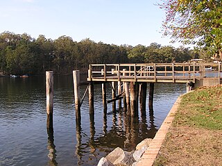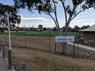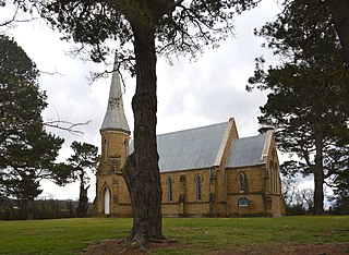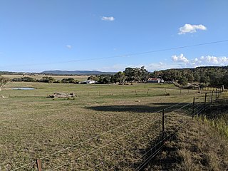
Bethungra is a locality in Junee Shire in the South West Slopes region of New South Wales, Australia situated on the Olympic Highway about 13 kilometres northeast of Illabo and 24 kilometres southwest of Cootamundra.

Abernethy is a small town in the City of Cessnock, in the Hunter Region in the state of New South Wales, Australia. Abernethy is located 8 kilometres south-east of the town of Cessnock, NSW and is adjacent to Werakata National Park and the Aberdare State Forest. The town was founded near a coal mine and some of the historic buildings remain. In 2016 348 lived there with the median age being 32 and 74.8% being born in Australia.

Aberdare is a suburb of Cessnock, a large town based on coal mining in the Lower Hunter Region, New South Wales, Australia. Aberdare is a small suburb just 15 minutes’ from beautiful wine country, 45 minutes to Newcastle and two hours to Sydney. George Brown found coal in the area in 1800's.Coal mining created the land boom of 1903-23 and by 1926 Cessnock had a population of 12,000 within a one mile radius

Upper Kangaroo River is a small village in the Southern Highlands of New South Wales, Australia, in Shoalhaven City Council. It is located on the Kangaroo River, a tributary of the Shoalhaven River. At the 2016 census, it had a population of 122.

Nelligen is a village on the Clyde River on the South Coast of New South Wales, Australia. It is located on the Kings Highway.
The Cordeaux River, a perennial river of the Hawkesbury-Nepean catchment, is located in the Southern Highlands and Macarthur regions of New South Wales, Australia.

Abermain is a town 8 km ENE of Cessnock and 3 km west of Weston, in New South Wales, Australia. Abermain is adjacent to Werakata National Park.

Majors Creek is a small village in the Southern Tablelands region of New South Wales, Australia. The nearest major town is Braidwood, 16 km (9.9 mi) to the north. At the 2016 census, the population of Majors Creek was 249.

Crestwood is a suburb of Queanbeyan, New South Wales, Australia. Crestwood is located west of the central business district (CBD) to the west of Ross Road and the north of Canberra Avenue and also borders the Australian Capital Territory. At the 2016 census, it had a population of 4,603.

Hoskinstown is a locality in Queanbeyan-Palerang Regional Council, New South Wales, Australia. The town is 38 km southeast of Canberra the Capital city of Australia, and 299 km southwest of Sydney. At the 2016 census, it had a population of 189.

Queanbeyan–Palerang Regional Council is a local government area located in the Southern Tablelands region of New South Wales, Australia. The council was formed on 12 May 2016 through a merger of the City of Queanbeyan and Palerang Council.

Bywong is a rural residential area in the Southern Tablelands of New South Wales, Australia in the Queanbeyan-Palerang Regional Council LGA. It is approximately 24 kilometres north-east of the Australian city of Canberra on the Federal Highway. It is also traversed by Macs Reef Road, Shingle Hill Way and Bungendore Road, the last two roads connecting Gundaroo and Bungendore. Its name is derived from an aboriginal word for "big hill". At the 2016 census, it had a population of 1,322. It had a public school from 1895 to 1906. It has a community association called Bywong Community Inc. http://www.bywongcommunity.org.au Its local Pony Club is called Gearys Gap Pony Club, which meets at the Les Reardon Reserve, Bywong. https://www.gearysgapponyclub.org.au

Rossi is a locality in the Queanbeyan–Palerang Regional Council, New South Wales, Australia. It is located about 33 km southeast of Queanbeyan and 25 km north of Captains Flat. At the 2016 census, it had a population of 95.

Primrose Valley is a locality in the Queanbeyan–Palerang Regional Council area, New South Wales, Australia. It is located on the road from Queanbeyan to Captains Flat about 33 km southeast of Queanbeyan and 25 km north of Captains Flat. At the 2016 census, it had a population of 146. It had a provisional school from 1884 to 1886 and a half-time school from 187 to 1889.

Larbert is a small village located in the Queanbeyan-Palerang Region of the Southern Tablelands region of New South Wales. It lies on mostly north of the Kings Highway between Bungendore and Braidwood where it crosses the Shoalhaven River. At the 2016 census, it had a population of 39. It had a public school from 1867 to 1868 and from 1874 to 1891. Larbert East school operated from 1874 to 1892. Both schools operated as "half-time" schools and as each other's partners from 1874, except in 1892 when Larbert East school was partnered with Uradux school.

Rose Valley is a locality in the Municipality of Kiama, in the Illawarra region of New South Wales, Australia. It lies west of the Princes Highway to the west of Gerringong about 130 km south of Sydney. At the 2016 census, it had a population of 76. It had a public school from 1868 to 1877 and 1884 to 1904.

Mulloon is a locality in the Queanbeyan-Palerang Region, Southern Tablelands, New South Wales, Australia.

Manar is a locality in the Queanbeyan-Palerang Region, Southern Tablelands, New South Wales, Australia. It lies on both sides of the Kings Highway between Bungendore and Braidwood at the intersection with the Braidwood–Goulburn road. At the 2016 census, it had a population of 118.

Terara is a suburb of Nowra in the City of Shoalhaven in New South Wales, Australia. It lies on the southern bank of the Shoalhaven about 3 km to the north-east of Nowra. At the 2016 census, it had a population of 234.

Rhine Falls is a locality within the Snowy Monaro Regional Council, halfway between Wambrook and Dry Plain at an altitude of 1,320 metres (4,330 ft); ranking as one of the highest-elevated localities in Australia. Likewise, snowfalls occur frequently from May through to September, and can occur at any time of the year. At the 2016 census, it had a population of 42, the same as neighbouring Dry Plain.


