Crystal Brook is a town in the Mid North of South Australia, 197 kilometres north of the capital, Adelaide. In 2016, the population of the town/postcode was 1,935. Crystal Brook is in a very picturesque location, being at the start of the Flinders Ranges. The town has multiple viewing points and parks. It was named after the spring-fed creek next to which it was founded.

The Yorke Peninsula is a peninsula located north-west and west of Adelaide in South Australia, between Spencer Gulf on the west and Gulf St Vincent on the east. The peninsula is separated from Kangaroo Island to the south by Investigator Strait. The most populous town in the region is Kadina.
The Eyre Peninsula is a triangular peninsula in South Australia. It is bounded on the east by Spencer Gulf, the west by the Great Australian Bight, and the north by the Gawler Ranges.

Wallaroo is a port town on the western side of Yorke Peninsula in South Australia, 160 kilometres (100 mi) northwest of Adelaide. It is one of the three Copper Triangle towns famed for their historic shared copper mining industry, and known together as "Little Cornwall", the other two being Kadina, about 8 kilometres (5 mi) to the east, and Moonta, about 18 kilometres (11 mi) south. In 2016, Wallaroo had a population of 3,988 according to the census held.

The Barunga West Council is a local government area in the Yorke and Mid North region of South Australia. The council seat is at Port Broughton, with a sub-office at Bute.

Barossa Reservoir is a reservoir in the Australian state of South Australia, built between 1899 and 1902 to supply water to Gawler and other northern country areas. Built at a cost of almost A£170,000 the reservoir was hailed on completion as an engineering marvel, and with the reservoir wall rising to a height of 36 metres (118 ft), it was, at the time of its completion, the highest dam wall in Australia.

Paskeville is a town on South Australia's Yorke Peninsula. It is located approximately 20 km east of Kadina on the Copper Coast Highway towards Adelaide. At the 2016 census, Paskeville had a population of 178. The town's district is administratively divided between the Copper Coast Council and the District Council of Barunga West.

Investigator Strait is a body of water in South Australia lying between the Yorke Peninsula, on the Australian mainland, and Kangaroo Island. It was named by Matthew Flinders after his ship, HMS Investigator, on his voyage of 1801–1802. It is bordered by the Gulf St Vincent in the northeast.

Bute is a town in the Northern Yorke peninsula of South Australia, approximately 40 kilometres (25 mi) east of Wallaroo and 24 kilometres west of Snowtown. It was proclaimed as a town in 1884 and named after the Isle of Bute, in the Firth of Clyde, Scotland. It was the original site of the Yorke Peninsula Field Days in 1895; they are now held outside Paskeville.
The Copper Coast Council is a local government area in the Australian state of South Australia located at the northern end of the Yorke Peninsula. It was established in 1997 and its seat is in Kadina.

The Enoggera Dam is a heritage-listed dam, which is located within the outer, western suburb of Enoggera Reservoir, in Brisbane, Queensland, Australia.

The Hummocks or Hummock Range is a range of hills in the northern Mount Lofty Ranges extending north from the eastern edge of Yorke Peninsula in South Australia. It is traversed by the Copper Coast Highway immediately west of where it passes around the northern end of Gulf St Vincent. The Augusta Highway passes to the east of the Hummocks. The Hummock Range includes the settlements of South Hummocks and Kulpara. Towards the range's northern end it continues as the Barunga Range north of Barunga Gap, approximately 10 kilometres (6.2 mi) south west of Snowtown.
The Tod Reservoir is located on the Eyre Peninsula in South Australia, in the localities of Whites Flat and Koppio, 27 km north of Port Lincoln. It is situated on the Tod River, the only stream on Eyre Peninsula, South Australia providing reliable flows; the reservoir is supplied by concrete channels fed from weirs constructed across the Tod River and its major tributary, Pillaworta Creek. The river was named after Robert Tod who discovered it during explorations in 1839. The Tod River flows into Louth Bay in Spencer Gulf. The reservoir is listed on the South Australian Heritage Register.
In South Australia, one of the states of Australia, there are many areas which are commonly known by regional names. Regions are areas that share similar characteristics. These characteristics may be natural such as the Murray River, the coastline, desert or mountains. Alternatively, the characteristics may be cultural, such as common land use. South Australia is divided by numerous sets of regional boundaries, based on different characteristics. In many cases boundaries defined by different agencies are coterminous.
Ninnes is a locality at the northeastern corner of Yorke Peninsula and western side of the Mid North of South Australia. It lies where the Upper Yorke Road from Kulpara to Bute is crossed by the road from Paskeville to Lochiel. The dominant industry is broadacre grain and sheep farming.

The County of Daly is one of the 49 cadastral counties of South Australia. It was proclaimed in 1862 and named for Governor Dominick Daly. It covers the northern half of Yorke Peninsula stretching just east of the Hummock-Barunga Range in the west and just past the Broughton River in the north.

The Balaklava-Moonta railway line was a railway line on the South Australian Railways network. It ran across the top of the Yorke Peninsula.
Aroona Dam is a reservoir in the Australian state of South Australia located in the gazetted locality of Leigh Creek about 5 kilometres (3.1 mi) west of the locality’s town centre.

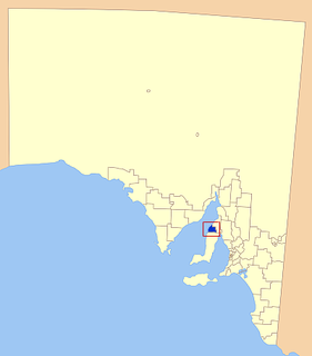
The Hundred of Kulpara is a cadastral unit of hundred located on the northern Yorke Peninsula in South Australia and centred on the township of Kulpara. It is one of the 16 hundreds of the County of Daly and was proclaimed by Governor Dominick Daly on 12 June 1862.
Baroota Reservoir is a reservoir on the western edge of the southern Flinders Ranges of South Australia. It was built in 1921 to supply additional water to Port Pirie as part of the Beetaloo Reservoir distribution network. The dam is not used to supply drinking water but is still used for a small amount of irrigation.