Keepit Dam is a major gated mass concrete gravity dam with an earth fill abutment and a central gated concrete overflow crest and six radial gate spillways across the Namoi River upstream of its junction with the Peel River in the North West Slopes region of New South Wales, Australia. The dam's purpose includes flood mitigation, hydro-power, irrigation, water supply and conservation. The impounded reservoir is called Lake Keepit.

Burrendong Dam is a rock-fill embankment major gated dam with a clay core across the Macquarie River upstream of Wellington in the central west region of New South Wales, Australia. The dam's purpose includes flood mitigation, irrigation, water supply and hydro-electric power generation. The dam impounds Lake Burrendong and is filled by the waters from the Macquarie, and Cudgegong rivers as well as Meroo Creek.

The Stephens Creek Dam is an earth-filled embankment dam built on a rock foundation with an uncontrolled spillway across the Stephens Creek, located in the Far West region of New South Wales, Australia. The principal purpose of the dam is to supply potable water for the town of Broken Hill. The impounded 2,000-megalitre reservoir is called Stephens Creek Reservoir.
The Pejar Dam is an earth and rock-filled embankment dam with an uncontrolled spillway across the Wollondilly River, located in the Southern Tablelands region of New South Wales, Australia. The principal purpose of the dam is to supply potable water for the city of Goulburn. The impounded 9,000-megalitre reservoir is also called Pejar Dam.

Copeton Dam is a major clay core and rock fill embankment dam with nine radial gates and a gated concrete chute spillway across the Gwydir River upstream of Bingara in the New England region of New South Wales, Australia. The dam's purpose includes environmental flows, hydro-electric power generation, irrigation, and water supply. The impounded reservoir is called Lake Copeton.
Windamere Dam is a minor ungated rock fill with clay core embankment dam with an uncontrolled unlined rock cutting spillway across the Cudgegong River at Cudgegong, upstream of Mudgee in the Central Tablelands of New South Wales, Australia. The dam's purpose includes hydro-power, irrigation, water supply, and conservation. The impounded reservoir is called Lake Windamere.

The Blowering Dam is a major ungated rock fill with clay core embankment dam with concrete chute spillway impounding a reservoir under the same name. It is located on the Tumut River upstream of Tumut in the Snowy Mountains region of New South Wales, Australia. Purposes for the dam include flood mitigation, hydro-power, irrigation, water supply and conservation. The dam is part of the Snowy Mountains Scheme, a vast hydroelectricity and irrigation complex constructed in south-east Australia between 1949 and 1974 and now run by Snowy Hydro.
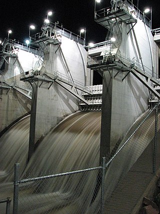
Tallowa Dam, completed in 1976, is a concrete gravity dam with central overflow spillway, located on the Shoalhaven River, downstream from the river's confluence with the Kangaroo River. The dam wall of 325 cubic metres (11,500 cu ft) is 43 metres (141 ft) high and 528 metres (1,732 ft) in length. At 100% capacity, the dam wall holds back approximately 85,500 megalitres and creates the impounded reservoir of Lake Yarrunga that has a surface area of 831 hectares, drawn from a catchment area of 5,750 square kilometres (2,220 sq mi). The spillway has a discharge capacity of 27,600 cubic metres per second (970,000 cu ft/s).
Cochrane Dam is a minor earthfill embankment dam with concrete spillway across Georges Creek, located in the South Coast region of New South Wales, Australia. The main purpose of the dam is to supply water for hydro-power at the downstream Brown Mountain Power Station and for irrigation purposes. The impounded reservoir is called Cochrane Lake.
The Ross River Dam is a rock and earthfill-filled embankment dam across the Ross River, located between Kelso and Mount Stuart in the City of Townsville in northern Queensland, Australia. Built initially for flood control, Lake Ross, the impoundment created by the dam, serves as one of the major potable water supplies for the region.

Rocky Creek Dam is a minor rock fill clay core embankment dam across the Rocky Creek, located upstream of Lismore in the Northern Rivers region of New South Wales, Australia. The dam's main purpose is to supply potable water for the region, including Lismore, Ballina, Byron Bay, Evans Head and Alstonville. The impounded reservoir is called Rocky Lake.
Gosling Creek Dam is a decommissioned minor earth and rock fill with clay core embankment dam with concrete chute spillway across the Gosling Creek upstream of Orange in the central western region of New South Wales, Australia. Commissioned in 1890 to supply Orange with potable water, the dam was decommissioned after the official commissioning of the Suma Park Dam in 1962. The impounded reservoir is called Gosling Creek Reservoir and is now used for recreation purposes.
Suma Park Dam is a concrete arch dam across the Summer Hill Creek in the central west region of New South Wales, Australia. The main purpose of the dam is to supply potable water to the city of Orange. The impounded reservoir is called Suma Park Reservoir.

Split Rock Dam is a minor ungated concrete faced rock fill embankment dam with concrete chute spillway across the Manilla River upstream of Manilla in the north-western slopes region of New South Wales, Australia. The dam's purpose includes flood mitigation, irrigation, water supply and conservation. The impounded reservoir is called Split Rock Reservoir.
Pindari Dam is a minor concrete faced rockfill embankment dam with an ungated uncontrolled rock cut with concrete sill spillway across the Severn River located upstream of the town of Ashford, in the North West Slopes region of New South Wales, Australia. The dam's purpose includes flood mitigation, hydro-power, irrigation, water supply and conservation. The impounded reservoir is called Lake Pindari.

Chaffey Dam is a minor ungated rock fill with clay core embankment dam with an uncontrolled morning glory spillway across the Peel River, located upstream of the city of Tamworth, in the New England region of New South Wales, Australia. The dam's purpose includes flood mitigation, irrigation, water supply, and water conservation.
Grahamstown Dam is a major off-stream earthfill Embankment dam with a controlled labyrinth spillway and baffle chute that stores water from the Williams River. The dam is located north of Newcastle and within the Port Stephens Council local government area in the Lower Hunter Region of New South Wales, Australia. The dam's main purpose is water supply; it provides about 40 per cent of the potable water for the Hunter region; and is the Hunter's largest drinking water supply dam.
Oberon Dam or Fish River Dam is a major ungated concrete slab and buttress with earth embankment dam comprising a concrete ski jump chute spillway and fuse plug across the Fish River upstream of Oberon in the Central Tablelands region of New South Wales, Australia. The dam's purpose includes flood mitigation, industrial, and water supply. The impounded reservoir is called Lake Oberon.
Brogo Dam is a minor ungated rockfill embankment dam with an uncontrolled unlined rock cut spillway across the Brogo River upstream of Brogo in the South Coast region of New South Wales, Australia. The dam's purpose includes environmental flows, hydro-electric power generation, irrigation, and water supply. The impounded reservoir is also called Brogo Dam.

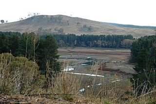
Wingecarribee Dam, completed in 1974 as part of the Shoalhaven Scheme, is an earth and rockfill embankment dam structure located on the Wingecarribee River about 15 kilometres (9.3 mi) southeast of Bowral in New South Wales, Australia. The embankment of 573 cubic metres (20,200 cu ft) is 19 metres (62 ft) high and 1,140 metres (3,740 ft) in length. At 100% capacity, the dam wall holds back approximately 25,875 megalitres and creates the impounded reservoir of Wingecarribee Reservoir that has a surface area of 625 hectares, drawn from a catchment area of 40 square kilometres (15 sq mi). The spillway has a discharge capacity of 520 cubic metres per second (18,000 cu ft/s). Wingecarribee Reservoir lost around 9,000 megalitres of storage capacity as a result of the inflow of peat from the Wingecarribee Swamp collapse in August 1998. The original storage capacity was 34,500 megalitres.