The following is a partial list of dams and reservoirs in Botswana.
The following is a partial list of dams and reservoirs in Botswana.

Gaborone is the capital and largest city of Botswana with a population of 246,325 based on the 2022 census, about 10% of the total population of Botswana. Its agglomeration is home to 534,842 inhabitants at the 2022 census.

The Middle Santiam River is a tributary of the South Santiam River, 38.5 miles (62.0 km) long, in western Oregon in the United States. It drains a remote area of the Cascade Range east of Sweet Home in the watershed of the Willamette River.

Morupule Thermal Power Station is a coal-fired power station in Botswana. It is responsible for an estimated 80 percent of the country's domestic power generation.

Lake Macdonald is a rural locality in the Shire of Noosa, Queensland, Australia. In the 2021 census, Lake Macdonald had a population of 1,352 people.

The Tokuyama Dam is an embankment dam near Ibigawa, Ibi District, Gifu Prefecture in Japan. The dam was completed in 2008 and will support a 153 MW hydroelectric power station that is expected to be fully operational in 2015. Unit 1 at 23 MW was commissioned in May 2014. The dam was originally intended to withhold the upper reservoir of a 400 MW pumped-storage power station until a design change in 2004. The dam is also intended for flood control and water supply. It is the largest dam by structural volume in Japan and withholds the country's largest reservoir by volume as well.
Çınarcık Dam is a rock-fill dam on the Orhaneli River about 30 km (19 mi) east of Mustafakemalpaşa in Bursa Province, Turkey. It serves several purposes to include power, irrigation, flood control and municipal water supply to the city of Bursa. The dam was constructed between 1996 and 2002. Construction of the Uluabat Hydroelectric Station, which the dam supplies water to, began in 2006 and it was commissioned in 2010. The 125 m (410 ft) tall dam diverts water north through an 11.27 km (7.00 mi) long tunnel where it reaches the power station on the southern bank of Lake Uluabat. Water discharged from the 100 MW power station then enters the lake. The dam and power station are owned by the Turkish State Hydraulic Works.

Kiğı Dam is a rock-fill embankment dam on the Peri River in Bingöl Province, Turkey. Its primary purpose is hydroelectric power generation and is the first dam in the Peri River cascade, serving as the headwaters. Construction began in 1998 and is backed by the Turkish State Hydraulic Works. When commissioned, it will support a 180 MW power station. Water from the reservoir will be diverted to an underground power station downstream via an 8.5 km (5.3 mi) long tunnel. In August 2015, suspected Kurdistan Workers' Party militants set fire to three cement trucks associated with the dam construction site. In January 2016, the dam was completed and the reservoir began to impound water.

The Sirindhorn Dam is in Sirindhorn District, Ubon Ratchatani, Thailand. It impounds the Lam Dom Noi River, and its reservoir is the province's largest water resource. The dam was commissioned in 1971 to serve as a hydropower facility as well as to supply irrigation water. The dam was named after Princess Royal Sirindhorn. All of the electricity generated by the dam is destined for domestic markets. The dam was constructed and is owned and operated by the Electricity Generating Authority of Thailand and is located in the Mekong River Basin, just upstream from the controversial Pak Mun Dam.
The Pulangi IV Hydroelectric Power Plant, also known as the Pulangi Dam, is located on the Pulangi River near Maramag in Bukidnon province on the island of Mindanao in the Philippines. It uses two reservoirs, produced by damming the Pulangi River, to supply water to a run-of-the-river hydroelectric power plant; the power plant is capable of generating 255 megawatts (342,000 hp) of power. Construction began in 1982; the first two generators became operational in December 1985, with the last generator being commissioned in 1986.
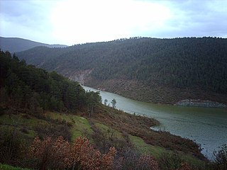
The Bokaa Dam is a dam on the Metsimotlhabe River, a tributary of the Ngotwane River, in Botswana. It provides water to the capital city of Gaborone. It is operated by the Water Utilities Corporation.

The Gaborone Dam is a dam on the Notwane River in Botswana with a capacity of 141,100,000 cubic metres (4.98×10⁹ cu ft). The dam is operated by the Water Utilities Corporation, and supplies water to the capital city of Gaborone.
The Nnywane Dam is a dam on the Nnywane River in Botswana. The reservoir provides a water supply to Lobatse, a town 70 kilometres (43 mi) south of Gaborone. Water from the reservoir may also be transferred to Gaborone if needed.
The Hatillo Dam is an earth and rock-filled embankment dam on the Yuna River about 6 km (3.7 mi) southwest of Cotuí in Sánchez Ramírez Province of the Dominican Republic. With a storage capacity of 710,000,000 m3 (580,000 acre⋅ft), the dam's reservoir is the largest in the country. The purpose of the dam is to produce hydroelectric power, provide water for irrigation and to control floods. The power station is located at the base of the dam and contains a single 8 MW Francis turbine-generator. Construction on the dam began in August 1977 and it was completed in 1984.
The Tianhuaban Dam is an arch dam on the Niulan River, a tributary of the Jinsha River. It straddles the border of Ludian and Qiaojia Counties in Yunnan Province, China. The primary purpose of the dam is hydroelectric power generation and it supports a 180 MW power station. In September 2006, construction on the dam's river diversion tunnels commenced. The first two of 90 MW Francis turbine-generator sets was commissioned in February 2011, the second in March of the same year. Water from the reservoir is diverted to a power station about 2.5 km (1.6 mi) downstream on the right bank of the river.
The Burç Bendi Dam is a gravity dam on the Göksu River, near the village of Burç in Adıyaman district, Adıyaman Province, Turkey. Its primary purpose is hydroelectric power generation and it supports a 27.9 MW run-of-the-river power station. Construction on the dam began in January 2008 and it was fully operational by 3 November 2010. The 57 m (187 ft) tall concrete dam withholds a reservoir of 26,600,000 m3 (21,600 acre⋅ft). Water is diverted through a 536 m (1,759 ft) long tunnel to the power station downstream which contains three 9.3 vertical Kaplan turbine-generators. It is owned and operated by ČEZ Group.
| Africa |  | |
|---|---|---|
| Asia | ||
| Australasia | ||
| Europe |
| |
| North America | ||
| South America | ||