
Transportation in Botswana is provided by an extensive network of railways, highways, ferry services and air routes that criss-cross the country. The transport sector in Botswana played an important role in economic growth following its independence in 1966. The country discovered natural resources which allowed it to finance the development of infrastructure, and policy ensured that the transport sector grew at an affordable pace commensurate with demands for services.
Selebi-Phikwe is a mining town located in the Central District of Botswana. It had a population of 42,488 in 2022. The town is an administrative district, separate from the surrounding Central District.

Central is the largest of Botswana's districts in terms of area and population. It encompasses the traditional homeland of the Bamangwato people. Some of the most politically connected Batswana have come from the Central District, including former President Sir Seretse Khama, former President Festus Mogae, and former President Lt. General Seretse Ian Khama. The district borders the Botswanan districts of Chobe in the north, North-West in the northwest, Ghanzi in the west, Kweneng in southwest, Kgatleng in the south and North-East in the northeast, as well as Zimbabwe also in the northeast and South Africa in the southeast.

Hinduism is a minority religion practised by 0.3% of the population of Botswana. The practice of Hinduism in Botswana is concentrated in and around Gaborone and Selebi-Phikwe. The community of Hindus began to form in the early 20th century with the beginning of immigration from India to Botswana. Most Hindus in Botswana are of Indian descent.
Botswana is experiencing one of the most severe HIV/AIDS epidemics in the world. The national HIV prevalence rate among adults ages 15 to 49 is 24.8 percent, which is the third highest in the world, behind Lesotho and Eswatini. HIV/AIDS threatens the many developmental gains Botswana has achieved since its independence in 1966, including economic growth, political stability, a rise in life expectancy, and the establishment of functioning public educational and health care systems.

The Shashe River is a major left-bank tributary of the Limpopo River in Zimbabwe. It rises northwest of Francistown, Botswana and flows into the Limpopo River where Botswana, Zimbabwe and South Africa meet. The confluence is at the site of the Greater Mapungubwe Transfrontier Conservation Area.
Tshokwe is a village in Central District of Botswana. The village is located south-east of Francistown, near the border with Zimbabwe, and it has a primary school. The population was 897 according to the 2001 census.
Mogapi is a village in Central District of Botswana. The village is located 47 km south of Selebi-Phikwe and is less than 100 km from the border with South Africa. The population was 1,814 at the 2001 census.
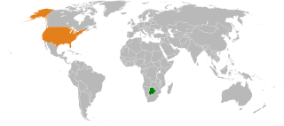
Botswana–United States relations are the bilateral relations between Botswana and the United States.
Tobane is a small village in the eastern part of Botswana about 20 km from the copper/nickel mining town of Selebi-Phikwe. The village has access to the town through a tarred road. The Motloutse River passes the village on the northeastern side. The village has a lot of facilities such as clean water from the Shashe dam, electricity, mobile phone connection through Orange, Bemobile and Mascom wireless. It also has landline service through Botswana Telecommunications Cooperation. There is a clinic, a primary school, and a junior school in the area. The population of the village is roughly 1925. The regent chief is Nametshego Nengu.
Tsetsebjwe is a village in the Bobirwa sub-district of the Central District of Botswana. It is in the Central Bobonong census district. As of 2001 it had a population of 4,396. The village is northwest of the privately owned Limpopo-Lipadi Game and Wilderness Reserve, near the South African border.
The Letsibogo Dam is a dam on the Motloutse River in Botswana, built to initially provide water to the industrial town of Selebi-Phikwe and surrounding areas, with the potential for use in irrigation. The dam now supplies Gaborone, the capital of the country, via a 400 kilometres (250 mi) pipeline, as well as major villages along the pipeline route.
The Shashe Dam is a dam on the Shashe River in Botswana that was built to supply water to the industrial city of Selebi-Phikwe. The large village of Tonota lies just south of the dam.

Water Utilities Corporation (WUC) is a government-owned corporation that provides water and waste water management services in Botswana. The Board is appointed by the Minister of Minerals, Energy and Water Resources. The water supply is critically important in the arid or semi-arid environment of Botswana.
The Dikgatlhong Dam is a dam near the village of Robelela on the Shashe River in Botswana, completed in December 2011. When full it will hold 400,000,000 cubic metres (1.4×10¹⁰ cu ft). The next largest dam in Botswana, the Gaborone Dam, has capacity of 141,000,000 cubic metres (5.0×10⁹ cu ft).

The North-South Carrier (NSC) is a pipeline in Botswana that carries raw water south for a distance of 360 kilometres (220 mi) to the capital city of Gaborone. Phase 1 was completed in 2000. Phase 2 of the NSC, under construction, will duplicate the pipeline to carry water from the Dikgatlhong Dam, which was completed in 2012. A proposed extension to deliver water from the Zambezi would add another 500 to 520 kilometres to the total pipeline length. The NSC is the largest engineering project ever undertaken in Botswana.
Patayamatebele is a village in the North East District of Botswana near to the Dikgatlhong Dam.
Matopi is a village in the North East District of Botswana near to the Dikgatlhong Dam.
Matsiloje is a village in the North East District of Botswana on the west bank of the Ramokgwebana River, which forms the border with Zimbabwe.
The Selebi-Phikwe Solar Power Station, is a 50 MW (67,000 hp) solar power plant under development in Botswana. It is owned and is being developed by Scatec, the multinational energy conglomerate, whose headquarters are located in Oslo, Norway. The off-taker is Botswana Power Corporation (BPC), under a 25-year power purchase agreement (PPA).
