
Warragamba Dam is a heritage-listed dam in the outer South Western Sydney suburb of Warragamba, Wollondilly Shire in New South Wales, Australia. It is a concrete gravity dam, which creates Lake Burragorang, the primary reservoir for water supply for the city of Sydney. The dam wall is located approximately 65 kilometres (40 mi) W of Sydney central business district, 4½ km SW of the town of Wallacia, and 1 km NW of the village of Warragamba.

Keepit Dam is a major gated mass concrete gravity dam with an earth fill abutment and a central gated concrete overflow crest and six radial gate spillways across the Namoi River upstream of its junction with the Peel River in the North West Slopes region of New South Wales, Australia. The dam's purpose includes flood mitigation, hydro-power, irrigation, water supply and conservation. The impounded reservoir is called Lake Keepit.

Palapye is a growing town in Botswana, situated about halfway between Francistown and Gaborone. Over the years its position has made it a convenient stopover on one of Southern Africa's principal north–south rail and road routes.

The Ilısu Dam is a concrete-face rock-fill dam on the Tigris near the village of Ilısu and along the border of Mardin and Şırnak Provinces in Turkey. It is one of the 22 dams of the Southeastern Anatolia Project and its purpose is hydroelectric power production, flood control and water storage. When operational, the dam will support a 1,200 MW power station and will form a 10.4 billion m3 reservoir. Construction of the dam began in 2006 and was originally expected to be completed by 2016. As part of the project, the much smaller Cizre Dam is to be constructed downstream for irrigation and power. The dam has drawn international controversy, because it will flood portions of ancient Hasankeyf and necessitate the relocation of people living in the region. Because of this, the dam lost international funding in 2008. Most historical structures in Hasankeyf were moved to the new Hasankeyf prior to the filling of the dam. The dam began to fill its reservoir in late July 2019. Due to rainfall, the dam has achieved water levels up to 100m above the river bed and stored 5 billion cubic meters of water. The water level had reached an elevation of 498.2m on 1 April 2020.

The Cordeaux Dam is a heritage-listed dam in Cordeaux, New South Wales, Australia. It provides water to the Macarthur and Illawarra regions, the Wollondilly Shire, and metropolitan Sydney. It is one of four dams and weirs in the catchment of the Upper Nepean Scheme. Completed in 1926 under the supervision of Ernest Macartney de Burgh, the dam is owned by Water NSW, an agency of the Government of New South Wales. It was listed on the New South Wales State Heritage Register on 18 November 1999.

Gomal Zam Dam is a multi-purpose gravity dam in South Waziristan Tribal District of Khyber Pakhtunkhwa, Pakistan. The dam impounds the Gomal River, a tributary of the Indus River, at Khjori Kach, where the Gomal River passes through a narrow ravine. The purpose of the dam is irrigation, flood control, and hydroelectric power generation. Construction of the dam began in August 2001 and was completed in April 2011. The powerhouse was completed in March 2013 and electricity production started in August 2013. The dam was officially inaugurated on 12 September 2013 by Minister for Water and Power Khawaja Muhammad Asif, along with US Ambassador Richard G. Olson and Khyber Pakhtunkhwa Governor Shaukatullah Khan.

The Shashe River is a major left-bank tributary of the Limpopo River in Zimbabwe. It rises northwest of Francistown, Botswana and flows into the Limpopo River where Botswana, Zimbabwe and South Africa meet. The confluence is at the site of the Greater Mapungubwe Transfrontier Conservation Area.
Lerala is a village in Central District of Botswana. The village is located at the south-eastern end of the Tswapong Hills, 30 km (19 mi) from the Limpopo River and the border with South Africa and approximately 90 km (56 mi) east of Palapye. The population of Lerala was 6,871 in the 2011 census, which was a 20.5% increase from the 2001 population.
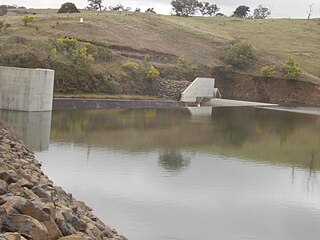
Maunatlala is a village in Central District of Botswana at the feet of the Tswapong Hills, near the Lotsane River. It is located 65 km (40 mi) east of Palapye and 60 km (37 mi) from the border with South Africa. The population was 4,364 in 2011 census. The village is the site of the Lotsane Dam, which started impounding in January 2012 and supplies drinking water as well as water for irrigation in a 250 hectares horticulture operation near Maunatlala.

The Cotter Dam is a concrete gravity and rockfill embankment dam across the Cotter River, located in the Australian Capital Territory, Australia. Both the dam and river are named after early settler in the area Garrett Cotter. The impounded Cotter Reservoir is a supply source of potable water for the city of Canberra and its environs.

The Yeywa Hydropower Station, located on the Myitnge River, 52 kilometres (32 mi) southeast of Mandalay city, at Yeywa village in Kyaukse Township, Mandalay Region in central Myanmar, is the country's first roller-compacted concrete (RCC) dam, and the site of a 790-megawatt (1,060,000 hp) hydroelectric power plant, the largest in the country.
Ben Chifley Dam, or Chifley Dam, is a rock and earth-fill embankment dam across the Campbells River in the central west region of New South Wales, Australia. The main purpose of the dam is to supply potable water to the city of Bathurst.

The Jatigede Dam is an embankment dam on the Cimanuk River in Sumedang Regency, West Java, Indonesia. It is located 19 km (12 mi) east of the town of Sumedang. Construction on the dam began in 2008 and it was completed in 2015. The power station is expected to be commissioned in 2019. The primary purpose of the dam is irrigation but it will also provide for flood control, water supply and hydroelectric power generation. Water in the reservoir will be used to help irrigate 90,000 ha of farmland and the power station is expected to have a 110 MW capacity. The project has become controversial, primarily due to the relocation of people in the future reservoir zone.
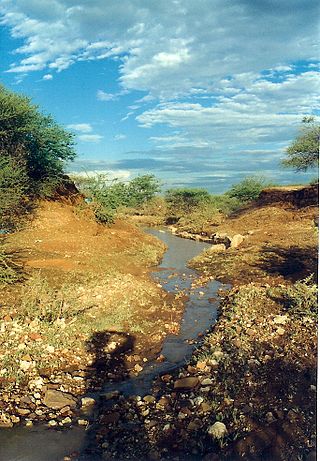
The Lotsane River is a river in southeastern Botswana. It is a seasonal left hand tributary of the Limpopo River and has a catchment area of 9,748 square kilometers.

The Gaborone Dam is a dam on the Notwane River in Botswana with a capacity of 141,100,000 cubic metres (4.98×10⁹ cu ft). The dam is operated by the Water Utilities Corporation, and supplies water to the capital city of Gaborone.
The Shashe Dam is a dam on the Shashe River in Botswana that was built to supply water to the industrial city of Selebi-Phikwe. The large village of Tonota lies just south of the dam.

Water Utilities Corporation (WUC) is a government-owned corporation that provides water and waste water management services in Botswana. The Board is appointed by the Minister of Minerals, Energy and Water Resources. The water supply is critically important in the arid or semi-arid environment of Botswana.
The Thune Dam is a dam on the Thune River in Botswana that was under construction in 2012. It has a planned capacity of 90,000,000 cubic metres (3.2×10⁹ cu ft).
The Dikgatlhong Dam is a dam near the village of Robelela on the Shashe River in Botswana, completed in December 2011. When full it will hold 400,000,000 cubic metres (1.4×10¹⁰ cu ft). The next largest dam in Botswana, the Gaborone Dam, has capacity of 141,000,000 cubic metres (5.0×10⁹ cu ft).

The North-South Carrier (NSC) is a pipeline in Botswana that carries raw water south for a distance of 360 kilometres (220 mi) to the capital city of Gaborone. Phase 1 was completed in 2000. Phase 2 of the NSC, under construction, will duplicate the pipeline to carry water from the Dikgatlhong Dam, which was completed in 2012. A proposed extension to deliver water from the Zambezi would add another 500 to 520 kilometres to the total pipeline length. The NSC is the largest engineering project ever undertaken in Botswana.
