
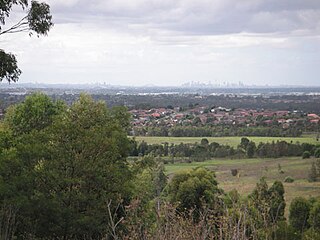
Green Valley Creek is a stream situated in Western Sydney, New South Wales, Australia. [1] A tributary of Orphan School Creek, the creek is one of the five significant creeks that are found within the Fairfield City Council LGA.
Green Valley Creek is a stream situated in Western Sydney, New South Wales, Australia. [1] A tributary of Orphan School Creek, the creek is one of the five significant creeks that are found within the Fairfield City Council LGA.
Green Valley Creek is piped upstream of North Liverpool Road and is generally subterranean around this area, with reedy natural channels. Though it travels downstream within a riparian waterway for approximately 7km to its confluence with Orphan School Creek. Having a 7.4-square-kilometre (1,800-acre) catchment area, the creek traverses Bonnyrigg, St Johns Park, Cabramatta West and Canley Heights, where it meets the Orphan School Creek at Endeavor Sports Park to the east (just south of Fairfield West). To the south of St John's Road and Chisholm Park in Canley Heights, the creek becomes intermittent due to its heavily marshy and reedy nature, where it would only fill during heavy rainfall events, although streams of water can be found irregularly in its course. [2]
There is a minor level of flood interaction and backwater at the Orphan School Creek/Green Valley Creek confluence, which can affect low-laying areas, as minor flood spill had occurred in Edensor Road at Edensor Park. [2]
The original vegetation on the floodplains that bounded these creek was the River-flat eucalypt forest and Coastal Swamp Oak Forest, which were vastly cleared as Sydney's metropolitan area grew larger and is now listed as an endangered community. Within the past few decades, Fairfield Council has been restoring the riparian vegetation near the creek, with a 2019 regeneration project been conducted at Barook Park, where over 4,700 plants were planted within the Green Valley Creek corridor. [3]
In May 2022, the creek gained local notoriety after a body of an 18 year old girl, who had been missing for a month, was discovered on its streambed. [4]

Edensor Park is a suburb of Sydney, New South Wales, Australia. Edensor Park is located 38 kilometres west of the Sydney central business district in the local government area of the City of Fairfield. It is mainly a residential area, Edensor Park is part of the Greater Western Sydney region.

The Division of Fowler is an Australian electoral division in the state of New South Wales.
St Johns Park is a suburb of Sydney, in the state of New South Wales, Australia 35 kilometres west of the Sydney central business district, in the local government areas of the City of Fairfield. It is part of the Greater Western Sydney region.

Smithfield is a suburb of Sydney, in the state of New South Wales, Australia. Smithfield is located 31 kilometres (19 mi) west of the Sydney central business district, in the local government areas of the City of Fairfield and Cumberland Council. Located in the Greater Western Sydney region, the suburb is one of the largest in Fairfield City by area.

Bonnyrigg is a suburb of Sydney, in the state of New South Wales, Australia 36 kilometres west of the Sydney central business district, in the local government area of the City of Fairfield. It is part of the Greater Western Sydney region.
Bonnyrigg Heights is a suburb of Sydney, in New South Wales, Australia. Its name originates from Bonnyrigg, Midlothian, Scotland. Bonnyrigg Heights is located on the traditional indigenous lands of the Dharug Nation.
Bossley Park is a suburb of Sydney, in the state of New South Wales, Australia. Bossley Park is located 36 kilometres west of the Sydney central business district in the local government area of the City of Fairfield. Bossley Park is part of the Greater Western Sydney region. The suburb is most well known for being an ethnic enclave of Assyrian and other Iraqi ethnic groups living in Sydney.

Canley Vale is a suburb of Sydney, in the state of New South Wales, Australia. Canley Vale is located 30 kilometres west of the Sydney central business district, in the local government area of the City of Fairfield and is part of the South Western Sydney region.
Canley Heights is a suburb of Sydney, in the state of New South Wales, Australia 31 kilometres west of the Sydney central business district, in the local government area of the City of Fairfield and is part of the South-western Sydney region.
Fairfield West is a suburb of Sydney, in the state of New South Wales, Australia. Fairfield West is located 27 kilometres west of the Sydney central business district in the local government area of the City of Fairfield. Fairfield West is part of the Greater Western Sydney region.

The Lockyer Creek is a creek in South East Queensland, Australia. A tributary of the Brisbane River, the creek is a major drainage system in the Lockyer Valley. Rising on the eastern slopes of the Great Dividing Range, the creek flows generally north-easterly for more than 100 kilometres (62 mi) before it reaches its confluence with the Brisbane River north-northeast of Lowood, and downstream from the Wivenhoe Dam. The creek is named after Edmund Lockyer.

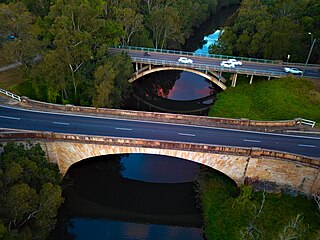
Prospect Creek is an urban watercourse of the Georges River catchment that is located in the western region of Sydney, in New South Wales, Australia. As Prospect Reservoir forms a part of the Sydney metropolitan water supply, the flow of the creek is regulated in accordance with the operational requirements of Sydney Water.

St Luke Parish is one of the 57 parishes of Cumberland County, New South Wales, a cadastral unit for use on land titles. It is bounded by Prospect Creek in the north-east, Georges River in the south-east, and Cowpasture Road in the west. It was named after the Anglican church of St Lukes in Liverpool, which was completed in 1819. The parish is mentioned in various legislation dealing with property law for the city of Liverpool.

Orphan School Creek is a tributary of Prospect Creek and is located entirely within the City of Fairfield. As the name suggests, Orphan School Creek was named after an orphan school in the area.

Clear Paddock Creek is a tributary of Orphan School Creek, which in turn, is a tributary of Prospect Creek, located in the City of Fairfield, NSW. The creek, being mostly concrete-lined, starts from Brisbane Road and ends at Orphan School Creek to the east near King Road.
Reedy Creek, an urban watercourse that is part of the Hawkesbury-Nepean catchment, is located in Greater Western Sydney, New South Wales, Australia.

Rosford Street Reserve, or Rosford Reserve, is an urban park and nature reserve situated in the western suburbs of Sydney, New South Wales, Australia. The reserve contains an open grassland, woodlands and recreational areas surrounded by native plants, such as eucalyptus trees. Janice Crosio Oval is a fenced sports ground incorporated within the reserve. The park is one of the largest in the Fairfield LGA area.
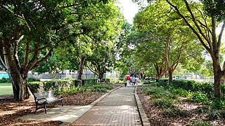
Fairfield Park Precinct, or Fairfield Park, is an urban park situated in the western suburbs of Sydney, New South Wales, Australia. Situated to the south of Fairfield CBD, the park contains an open grassland, bushland, picnic spots, playgrounds, indoor and outdoor sport facilities, and recreational areas within the vicinity of native plants, such as eucalyptus trees.
The Lennox River is the proposed name for a waterway located in Sydney's South-Western Suburbs. The existing waterway is the tidal reach of Prospect Creek, a tributary of the Georges River. A proposal has been made to upgrade and reclassify the waterway as a 'river'. The proposed river would be 6.5 kilometres (4 mi) long, starting at the confluence of Orphan School Creek and Prospect Creek at Fairfield and flowing to the Georges River emptying into Dhurawal Bay at Garrison Point.