Port Jackson, consisting of the waters of Sydney Harbour, Middle Harbour, North Harbour and the Lane Cove and Parramatta Rivers, is the ria or natural harbour of Sydney, New South Wales, Australia. The harbour is an inlet of the Tasman Sea. It is the location of the Sydney Opera House and Sydney Harbour Bridge. The location of the first European settlement and colony on the Australian mainland, Port Jackson has continued to play a key role in the history and development of Sydney.

Middle Harbour, a semi–mature tide dominated drowned valley estuary, is the northern arm of Port Jackson, an inlet of the Tasman Sea located north of Sydney central business district on the coast of New South Wales, Australia.

The Clyde River is an open intermediate tide-dominated drowned valley estuary or perennial river that flows into the Tasman Sea at Batemans Bay, located in the South Coast region of New South Wales, Australia.

Glebe is an inner-western suburb of Sydney in New South Wales. Glebe is located 3 kilometres (1.9 mi) southwest of the Sydney central business district and is part of the local government area of the City of Sydney, in the Inner West region.

Huskisson is a village in New South Wales, Australia in the City of Shoalhaven, on the shores of Jervis Bay. It is 24 km south-east of Nowra.

Rozelle is a suburb in the inner west of Sydney, in the state of New South Wales, Australia. It is located 4 kilometres west of the Sydney central business district, in the local government area of the Inner West Council.

The South Creek or Wianamatta is a creek that is part of the Hawkesbury-Nepean catchment, located on the Cumberland Plain in Greater Western Sydney, New South Wales, Australia.
The Akuna Bay is a bay within Broken Bay, located in the Northern Beaches Council local government area in the Northern Suburbs of Sydney, Australia. The bay is fed by Coal and Candle Creek, with its land boundaries encased within the Ku-ring-gai Chase National Park. A large marina in located within the bay. The urban locality of Akuna Bay is located at the southern boundary of the bay.

Akuna Bay is an urban place in Sydney, Australia. Akuna Bay is located 38 kilometres (24 mi) north of the Sydney central business district, in the local government area of Northern Beaches Council.

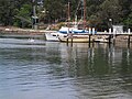
White Bay is a bay on Sydney Harbour with a surrounding locality near the suburbs of Balmain and Rozelle in the Inner West of Sydney, New South Wales, Australia.

Mooney Mooney Creek is a suburb of the Central Coast region of New South Wales, Australia, located 60 kilometres (37 mi) north of Sydney along both sides of the river after which it is named. It is part of the Central Coast Council local government area.
The Billabong Creek, a perennial river of the Murrumbidgee catchment within the Murray–Darling basin, is located in the South West Slopes region of New South Wales, Australia.

Petersham Parish is one of the 57 parishes of Cumberland County, New South Wales, a cadastral unit for use on land titles. It is located to the south of Iron Cove, Rozelle Bay and the Parramatta River, and to the north of Cooks River. It includes the suburbs of Balmain, Leichhardt, Petersham, Newtown, Marrickville, Tempe, Glebe and St Peters. It roughly corresponds to the eastern half of the Inner West region, with the neighbouring Parish of Concord making up the western half.

Annandale is a suburb in the Inner West of Sydney, in the state of New South Wales, Australia. Annandale is located within 5 kilometres west of the Sydney central business district and is part of the local government area of the Inner West Council. Annandale's northern end lies on Rozelle Bay, which is on Sydney Harbour. Glebe lies to its east, Lilyfield and Leichhardt to its west and Stanmore and Camperdown to its south.
Johnstons Creek, formerly Johnston's Creek, is an urban gully, located in Sydney, Australia and situated in the Inner West and Sydney local government areas. The creek flows from Petersham, past Annandale, Camperdown, Forest Lodge and Harold Park, before spilling into Rozelle Bay, within Sydney Harbour.

Cup and Saucer Creek, an urban watercourse of the Cooks River catchment, is located in the Canterbury-Bankstown region of Sydney, in New South Wales, Australia.
Tumbarumba Creek, a watercourse of the Murray catchment within the Murray–Darling basin, is located in the region bordering the Riverina and Australian Alps of New South Wales, Australia.
Blaxland Creek, a watercourse that is part of the Hawkesbury–Nepean catchment, is located in Greater Western Sydney, Australia.