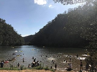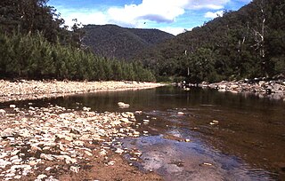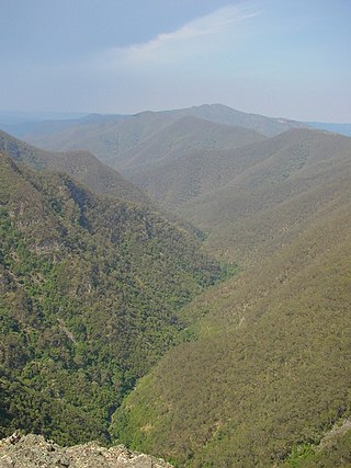
Glenbrook Creek is a freshwater tributary of the Nepean River. It is located within the Blue Mountains of New South Wales, Australia.
Contents


Glenbrook Creek is a freshwater tributary of the Nepean River. It is located within the Blue Mountains of New South Wales, Australia.

The headwaters of Glenbrook Creek are approximately 5 km south-east of Linden, in the Blue Mountains National Park. The creek follows a mainly south-easterly course for its 17 km length. [1] It starts at an altitude of 300m, and empties into the Nepean River at 30m, which is a descent of 270m. The lower reach of the creek passes through a valley known as "Glenbrook Gorge". It is the site of two swimming holes, Blue Pool and Jellybean Pool

, and there are many bushwalking tracks along its banks.
Glenbrook Creek gave its name to Glenbrook Railway Station, which in turn gave its name to Glenbrook village, which the creek flows to the south of.

The Colo River, a perennial stream that is part of the Hawkesbury-Nepean catchment, is located in the Central Tablelands of New South Wales, Australia.

Glenbrook is a township of the Lower Blue Mountains of New South Wales, Australia. It is located 63 kilometres west of the Sydney central business district, in the local government area of the City of Blue Mountains. As of the 2021 Australian census Glenbrook had a population of 5,078 people.
The Wollemi Creek, a partly perennial stream of the Hawkesbury-Nepean catchment, is located in the Central Tablelands and Blue Mountains regions of New South Wales, Australia.

Bents Basin is a protected nature reserve and state park near Wallacia, New South Wales, Australia in the Sydney metropolitan area. The lake basin, which formed at the efflux of the Nepean River from the Hawkesbury Sandstone gorge, is a popular swimming hole with a camping area and an education centre used by local school groups. Also featuring a large woodland area and native wildlife, the reserve is the only picnic area along the Nepean River and it is one of the most popular water-based picnic parks in Greater Western Sydney.
Leonay is a suburb of Sydney, in the state of New South Wales, Australia 58 kilometres west of the Sydney central business district, in the local government area of the City of Penrith. It is part of the Greater Western Sydney region.

Lapstone is a township on the eastern escarpment of the Blue Mountains in New South Wales, Australia. Elevation 160 m (525 ft). Lapstone is located 62 kilometres west of the Sydney CBD in the local government area of the City of Blue Mountains and is part of the federal electorate of Macquarie. Lapstone consists mostly of stand-alone housing and has a few public facilities. At the 2016 census, Lapstone had a population of 961 people. Lapstone was originally bought and developed by Mr Arthur J Hand, an Alderman of the Blue Mountains City Council.

The Lapstone Zig Zag was a zig zag railway built between Emu Plains and Blaxland stations on the Main Western Line of New South Wales in Australia. Constructed between 1863 and 1865 to overcome an otherwise insurmountable climb up the eastern side of the Blue Mountains, the zig zag and associated Knapsack Viaduct, a sandstone arch viaduct, were designed by John Whitton, Engineer-in-Charge of New South Wales Government Railways, and were built by William Watkins. The zig zag was listed on the Blue Mountains local government heritage register on 27 December 1991; while the adjacent Knapsack Viaduct was listed on the New South Wales Heritage Database on 2 April 1999. The Lapstone Zig Zag was the world-first Zig Zag constructed on any main-line railway.

The Coxs River, a perennial river that is part of the Hawkesbury-Nepean catchment, is located in the Central Tablelands, Blue Mountains, and Macarthur regions of New South Wales, Australia.

The Grose River, a perennial river that is part of the Hawkesbury-Nepean catchment, is located in the Blue Mountains region of New South Wales, Australia.

The Kurrajong railway line was a railway line in the distant rural western suburbs of Sydney, Australia. It was an extension of the branch off the Main Western line from Blacktown to Richmond and was operated by the New South Wales Government Railways.
The Kowmung River, a perennial river that is part of the Hawkesbury-Nepean catchment, is located in the Central Tablelands region of New South Wales, Australia.
The Tonalli River, a perennial river that is part of the Hawkesbury-Nepean catchment, is located in the Blue Mountains region of New South Wales, Australia.

The Wollangambe River, an Australian perennial river that is part of the Hawkesbury–Nepean catchment within the Sydney Basin, is located in the Greater Blue Mountains Area of New South Wales.
The Little River, a perennial river that is part of the Hawkesbury-Nepean catchment, is located in the Central Tablelands region of New South Wales, Australia.

The 1813 crossing of the Blue Mountains was the expedition led by Gregory Blaxland, William Lawson and William Charles Wentworth, which became the first successful crossing of the Blue Mountains in New South Wales by European settlers. The crossing enabled the settlers to access and use the land west of the mountains for farming, and made possible the establishment of Australia's first inland colonial settlement at Bathurst.
The Erskine Creek, a perennial stream of the Hawkesbury-Nepean catchment, is located in the Blue Mountains region of New South Wales, Australia.

The Bedford Creek, a perennial stream of the Hawkesbury-Nepean catchment, is located in the Blue Mountains region of New South Wales, Australia.
The Du Faur Creek, a perennial stream of the Hawkesbury-Nepean catchment, is located in the Blue Mountains region of New South Wales, Australia.

The Kanangra Creek, a perennial stream of the Hawkesbury-Nepean catchment, is located in the Blue Mountains region of New South Wales, Australia.

The Mogo Creek, a perennial stream of the Hawkesbury-Nepean catchment, is located in the Blue Mountains region of New South Wales, Australia.