
Sydney Cove is a bay on the southern shore of Sydney Harbour, one of several harbours in Port Jackson, on the coast of Sydney, New South Wales. Sydney Cove is a focal point for community celebrations, due to its central Sydney location between the Sydney Opera House and the Sydney Harbour Bridge.
Greenwich is a suburb on the Lower North Shore of Sydney, in the state of New South Wales, Australia. Greenwich is located 7 kilometres (4.3 mi) north-west of the Sydney central business district, in the local government area of the Municipality of Lane Cove.

Lane Cove is a suburb on the Lower North Shore of Sydney, in the state of New South Wales, Australia. Lane Cove is nine kilometres north-west of the Sydney central business district and is the administrative centre for the local government area of the Lane Cove Council. Lane Cove West and Lane Cove North are separate suburbs.

The Division of North Sydney is an Australian electoral division in the state of New South Wales.

The Division of Bradfield is an Australian electoral division in the state of New South Wales.

Milsons Point is a suburb on the lower North Shore of Sydney, in the state of New South Wales, Australia. The suburb is located 3 kilometres north of the Sydney central business district in the local government area of North Sydney Council.

Watsons Bay is a harbourside, eastern suburb of Sydney, in the state of New South Wales, Australia. Watsons Bay is located 11 km north-east of the Sydney central business district, in the local government area of the Municipality of Woollahra.

Farm Cove is a tidal inlet and shallow bay in Sydney Harbour, separated from Sydney Cove by Bennelong Point, New South Wales, Australia. Farm Cove is one of the places around Sydney Harbour that has been officially gazetted as a dual named site by the Geographical Names Board (GNB). The official dual name for this place is: 'Farm Cove / Wahganmuggalee'.

Cremorne Point is a harbourside suburb on the Lower North Shore of Sydney, New South Wales, Australia. Cremorne is located 6 kilometres north of the Sydney central business district, in the local government area of North Sydney Council.

Careening is a method of gaining access to the hull of a sailing vessel without the use of a dry dock. It is used for cleaning or repairing the hull. Before ship's hulls were protected from marine growth by fastening copper sheets over the surface of the hull, fouling by this growth would seriously affect the sailing qualities of a ship, causing a large amount of drag.
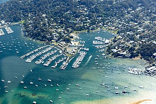
Newport is a suburb of northern Sydney in the state of New South Wales, Australia, in the local government area of Northern Beaches Council. It is part of the Northern Beaches region.

The Iron Cove Bridge is a heritage-listed road bridge that carries Victoria Road (A40) across Iron Cove, linking the Sydney suburbs of Drummoyne to Rozelle in the City of Canada Bay local government area of New South Wales, Australia.

Huntleys Cove is a suburb on the Lower North Shore of Sydney, in the state of New South Wales, Australia. Huntleys Cove is located 9 kilometres north-west of the Sydney central business district, in the local government area of the Municipality of Hunter's Hill. Huntleys Cove sits on the peninsula between Tarban Creek and the Parramatta River.

The Bennelong Apartments is a residential apartment building and multi-use complex on the east side of Sydney's Circular Quay. The buildings were designed by Andrew Andersons and PTW Architects, and completed in 1998.

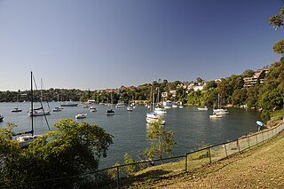
Riverview is a suburb on the Lower North Shore of Sydney of Sydney, in the state of New South Wales, Australia. Riverview is located 9 kilometres north-west of the Sydney central business district, in the local government area of the Municipality of Lane Cove. It is situated on the northern side of the Lane Cove River, at the head of Tambourine Bay; the foreshore is occupied by Tambourine Bay Park. Riverview is primarily a residential area.
Balls Head Bay, formerly known as Oyster Cove, Wollstonecraft Bay,Sugarworks Bay, Powder Works Bay and Kerosene Bay, is a bay located to the west of the Waverton Peninsula, west of Balls Head and to the east of Berry Island, on the north of Sydney Harbour, Sydney, New South Wales, Australia.

North Shore Rowing Club is the oldest sporting club on the north side of Sydney Harbour in Sydney, Australia formed in 1879. It has occupied its current site on the Lane Cove River at Yacht Bay, Longueville since 1933. The club has a focus on masters, juniors and social rowing. The club conducts an annual corporate regatta and a learn-to-row program.
Devlins Creek, an urban watercourse that is part of the Parramatta River catchment, is located in Northern Suburbs region of Sydney, Australia.
Terrys Creek, an urban watercourse that is part of the Lane Cove River catchment, is located in Northern Suburbs region of Sydney, Australia. It was named after Edward Terry who served as the first mayor of Eastwood municipality.
Gore Creek, an urban watercourse that is part of the Parramatta River catchment, is located in Northern Suburbs region of Sydney, Australia.

