This article needs additional citations for verification .(March 2007) |
Illawarra | |
---|---|
Highest point | |
Peak | Bells Hill, New South Wales |
Elevation | 803 m (2,635 ft) |
Coordinates | 34°37′S150°36′E / 34.617°S 150.600°E [1] |
Dimensions | |
Length | 92 km (57 mi)NNE [2] |
Geography | |
Country | Australia |
State | New South Wales |
Region | Illawarra |
Range coordinates | 34°22′02″S150°52′33″E / 34.36722°S 150.87583°E [2] |
Geology | |
Orogeny | Sydney Basin |
Age of rock | Tertiary |
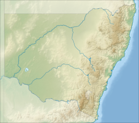
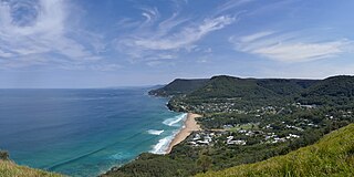
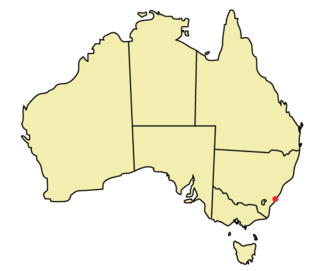
The Illawarra escarpment, or officially the Illawarra Range, [2] is the fold-created cliffs and plateau-eroded outcrop mountain range west of the Illawarra coastal plain south of Sydney, in the state of New South Wales, Australia. The range encloses the Illawarra region which stretches from Stanwell Park in the north to Kiama, Gerringong and the Shoalhaven River in the south.
Bells Hill, west of Knights Hill, is the highest point in the range at 803 metres (2,635 ft) AHD on the range's plateau; with a number of other peaks on the escarpment ranging from 300 metres (980 ft) to a maximum of 768 metres (2,520 ft) at Mount Murray southwest of Dapto.
The escarpment or scarp was created between 225 and 280 million years ago and since eroded by creeks to its present height around 30 million years ago. Most of it is sandstone, with many Hawkesbury sandstone boulders and ledges visible in addition to the actual cliffs. Its maximum heights are reached in the south, west of Albion Park at Knights Hill, 709 metres (2,326 ft), and Mount Murray, 768 metres (2,520 ft). This forms the eastern edge of the Southern Highlands plateau, uplifted along with the Blue Mountains around 70 million years ago.
Many of the towns on the coastal plain adjacent to the escarpment were first founded to harvest the cedar trees on the slopes of the escarpment or the coal seams beneath it. With the original logging industry of the area came the need for passes over the escarpment, creating such ones as Rixons Pass, Bulli Pass, O'Briens Road and Macquarie Pass. The city of Wollongong is the central city in the Illawarra.
The escarpment contains a wide variety of native flora and fauna and is a haven for many forms of wildlife.
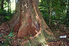
It is known for the Illawarra Flame Tree with its bright foliage, as well as rare surviving red cedar trees that haven't been logged. On Saddleback Mountain and at Minnamurra Rainforest and other places there are remnant localities of rainforest bushland, as well as, to the north, dry sclerophyll forests. The southern typical bush meets the northern at Mount Kembla, creating a unique effect.
Many native species thrive here such as wallabies, brushtail possums and gliding possums, frogs, goannas, brush turkeys, flying foxes, snakes, bower birds, glossy black cockatoos and other colourful parrots, owls and native birds of prey.
The area also has many introduced species including fallow deer, red deer, rabbits, feral cats and red foxes. It also acts as a significant haven for species that have been affected by environmental disturbances such as development and bushfire. There are currently 12 threatened animal species in the area. [3]
The escarpment also contains many historic sites such as mine entrances and passes.
The escarpment contains the Illawarra Escarpment Subtropical Rainforest (S_RF01) ecological community, which has been declared an endangered ecological community, under the New South Wales TSC Act. [4]
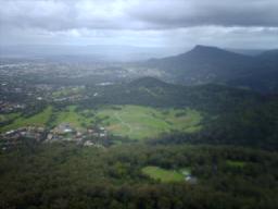
Geographically it stretches from the white cliffs of the Royal National Park and its northern hilly ridge formations like Bulgo and Otford Hills and Stony Batter, Undola Ridge and Bald Hill, south past the Otford Valley to the west and around an eroded valley containing Stanwell Park, then it goes south, featuring cliffs and running close to the coastal headlands, approximately 300 metres (1,000 ft) above sea level at Scarborough to the turn at Sublime Point at 415 metres (1,362 ft) near Thirroul, south to Brokers Nose at 440 metres (1,440 ft) promontory, south to Mount Keira, which juts out from the main cliffs, south to a similar eroded sandstone outcrop, Mount Kembla at 534 metres (1,752 ft), then southwest along the Dapto scarp cliffs including Mount Bong Bong to the turn inland at Macquarie Pass, then back east to the promontory at Knights Hill at 709 metres (2,326 ft), south including Jamberoo Mountain and east to Noorinan Mountain promontory at Barren Grounds Plateau, then along a ridge to its southern tip, Saddleback Mountain.
The Cambewarra Range is considered a separate, yet related, geological formation that continues around the Noorinan promontory and continues around Kangaroo Valley.
It ranges in height from the tops of Bald Hill and Stony Batter around 300 metres (980 ft) above sea level, to 440 metres (1,440 ft) at Brokers Nose, generally above 350 metres (1,150 ft) high south of Mount Ousley Road (between Keira and Brokers Nose) it reaches 464 metres (1,522 ft) at Mount Keira, 464 metres (1,522 ft) at Mount Warra, 469 metres (1,539 ft) at Mount Brisbane, 531 metres (1,742 ft) at Mount Burelli, 512 metres (1,680 ft) at Kembla West, 534 metres (1,752 ft) at Mount Kembla, 564 metres (1,850 ft) at Wanyambilli Hill on the plateau to the west and 709 metres (2,326 ft) at Knights Hill, just over 663 metres (2,175 ft) at Noorinan Mountain and about 600 metres (2,000 ft) at Saddleback Mountain.
It is mostly of hard sandstone, with outcrops like Mount Keira and Mount Kembla rising above 450 metres (1,480 ft). There are many tracks to the top of such summits including the southern tip of the escarpment, Saddleback Mountain and Noorinan Mountain promontory. The flora ranges from northern and southern eucalypts and at Mount Kembla fuses, providing an interesting phenomena. The range has much history, including Hoddles Track which used to go to Bowral from Kiama.
To the north the range is mostly a coastal ridge east of Otford, becoming a cliff at Mount Mitchell, and continuing to include an eroded cliff at its top until Bulli Pass where it becomes rounded, forming Woonona Mountain, until Brokers Nose where the cliff reappears, before appearing again on the edge of Mount Keira and Warra, disappearing until west of Dapto where it forms the famous southern escarpment and curves in for Macquarie Pass National Park and Mount Murray at 768 metres (2,520 ft) before turning into Knights Hill at 709 metres (2,326 ft) and then forming Noorinan promontory, its summit at 663 metres (2,175 ft), and Saddleback Mountains.
There are several passes over the escarpment:
Saddleback Mountain Road only reaches the summit after a short, steep, turnoff, but was once part of Hoddles Track, which is now only in existence in a small ridge track from the summit but used to extend west to the Southern Highlands.
Numerous areas are protected as part of the Illawarra Escarpment State Conservation Area or as state forests such as Kembla State Forest southwest of Wollongong. However, much is private property or owned by mining companies like BHP. Well known and popular lookouts such as at Mount Keira and Bald Hill are reserves or parks, the Mount Keira Summit Park is an annexe of the Wollongong Botanic Garden like Puckeys Estate Reserve on the plain.
There are many walking tracks and lookouts with views of the surrounding countryside to the south, or suburbs to the north and coastal villages to the far north, and bushland and suburbs to the north. There are several well-known lookouts, such as Bald Hill, Bulli Pass, Sublime Point and Mount Keira, as well as lesser known tracks with views such as Hoddles Track west of Saddleback Mountain. Some tracks have gone into disrepair such as the Wodi Wodi track at Stanwell Park, but some such as the Mount Keira Ring Track have been upgraded. Weed infestation is a problem, with many areas invaded by lantana and other invasive weeds.
Maddens Plains (also written as Madden's Plains) was named after John Madden who arrived from Ireland in 1850 at the age of 11. [5] [6]
The "address locality" of Maddens Plains is defined as a suburb of the City of Wollongong, "about 1 km N of Scarborough and about 7 km E of Southend [trig] Station". [7] At the 2021 census, it had no population. [8] There is a group of telecommunications antennae, including amateur radio repeaters.
Wollongong is a city located in the Illawarra region of New South Wales, Australia. The name is believed to originate from the Dharawal language, meaning either 'five islands/clouds', 'ground near water' or 'sound of the sea'. Wollongong lies on the narrow coastal strip between the Illawarra Escarpment and the Pacific Ocean, 85 kilometres south of central Sydney. Wollongong had an estimated urban population of 302,739 at June 2018, making it the third-largest city in New South Wales after Sydney and Newcastle and the tenth-largest city in Australia by population. The city's current Lord Mayor is Gordon Bradbery AM who was elected in 2021.
Bulli is a northern suburb of Wollongong situated on the south coast of New South Wales, Australia.
The Illawarra is a coastal region in the southeast of the Australian state of New South Wales. It is situated immediately south of Sydney and north of the South Coast region. It encompasses the two cities of Wollongong, Shellharbour and the coastal town of Kiama. Wollongong is the largest city of the Illawarra with a population of 240,000, then Shellharbour with a population of 70,000 and Kiama with a population of 10,000. These three cities have their own suburbs. Wollongong stretches from Otford in the north to Windang in the south, with Maddens Plains and Cordeaux in the west.
Mount Keira is a suburb and mountain in the Illawarra region of New South Wales, Australia.
Mount Kembla is a suburb and a mountain in the Illawarra region of New South Wales, Australia.
Stanwell Park is a coastal village and northern suburb of Wollongong, New South Wales, Australia. It is the northernmost point of the Illawarra coastal strip and lies south of Sydney's Royal National Park. It is situated in a small valley between Bald Hill to the north, Stanwell Tops to the west and Mount Mitchell to the south. It has two lagoons from the village's two creeks, Stanwell and Hargrave Creeks, and a beach running between headlands. Stanwell Park and the surrounding suburbs are colloquially referred to by its postcode 2508.
Princes Motorway is a 62-kilometre (39 mi) predominantly dual carriage untolled motorway that links Sydney to Wollongong and further south through the Illawarra region to Oak Flats. Part of the Australian Highway 1 network, the motorway is designated route M1.
The South Coast Railway is a commuter and goods railway line from Sydney to Wollongong and Bomaderry in New South Wales, Australia. Beginning at the Illawarra Junction, the line services the Illawarra and South Coast regions of New South Wales.
Otford is a village in the Otford Valley located 55 km south of the Sydney and 30 km north of the Wollongong CBD in New South Wales, Australia. Otford is within the local government area of the City of Wollongong.
Bald Hill is a hill on the Illawarra Range, in the state of New South Wales, Australia. With an elevation of approximately 180 metres (590 ft) AMSL, Bald Hill is one of the best known and most popular lookouts in the Illawarra region providing panoramic vistas across the Illawarra escarpment and over the Illawarra plain and the Tasman Sea of the South Pacific Ocean.
Unanderra railway station is located on the South Coast railway line in the Wollongong suburb of Unanderra, New South Wales, Australia.
Lawrence Hargrave Drive, part of the Grand Pacific Drive, is a scenic coastal road and popular tourist drive connecting the northernmost suburbs of Wollongong, New South Wales, Australia, to Wollongong, in the south, and Sydney, in the north across the scenic Sea Cliff Bridges. It was named after Lawrence Hargrave, an Australian aviation pioneer who lived nearby.
Wollongong Central is a large shopping centre in Wollongong, New South Wales, Australia.
Coalcliff is a town on the coast of New South Wales, Australia, between Sydney and Wollongong.
Mount Nebo, a tall hill that is part of the Illawarra Range, is located in the foothills of the Illawarra escarpment on the edge of the suburban fringe of the city of Wollongong, New South Wales, Australia. At 251 metres (823 ft) above sea level, the hill is reached by the steep O'Brien's Road from the suburb of Figtree.
The Illawarra Rugby League is a rugby league competition in Wollongong, NSW. It is one of the oldest rugby league competitions in Australia, founded in 1911 with five clubs. The area provides a nursery of juniors for the Illawarra Steelers and St George Illawarra Dragons. The season is contested by seven teams and concludes with a finals series involving the top four teams.
Saddleback Mountain is a mountain near Kiama in the Illawarra region of New South Wales, Australia. The mountain rises to about 600 metres (2,000 ft) above sea level on the Illawarra escarpment and has views of Noorinan Mountain, 662 metres (2,172 ft) above sea level, and Barren Grounds Plateau to the west and south to Coolangatta Mountain and Pigeon House Mountain to Ulladulla, and north over Lake Illawarra, the Illawarra escarpment and to the Cronulla Sandhills and Kurnell Oil Refinery on a clear day.
Bulli Pass is a mountain pass with an elevation of 283 metres (928 ft) AHD located northwest of Bulli, New South Wales, Australia. It is situated on the Illawarra escarpment west of the Illawarra coastal plain. It was built during the 19th century for use by loggers and locals transporting goods to and from Sydney. Beforehand sea travel was the only reliable method.
The city of Wollongong has a distinct geography. It lies on a narrow coastal plain flanked by the Pacific Ocean to the east and a steep sandstone precipice known as the Illawarra Escarpment to the west, most notably Mount Keira, joined to the escarpment by a high saddle.