Mount Irvine, New South Wales

Last updated

Mount Irvine
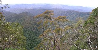
Mt Irvine Nutwood.jpg
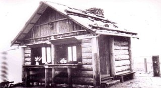
Nutwood Farm, Mt Irvine
Highest point
Elevation 850 m (2,790 ft)
Coordinates 33°30′S150°28′E / 33.500°S 150.467°E / -33.500; 150.467 [1]
Geography
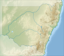
Australia New South Wales relief location map.png
Red triangle with thick white border.svg
Mount Irvine
Location in New South Wales

Mount Irvine is a small village and a mountain located in the Blue Mountains region in the state of New South Wales, Australia. The village is situated in the City of Blue Mountains in Greater Western Sydney. As of the 2016 Census, Mount Irvine has a population of 28. [2]

Contents

At an elevation of 850 metres (2,790 ft) above sea level, the mountain is approximately 85 kilometres (53 mi) west northwest from Sydney CBD and more than two hours by car. The area has a wet micro climate and rich basalt soils, weathered from ancient volcanics. Rainfall is in excess of 1,500 millimetres (59 in) a year and vegetation is predominantly temperate rain forest. The area is typified by some spectacular temperate gardens, similar to those in the neighbouring area of Mount Wilson.

There are only twenty or so properties with a small amount of commercial activity; mainly walnut and chestnut groves. There is no large-scale commercial farming, and organic methods are widely used.

History

Mt Irvine Road was first surveyed in 1897 by government surveyor Charles Scrivener. Later the same year he returned with his son, Charles Passevile Scrivener, who brought two of his fellow graduates from Hawkesbury Agricultural College. The elder Scrivener proposed to designate the area as a national reserve. When this failed and 400 hectares of land was released for sale, Scrivener's son and his two friends bought up the first three grants. Scrivener himself settled in Mt. Irvine upon his retirement in 1915. Their families remain in Mt. Irvine to this day. [3]

Activities

In Mt Irvine, there are several things to do, including picking chestnuts and walnuts in the nearby Nutwood or Kookootonga Farm. [4] [5] These farms are located near the summit of Mt Irvine, and are accessed by Mt Irvine Road. [4] [5]

See also

Related Research Articles

<span class="mw-page-title-main">Blue Mountains (New South Wales)</span> Mountain range in Australia

The Blue Mountains are a mountainous region and a mountain range located in New South Wales, Australia. The region is considered to be part of the western outskirts of the Greater Sydney area. The region borders on Sydney's main metropolitan area, its foothills starting about 50 kilometres (31 mi) west of centre of the state capital, close to Penrith. The public's understanding of the extent of the Blue Mountains is varied, as it forms only part of an extensive mountainous area associated with the Great Dividing Range. As defined in 1970, the Blue Mountains region is bounded by the Nepean and Hawkesbury rivers in the east, the Coxs River and Lake Burragorang to the west and south, and the Wolgan and Colo rivers to the north. Geologically, it is situated in the central parts of the Sydney Basin.

<span class="mw-page-title-main">Blue Mountains National Park</span> Protected area in New South Wales, Australia

The Blue Mountains National Park is a protected national park that is located in the Blue Mountains region of New South Wales, in eastern Australia. The 267,954-hectare (662,130-acre) national park is situated approximately 80 kilometres (50 mi) west of the Sydney CBD, and the park boundary is quite irregular as it is broken up by roads, urban areas and areas of private property. Despite the name mountains, the area is an uplifted plateau, dissected by a number of larger rivers. The highest point in the park is Mount Werong at 1,215 metres (3,986 ft) above sea level; while the low point is on the Nepean River at 20 metres (66 ft) above sea level as it leaves the park.

<span class="mw-page-title-main">Braidwood, New South Wales</span> Town in New South Wales, Australia

Braidwood is a town in the Southern Tablelands of New South Wales, Australia, in Queanbeyan–Palerang Regional Council. It is located on the Kings Highway linking Canberra with Batemans Bay. It is approximately 200 kilometres south west of Sydney, 60 kilometres inland from the coast, and 55 kilometres east of Canberra. Braidwood is a service town for the surrounding district which is based on sheep and cattle grazing, and forestry operations.

<span class="mw-page-title-main">Mount Warning</span> Mountain in New South Wales, Australia

Mount Warning, a mountain in the Tweed Range in the Northern Rivers region of New South Wales, Australia, was formed from a volcanic plug of the now-gone Tweed Volcano. The mountain is located 14 kilometres (9 mi) west-south-west of Murwillumbah, near the border between New South Wales and Queensland. Lieutenant James Cook saw the mountain from the sea and named it Mount Warning.

<span class="mw-page-title-main">Rooty Hill, New South Wales</span> Suburb of Sydney, New South Wales, Australia

Rooty Hill is a suburb of Sydney, in the state of New South Wales, Australia. Rooty Hill is located 42 kilometres west of the Sydney central business district, in the local government area of the City of Blacktown and is part of the Greater Western Sydney region.

<span class="mw-page-title-main">Crookwell, New South Wales</span> Town in New South Wales, Australia

Crookwell is a small town located in the Southern Tablelands of New South Wales, Australia, in the Upper Lachlan Shire. At the 2016 census, Crookwell had a population of 2,641. The town is at a relatively high altitude of 887 metres and there are several snowfalls during the cooler months. The nearest major centre is the city of Goulburn which is about a half-hour drive to the south-east of the town. Crookwell is easily accessible to the state capital of Sydney and also the federal capital of Canberra.

<span class="mw-page-title-main">Wentworthville, New South Wales</span> Suburb of Sydney, New South Wales, Australia

Wentworthville is a suburb in Sydney, in the state of New South Wales, Australia. Wentworthville is located 27 kilometres west of the Sydney central business district and is part of the Greater Western Sydney region. Wentworthville is split between the local government areas of the City of Parramatta and the Cumberland Council. Wentworthville is colloquially known as 'Wenty'.

<span class="mw-page-title-main">City of Blue Mountains</span> Local government area in New South Wales, Australia

The City of Blue Mountains is a local government area of New South Wales, Australia, governed by the Blue Mountains City Council. The city is located in the Blue Mountains, on the Great Dividing Range at the far western fringe of the Greater Sydney area. Major settlements include, Katoomba, Lawson, Springwood and Blaxland.

<span class="mw-page-title-main">Mount Victoria, New South Wales</span> Town in New South Wales, Australia

Mount Victoria is a village in the Blue Mountains of New South Wales, Australia. Geographically, Mount Victoria is the westernmost village and suburb of Greater Sydney on the Great Western Highway in the City of Blue Mountains, located about 120 kilometres (75 mi) west-northwest by road from the Sydney central business district and at an altitude of about 1,052 metres (3,451 ft) AHD. At the 2021 Census, the settlement had a population of 945.

<span class="mw-page-title-main">Mount Druitt</span> Suburb of Sydney, New South Wales, Australia

Mount Druitt is a suburb of Sydney, in the state of New South Wales, Australia. It is located 43 kilometres (27 mi) west of the Sydney central business district, in the local government area of the City of Blacktown, and is part of the Greater Western Sydney region.

<span class="mw-page-title-main">Mount Riverview, New South Wales</span> Town in New South Wales, Australia

Mount Riverview is a town off the Great Western Highway about 2 km NE of Blaxland in the Lower Blue Mountains, New South Wales, 70 kilometres west of the Sydney CBD, Australia. At the 2006 census, Mount Riverview had a population of 2,993 people.

<span class="mw-page-title-main">Macarthur, New South Wales</span> Region in South Western Sydney

Macarthur is a region in the south-west part of the Greater Sydney area, in the state of New South Wales, Australia. The region includes the local government areas of the City of Campbelltown, Camden Council, and Wollondilly Shire. It covers an area of 3,067 square kilometres and has a population of close to 310,000 residents. The region geographically forms the foothills between the Blue Mountains and Southern Highlands regions.

<span class="mw-page-title-main">Mount Wilson, New South Wales</span> Town in New South Wales, Australia

Mount Wilson is a village in the Blue Mountains region of New South Wales, Australia. The village is about 14 kilometres (8.7 mi) east of the township of Bell, and about 100 kilometres (62 mi) west of the Sydney CBD. At the 2021 census, the village of Mount Wilson had a population of 81 people. Mount Wilson is known for its multiple large gardens, walks and access to nature, and popularity as a base for practitioners of canyoning.

Kembla Heights is a village west of Wollongong, New South Wales in the Parish of Kembla County of Camden. It is situated along Harry Graham Drive and upper Cordeaux Road and is part of a tourist route that runs along the Illawarra escarpment for a distance between Mount Kembla and Mount Keira. The Dendrobium Colliery is located in Kembla Heights.

<span class="mw-page-title-main">Mount Piddington</span> Mountain in New South Wales, Australia

Mount Piddington is a mountain in the Explorer Range of the Blue Mountains region, located south of the village of Mount Victoria in New South Wales, Australia.

<span class="mw-page-title-main">Mount Banda Banda</span> Mountain in New South Wales, Australia

Mount Banda Banda, a mountain of the Mid North Coast region of New South Wales, Australia, is situated 320 kilometres (200 mi) from Sydney within the Willi Willi National Park. Banda Banda can be seen on the north-western horizon from Port Macquarie, as well as on the south-western horizon 39 km from the town of Kempsey. At 1,258 metres (4,127 ft) AHD it is the highest mountain in the region.

<span class="mw-page-title-main">Grundy Mountain</span> Mountain in New South Wales, Australia

Grundy Mountain or Mount Grundy, a mountain of the Great Dividing Range, is located on the Northern Tablelands of New South Wales, Australia.

<span class="mw-page-title-main">Nightcap Range</span> Mountain range in New South Wales, Australia

The Nightcap Range is a mountain range located in the Northern Rivers region of New South Wales, Australia, in the area between Lismore and the New South Wales-Queensland border. It includes Mount Burrell and Mount Nardi as well as containing the Nightcap National Park. The range is mainly covered with relict warm temperate rainforest and contains several rare and/or endemic species, most notably the Nightcap oak and the Minyon quandong.

<span class="mw-page-title-main">Chimney Cottage</span> Heritage building in Mount Wilson Australia

Chimney Cottage is a heritage building of significance located at 9-13 Waterfall Road, Mount Wilson in the City of Blue Mountains local government area of New South Wales postcode 2786, Australia. It was designed by Charles Jefferson and built during 1932 by the Kirk Brothers for the Gregson family. It is also known as The Loft and Blueberry Lodge at Chimney Cottage. The property is privately owned.

Lieutenant George Meares Countess Bowen (1803–1889) was a military officer and colonial settler of New South Wales, Australia. He was mainly associated with Bowen Mountain, Mount Tomah, Berambing, and the nearby areas of the Blue Mountains.

References

  1. "Mount Irvine (mountain)". Geographical Names Register (GNR) of NSW. Geographical Names Board of New South Wales . Retrieved 12 May 2015. OOjs UI icon edit-ltr-progressive.svg
  2. "2016 Census QuickStats: Mount Irvine". quickstats.censusdata.abs.gov.au. Retrieved 8 October 2019.
  3. "Mi001 : Mount Irvine and Environs | NSW Environment, Energy and Science". www.environment.nsw.gov.au. Retrieved 8 October 2019.
  4. 1 2 "Pick your own Chestnuts & Walnuts | Kookootonga | Mount Irvine". Kookootonga. Retrieved 27 May 2024.
  5. 1 2 "Just another WordPress site" . Retrieved 27 May 2024.