Lawson, New South Wales

Last updated

Lawson
Blue Mountains,  New South Wales
(1) Blue Mountain Hotel2.JPG
Blue Mountain Hotel
Australia New South Wales location map blank.svg
Red pog.svg
Lawson
Lawson, New South Wales
Coordinates 33°43′S150°26′E / 33.717°S 150.433°E / -33.717; 150.433
Population2,651 (2021 census) [1]
Postcode(s) 2783
Elevation732 m (2,402 ft)
Location
LGA(s) City of Blue Mountains
State electorate(s) Blue Mountains
Federal division(s) Macquarie
Suburbs around Lawson:
Blue Mountains National Park Blue Mountains National Park Hazelbrook
Bullaburra Lawson Hazelbrook
Bullaburra Hazelbrook

Lawson is a town in the Blue Mountains area of New South Wales, Australia. It is located on the Great Western Highway between Hazelbrook in the east and Bullaburra in the west. Lawson has a station on the Main Western line. The town is also served by a public swimming pool and over the years has developed into the commercial hub of the mid-mountains area, which spans from Linden to Bullaburra, boasting a significant industrialized area as well as a shopping centre located on the south-eastern side of the highway.

Contents

Transport

Blue Mountains Transit operates one bus route through Lawson:

History

One of the first settlements on the eastern slopes of the Blue Mountains, Lawson was identified on early maps as 24 Mile Hollowa name which was changed to Christmas Swamp for a few years. When the Blue Mountain Inn was opened in 1848, the locals adopted the name Blue Mountain for the village. This name was also given to the original railway station after the Main Western railway line was pushed through in 1867. The presence of a Blue Mountain on the Blue Mountains, however, became so confusing to visitors that the authorities stepped in and renamed the village Lawson in honour of William Lawson who, along with William Wentworth and Gregory Blaxland, were the first Europeans to cross the Blue Mountains in 1813. [3]

In 1931, the Railway Department agreed to supply electricity to the Blue Mountains Shire Council. Power lines were constructed between Blackheath and Lawson, accompanied by a maintenance track. The authorities then decided to promote the maintenance track as a walking trail; it became known as Bruce's Walk, after the surveyor who planned it. [4] The track later became neglected and forgotten, until it was rediscovered and improved by bushwalkers in the 1980s. It can now be followed from Medlow Bath to the north side of Lawson, although it is not shown on the relevant topographic map.

In more recent years, Lawson was at the centre of controversy due to an ongoing government proposal to widen the Great Western Highway. The highway was a single lane in each direction through the town; the proposed plan by the Roads & Traffic Authority for widening necessitated the removal and relocation of the existing shops and the demolition of the Lawson Community Centre, formerly known as the Mechanics' Institute Hall, which dated back to 1903. Groups opposed to the demolition claimed the hall could be re-sited; others claimed this would be too costly, that the building was in poor repair and contained dangerous levels of asbestos. There was also a group lobbying for the retention of the shops on heritage grounds. By the end of 2008, the Community Centre had been saved. [5]

Heritage listings

Lawson has a number of heritage-listed sites, including:

Population

According to the 2021 census of Population, there were 2,651 people in Lawson.

Attractions

The walks in South Lawson can be accessed from several points along Honour Ave, within easy walk of the train station. This includes four waterfalls: Adelina Falls, Cataract Falls, Federal Falls and Junction Falls. While not having the height of upper mountains waterfalls, this waterfalls walk can be completed in 2 hours. On the north side of town beyond the swimming centre, walks take in Fairy Falls, Dante's Glen, St Michael's Falls, and Echo Bluff (sometimes referred to as Echo point).

Community activities include: Magpie Markets at Lawson Public School are held on the third Sunday on most months (2nd Sunday December, no market in January) In November, the "Love Lawson Festival", later changed to the Mid Mountains Festival is held in conjunction with the Magpie Markets celebrating what is good about living in Lawson and the mid mountains.

The historic Lawson Community Hall (Mechanics Institute) built in 1903 has now reopened after a long battle to save it from demolition due to road widening, and is now the location of numerous community activities.

See also

Related Research Articles

<span class="mw-page-title-main">Katoomba, New South Wales</span> Chief town of the City of Blue Mountains in New South Wales, Australia

Katoomba is the chief town of the City of Blue Mountains in New South Wales, Australia, and the administrative headquarters of Blue Mountains City Council. Katoomba is located on the lands of the Dharug and Gundungurra Aboriginal peoples.

<span class="mw-page-title-main">Blackheath, New South Wales</span> Suburb of City of Blue Mountains, New South Wales, Australia

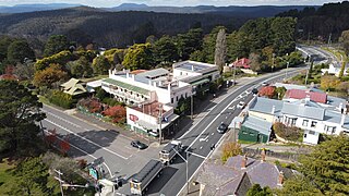
Blackheath is a town located near the highest point of the Blue Mountains, between Katoomba and Mount Victoria in New South Wales, Australia. The town's altitude is about 1,065 m (3,494 ft) AHD  and it is located about 120 km (75 mi) west north-west of Sydney, 11 km (6.8 mi) north-west of Katoomba, and about 30 km (19 mi) south-east of Lithgow.

<span class="mw-page-title-main">Great Western Highway</span> Highway in New South Wales

Great Western Highway is a 202-kilometre-long (126 mi) state highway in New South Wales, Australia. From east to west, the highway links Sydney with Bathurst, on the state's Central Tablelands.

<span class="mw-page-title-main">Glenbrook, New South Wales</span> Town in New South Wales, Australia

Glenbrook is a township of the Lower Blue Mountains of New South Wales, Australia. It is located 63 kilometres west of the Sydney central business district, in the local government area of the City of Blue Mountains. As of the 2021 Australian census Glenbrook had a population of 5,078 people.

<span class="mw-page-title-main">Blaxland, New South Wales</span> Town in New South Wales, Australia

Blaxland is a town in the Blue Mountains of New South Wales, Australia. Blaxland is located 65 kilometres west of Sydney in the local government area of the City of Blue Mountains. It is at an altitude of 234 metres and borders the townships of Glenbrook, Mount Riverview and Warrimoo.

<span class="mw-page-title-main">Medlow Bath, New South Wales</span> Suburb of City of Blue Mountains, New South Wales, Australia

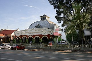
Medlow Bath is a village located near the highest point of the Blue Mountains, New South Wales, Australia. Located between Katoomba and Blackheath, its altitude is about 1,050 metres (3,440 ft) AHD . It is about 115 kilometres (71 mi) west-north-west of the Sydney central business district and 5 kilometres (3.1 mi) north-west of Katoomba. At the 2016 census, Medlow Bath had a population of 611 people.

<span class="mw-page-title-main">Faulconbridge, New South Wales</span> Town in New South Wales, Australia

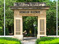
Faulconbridge is a village located in the Blue Mountains 77 km west of the Sydney central business district, New South Wales and is 450 metres above sea level. At the 2016 census, Faulconbridge had a population of 4,025 people. At the 2021 cenus, the population had risen to 4,156.

<span class="mw-page-title-main">Springwood, New South Wales</span> Town in New South Wales, Australia

Springwood is a town in the Blue Mountains, New South Wales, Australia. Springwood is located 72 kilometres west of the Sydney CBD in the local government area of the City of Blue Mountains. At the 2021 census, Springwood had a population 8,423 people.

Hazelbrook is a town in New South Wales, Australia It is located 91 kilometres west of Sydney and 16 kilometres east of Katoomba in the Blue Mountains on the Great Western Highway.

<span class="mw-page-title-main">City of Blue Mountains</span> Local government area in New South Wales, Australia

The City of Blue Mountains is a local government area of New South Wales, Australia, governed by the Blue Mountains City Council. The city is located in the Blue Mountains, on the Great Dividing Range at the far western fringe of the Greater Sydney area.

<span class="mw-page-title-main">Mount Victoria, New South Wales</span> Town in New South Wales, Australia

Mount Victoria is a village in the Blue Mountains of New South Wales, Australia. Mount Victoria is geographically the western most village and suburb of Greater Sydney on the great western highway in the City of Blue Mountains, located about 120 kilometres (75 mi) west-northwest by road from the Sydney central business district and at an altitude of about 1,052 metres (3,451 ft) AHD . The settlement had a population of 823 people at the 2011 Census.

<span class="mw-page-title-main">Wentworth Falls, New South Wales</span> Suburb of City of Blue Mountains, New South Wales, Australia

Wentworth Falls is a town in the Blue Mountains region of New South Wales, situated approximately 100 kilometres (62 mi) west of the Sydney central business district, and about 8 kilometres (5.0 mi) east of Katoomba, Australia on the Great Western Highway, with a Wentworth Falls railway station on the Main Western line. The town is at an elevation of 867 metres (2,844 ft) AHD . At the 2016 census, Wentworth Falls had a population of 6,076.

<span class="mw-page-title-main">Leura, New South Wales</span> Suburb of Blue Mountains, New South Wales, Australia

Leura is a suburb in the City of Blue Mountains local government area that is located 100 kilometres (62 mi) west of the Sydney central business district in New South Wales, Australia. It is one of the series of small towns stretched along the Main Western railway line and Great Western Highway that bisects the Blue Mountains National Park. Leura is situated adjacent to Katoomba, the largest centre in the upper mountains, and the two towns merge along Leura's western edge.

<span class="mw-page-title-main">Bullaburra, New South Wales</span> Suburb of City of Blue Mountains, New South Wales, Australia

Bullaburra is a small town in the state of New South Wales, Australia, in the City of Blue Mountains. It is one of the towns that stretch along the route of the Main Western railway line and Great Western Highway which pass over the Blue Mountains, west of Sydney. Bullaburra used to have a service station but it was demolished in 2008. Bullaburra is an Aboriginal word meaning clear day.

<span class="mw-page-title-main">Blackheath railway station, New South Wales</span> Railway station in New South Wales, Australia

Blackheath railway station is a heritage-listed former railway bridge and now railway station located on the Main Western line in Blackheath in the City of Blue Mountains local government area of New South Wales, Australia. It was designed and built by NSW Government Railways and built from 1897 to 1985. It is also known as the Blackheath Railway Station Group. The property was added to the New South Wales State Heritage Register on 2 April 1999. The station opened on 28 December 1869.

<span class="mw-page-title-main">Woodford, New South Wales</span> Town in New South Wales, Australia

Woodford is a village in the Blue Mountains in New South Wales, Australia, about 90 kilometres west of the Sydney CBD. Its elevation is 609 metres (1,998 ft) above sea level. It is situated on the Great Western Highway and has a railway station on the Main Western railway line served by NSW TrainLink's Blue Mountains services. At the 2016 census, Woodford had a population of 1,934.

<span class="mw-page-title-main">Bruce's Walk</span>

Bruce's Walk is a bush track in the Blue Mountains area of New South Wales, Australia. It is located approximately 100 kilometres west of Sydney, the capital of New South Wales.

<span class="mw-page-title-main">Beauchamp Falls (Blue Mountains)</span> Waterfall in New South Wales, Australia

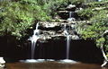
The Beauchamp Falls is a cascade waterfall on the Greaves Creek where it spills into the Grose Valley, located east of the Evans Lookout, approximately 2.5 kilometres (1.6 mi) east of Blackheath in the Blue Mountains region of New South Wales, Australia.

<span class="mw-page-title-main">Bridal Veil Falls, Leura</span> Waterfall in New South Wales, Australia

The Bridal Veil Falls is a cascade waterfall on the Leura Falls Creek where it spills into the Jamison Valley, located south-east of Leura in the Blue Mountains region of New South Wales, Australia.

References

  1. 1 2 Australian Bureau of Statistics (28 June 2022). "Lawson (State Suburb)". 2021 Census QuickStats. Retrieved 14 October 2022. OOjs UI icon edit-ltr-progressive.svg
  2. "| transportnsw.info". transportnsw.info. Retrieved 25 January 2024.
  3. "Origin of Blue Mountains Town Names" Blue Mountains City Council Archived 2007-04-15 at the Wayback Machine
  4. How to See the Blue Mountains, Jim Smith (Second Back Row Press), 1986, pp.64-66
  5. Mid Mountains History:Retrieved 1st January 2009
  6. "Blue Mountains Walking tracks". New South Wales State Heritage Register . Department of Planning & Environment. H00980. Retrieved 18 May 2018. CC BY icon.svg Text is licensed by State of New South Wales (Department of Planning and Environment) under CC-BY 4.0 licence .
  7. "Lawson Railway Station Group". New South Wales State Heritage Register . Department of Planning & Environment. H01177. Retrieved 18 May 2018. CC BY icon.svg Text is licensed by State of New South Wales (Department of Planning and Environment) under CC-BY 4.0 licence .
  8. "Ln014 : Honour Gardens Conservation Area | NSW Environment & Heritage". www.environment.nsw.gov.au. Retrieved 3 January 2019.