Related Research Articles

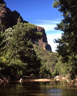
The Blue Mountains are a mountainous region and a mountain range located in New South Wales, Australia. The region is considered to be part of the western outskirts of the Greater Sydney area. The region borders on Sydney's main metropolitan area, its foothills starting about 50 kilometres (31 mi) west of centre of the state capital, close to Penrith. The public's understanding of the extent of the Blue Mountains is varied, as it forms only part of an extensive mountainous area associated with the Great Dividing Range. As defined in 1970, the Blue Mountains region is bounded by the Nepean and Hawkesbury rivers in the east, the Coxs River and Lake Burragorang to the west and south, and the Wolgan and Colo rivers to the north. Geologically, it is situated in the central parts of the Sydney Basin.

Katoomba is the main town and council seat of the City of Blue Mountains in New South Wales, Australia, and is the administrative centre of Blue Mountains City Council. Katoomba is located on the lands of the Dharug and Gundungurra Aboriginal peoples.

Biamanga National Park is a protected area in New South Wales, Australia, 408 km (254 mi) south of Sydney and 40 km (25 mi) north of Bega. The park forms part of the Ulladulla to Merimbula Important Bird Area because of its importance for swift parrots.

Ku-ring-gai Chase National Park is a national park on the northern side of Sydney in New South Wales, Australia. The 14,977-hectare (37,010-acre) park is 25 kilometres (16 mi) north of the Sydney central business district and generally comprises the land east of the M1 Pacific Motorway, south of the Hawkesbury River, west of Pittwater and north of Mona Vale Road. It includes Barrenjoey Headland on the eastern side of Pittwater.

The Mutawintji National Park, formerly the Mootwingee National Park, is a protected national park that is located in the Far West region of New South Wales, in eastern Australia. The 68,912-hectare (170,290-acre) national park is situated approximately 880 kilometres (550 mi) west of Sydney and about 130 kilometres (81 mi) north-east of Broken Hill.
The Toonumbar National Park is a protected national park located in the Northern Rivers region of New South Wales, Australia. The 14,910-hectare (36,800-acre) park is situated approximately 620 kilometres (390 mi) north of Sydney, near the town of Woodenbong.
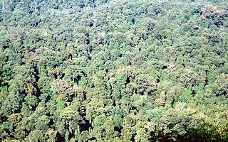
The Wollemi National Park is a protected national park and wilderness area that is located in the Central West and Hunter region of New South Wales, in eastern Australia. The 501,703-hectare (1,239,740-acre) park, the second largest national park in New South Wales, contains the 361,113-hectare (892,330-acre) Wollemi Wilderness – the largest such wilderness area in Australia – and is situated approximately 130 kilometres (81 mi) northwest of Sydney.

Cobar is a town in central western New South Wales, Australia whose economy is based mainly upon base metals and gold mining. The town is 712 km (442 mi) by road northwest of the state capital, Sydney. It is at the crossroads of the Kidman Way and Barrier Highway. The town and the local government area, the Cobar Shire, are on the eastern edge of the outback. At the 2016 census, the town of Cobar had a population of 3,990. The Shire has a population of approximately 4,700 and an area of 44,065 square kilometres (17,014 sq mi).

Mount Warning, a mountain in the Tweed Range in the Northern Rivers region of New South Wales, Australia, was formed from a volcanic plug of the now-gone Tweed Volcano. The mountain is located 14 kilometres (9 mi) west-south-west of Murwillumbah, near the border between New South Wales and Queensland. Lieutenant James Cook saw the mountain from the sea and named it Mount Warning, believing he was the first person to ever see it.
The Ngiyampaa language, also spelt Ngiyambaa, Ngempa, Ngemba and other variants, is a Pama–Nyungan language of the Wiradhuric subgroup. It was the traditional language of the Wangaaypuwan and Wayilwan peoples of New South Wales.
Gulaga, dual-named as Mount Dromedary and also referred to as Mount Gulaga, is a mountain located in the south coast region of New South Wales, Australia. It rises above the village of Central Tilba and is within the Gulaga National Park. At its highest point, it measures 806 metres (2,644 ft) above sea level.

The South Western Slopes, also known as the South West Slopes, is a region predominantly in New South Wales, Australia. It covers the lower inland slopes of the Great Dividing Range, extending from north of Dunedoo through central NSW and into north-east Victoria, meeting its south-western end around Beechworth. More than 90% of the region is in the state of New South Wales and it occupies about 10% of that state – more than 80,000 km2.

Bourke Shire is a local government area in the Orana region of New South Wales, Australia. The Shire is located adjacent to the Darling River, which is known as the Barwon River upstream from Bourke; and located adjacent to the Mitchell Highway. The northern boundary of the Shire is located adjacent to the border between New South Wales and Queensland. The shire is a wool and beef producing area.
The Bulagaranda Aboriginal Area is located on the Northern Tablelands in the New England region of New South Wales, in eastern Australia. The 585-hectare (1,450-acre) reserve is situated near Yarrowyck and 30 kilometres (19 mi) west of Armidale.
Dingo Creek, a perennial stream of the Manning River catchment, is located in the Mid North Coast region of New South Wales, Australia.
The Wangaaypuwan, also known as the Wongaibon or Ngiyampaa Wangaaypuwan, are an Aboriginal Australian people who traditionally lived between Nyngan, the headwaters of Bogan Creek, and on Tigers Camp and Boggy Cowal creeks and west to Ivanhoe, New South Wales. They are a clan of the Ngiyampaa nation.
The Wayilwan are an Aboriginal Australian people of the state of New South Wales. They are a clan of the Ngiyambaa (nee-yam-bar) nation.
The Ngiyampaa people, also spelt Ngyiyambaa, Nyammba and Ngemba, are an Aboriginal Australian people of the state of New South Wales. The generic name refers to an aggregation of three groups, the Ngiyampaa, the Ngiyampaa Wangaaypuwan, and the Ngiyampaa Wayilwan, respectively clans of a larger Ngiyampaa nation.

Mount Allen is a ghost town in the Orana region of New South Wales, Australia. There was once a village of the same name associated with gold mining. For statistical purposes, it is considered part of Mount Hope.
Mount Drysdale is a ghost town in the Orana region of New South Wales, Australia. It was once a village associated with gold mining. It lies within the locality of Tindarey, named after the original pastoral holding from which the village site was excised.
References
- ↑ "Mount Grenfell Historic Site | Learn more". NSW National Parks. Archived from the original on 5 November 2021. Retrieved 5 November 2021.
- "Mount Grenfell Historic Site: return to Aboriginal ownership". New South Wales Department of Environment, Climate Change and Water. 3 June 2010.