Macquarie Pass National Park is a national park in New South Wales, Australia, 90 km southwest of Sydney. It is located around the pass of the same name, which is on the Illawarra Highway and part of the Illawarra escarpment.

Wollongong, informally referred to as "The Gong", is a seaside city located in the Illawarra region of New South Wales, Australia. Wollongong lies on the narrow coastal strip between the Illawarra Escarpment and the Pacific Ocean, 68 kilometres south of central Sydney. Wollongong had an estimated urban population of 302,739 at June 2018, making it the third-largest city in New South Wales after Sydney and Newcastle, and the tenth-largest city in Australia. The city's current Lord Mayor is Gordon Bradbery AM who was elected in 2018.

The Princes Highway is a major road in Australia, extending from Sydney to Adelaide via the coast through the states of New South Wales, Victoria and South Australia. It has a length of 1,941 kilometres (1,206 mi) or 1,898 kilometres (1,179 mi) via the former alignments of the highway, although these routes are slower and connections to the bypassed sections of the original route are poor in many cases.

Robertson is a large village in the Southern Highlands of New South Wales, Australia, in Wingecarribee Shire. The town is located on the edge of an elevated plateau about 35 km (22 mi) from the coast. At the 2016 census, Robertson and its surrounding area had a population of 1,865.

Illawarra is a region in the Australian state of New South Wales. It is a coastal region situated immediately south of Sydney and north of the Shoalhaven or South Coast region. It encompasses the cities of Wollongong, Shellharbour and the town of Kiama.

Mount Keira is a suburb and mountain in the Illawarra region of New South Wales, Australia.
The Illawarra Highway is a state highway in New South Wales, Australia. It connects Wollongong to the Southern Highlands and links the Princes Highway and Hume Highway.

The Princes Motorway is a 55-kilometre (34 mi) predominately dual carriage untolled motorway that links Sydney to Wollongong and further south through the Illawarra region to Albion Park Rail. Part of the Australian Highway 1 network, the motorway is designated with the route number M1.

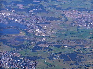
Albion Park is a suburb situated in the Macquarie Valley in the City of Shellharbour, which is in turn one of the three local government areas that comprise the Wollongong Metropolitan Area, New South Wales, Australia. Although it is surrounded by a 'green belt' of farms, Albion Park had a population of 13,316 at the 2016 census.

The Division of Throsby was an Australian electoral division in the state of New South Wales. The division was named after Charles Throsby, a prominent pioneer and explorer in the early nineteenth century of the areas to the south of Sydney.

Jamberoo is a town approx 11.3 km inland from Kiama on the South Coast of New South Wales, Australia in the Municipality of Kiama. At the 2016 census, Jamberoo had a population of 1,667. The town's name is derived from an Aboriginal word meaning 'track'.

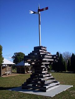
Dunmore railway station is a heritage-listed former railway station that was located on the South Coast railway line in Dunmore, City of Shellharbour, New South Wales, Australia. The station served the southern Wollongong suburb of Dunmore and indirectly Shellharbour and opened on 9 November 1887. The weatherboard station on Platform 2 dates from 1887. It is also known as the Shellharbour Railway Station Group, Shellharbour railway station and Dunmore Railway Station. The property is owned by RailCorp, an agency of the Government of New South Wales. The site was added to the New South Wales State Heritage Register on 2 April 1999.

The Illawarra escarpment, or officially the Illawarra Range, is the fold-created cliffs and plateau-eroded outcrop mountain range west of the Illawarra coastal plain south of Sydney, in the state of New South Wales, Australia. The range encloses the Illawarra region which stretches from Stanwell Park in the north to Kiama, Gerringong and the Shoalhaven River in the south.

The City of Wollongong is a local government area in the Illawarra region of New South Wales, Australia. The area is situated adjacent to the Tasman Sea, the Southern Freeway and the South Coast railway line.

The City of Shellharbour is a local government area in the Illawarra region of New South Wales, Australia. The City is located about 100 kilometres (62 mi) south of Sydney and covers the southern suburbs of the Wollongong urban area centred on Shellharbour and it had an estimated population of 68,460 at the 2016 census.

Saddleback Mountain is a mountain near Kiama in the Illawarra region of New South Wales, Australia. The mountain rises to about 600 metres (2,000 ft) above sea level on the Illawarra escarpment and has views of Noorinan Mountain, 662 metres (2,172 ft) above sea level, and Barren Grounds Plateau to the west and south to Coolangatta Mountain and Pigeon House Mountain to Ulladulla, and north over Lake Illawarra, the Illawarra escarpment and to the Cronulla Sandhills and Kurnell Oil Refinery on a clear day.

Macquarie Rivulet is a perennial river located in the Southern Highlands and Illawarra regions of New South Wales, Australia.
The 2011 Wollongong floods, beginning in March 2011, were a series of floods occurring throughout Wollongong and the Illawarra regions of New South Wales, Australia. The floods were the result of a storm cell covering most of the southern regions of the state and torrential rain in suburban Sydney and nearby regional areas.
The Macquarie Valley, also known as Albion Park, Rural West or Western Valley, is an area located in the Shellharbour local government area in the Illawarra region of New South Wales, Australia.


