
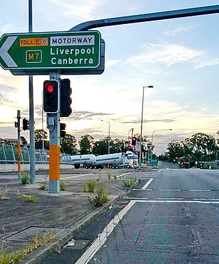
The Hume Highway, including the sections now known as the Hume Freeway and the Hume Motorway, is one of Australia's major inter-city national highways, running for 840 kilometres (520 mi) between Melbourne in the southwest and Sydney in the northeast. Upgrading of the route from Sydney's outskirts to Melbourne's outskirts to dual carriageway was completed on 7 August 2013.

Barton Highway is a highway in New South Wales and the Australian Capital Territory. It connects Canberra to Hume Highway at Yass, and it is part of the route from Melbourne to Canberra. It is named in honour of Sir Edmund Barton, the first Prime Minister of Australia.

The A6 is a route designation of a major metropolitan arterial route through suburban Sydney, linking Cumberland Highway at Carlingford and Princes Highway at Heathcote, via Lidcombe and Bankstown. This name covers a few consecutive roads and is widely known to most drivers, but the entire allocation is also known – and signposted – by the names of its constituent parts: Marsden Road, Stewart Street, Kissing Point Road, Silverwater Road, St Hilliers Road, Boorea Street, Olympic Drive, Joseph Street, Rookwood Road, Stacey Street, Fairford Road, Davies Road, Alfords Point Road, New Illawarra Road and Heathcote Road.

Snowy Mountains Highway is a 333-kilometre-long (207 mi) state highway located in New South Wales, Australia. Its two sections connect the New South Wales South Coast to the Monaro region, and the Monaro to the South West Slopes via the Snowy Mountains. The higher altitude regions of this road are subject to snow over the winter months, and the road also provides access to many parts of the Snowy Mountains Scheme. The highway bears the B72 shield along its entire length.

Olympic Highway is a 317-kilometre (197 mi) rural road in the central western and south-eastern Riverina regions of New South Wales, Australia. It services rural communities, links Hume Highway with Mid-Western Highway, and provides part of an alternate road link between Sydney and Albury via Bathurst and Cowra as well as servicing Wagga Wagga, linking with Sturt Highway.

The A3 is a route designation of a major metropolitan arterial route through suburban Sydney, connecting the A8 at Mona Vale at its northern end, to Princes Highway at Blakehurst at its southern end. This name covers a few consecutive roads and is widely known to most drivers, but the entire allocation is also known – and signposted – by the names of its constituent parts: Mona Vale Road, Ryde Road, Lane Cove Road, Devlin Street, Church Street, Concord Road, Homebush Bay Drive, Centenary Drive, Roberts Road, Wiley Avenue and King Georges Road.

The A9 is a route designation of the outer western Sydney Bypass, connecting Windsor to Campbelltown via Penrith. This name covers a few consecutive roads and is widely known to most drivers, but the entire allocation is also known – and signposted – by the names of its constituent parts: Macquarie Street, George Street, The Northern Road, Richmond Road, Parker Street and Narellan Road.

Princes Motorway is a 62-kilometre (39 mi) predominantly dual carriage untolled motorway that links Sydney to Wollongong and further south through the Illawarra region to Oak Flats. Part of the Australian Highway 1 network, the motorway is designated route M1.

Burley Griffin Way is a New South Wales state route, is located in south eastern Australia. Named after the American architect Walter Burley Griffin, designer of the cities of Canberra and Griffith, the road links these two cities via Yass and Barton Highway.

Moss Vale is a town in the Southern Highlands of New South Wales, Australia, in the Wingecarribee Shire. It is located on the Illawarra Highway, which connects to Wollongong and the Illawarra coast via Macquarie Pass.

Riverina Highway is a 220-kilometre (140 mi)-long state highway located in the Riverina region of New South Wales, Australia. The road was constructed over several decades with final asphalt concrete sealing completed during the 1960s.

Appin Road is a New South Wales secondary highway linking Campbelltown and Sydney's western suburbs with Wollongong. It is named after Appin, which lies on its path.
Picton Road is a 37-kilometre (23 mi) rural road that links Picton and Wollongong through the Macarthur region of New South Wales. It provides an important link between the Hume and Princes Motorways.
The Unanderra–Moss Vale railway line is a cross country railway line in New South Wales, Australia. The line branches from the Illawarra line at Unanderra and winds west up the Illawarra escarpment to join the Main South line at Moss Vale. The line is one of the most scenic in New South Wales, and for the first 20 km (12 mi) after leaving Unanderra has an almost continuous grade 1 in 30 providing extensive views over the Illawarra coastline.
Pittwater Road is a 21-kilometre-long (13 mi) major arterial road along the coast of the Northern Beaches suburbs of Sydney, Australia, the majority of which is a constituent part of the A8 route.
Camden Valley Way is a 23-kilometre (14 mi) arterial road between the southwestern fringes of suburban Sydney and the historic town of Camden. It is a former alignment of Hume Highway.
Remembrance Drive is a rural road that links Camden and Alpine on the fringes of south-western Sydney, New South Wales. The road served as the former alignment of Hume Highway and now forms part of Old Hume Highway.

Heathcote Road is a 24-kilometre-long (15 mi) major arterial road in the south of Sydney, Australia. It plays a major role in the servicing of traffic travelling between the Illawarra and Western Sydney, and its eastern end is a constituent part of the A6 route.
The Horsley Drive is a 13-kilometre (8.1 mi) urban sealed road located in the City of Fairfield in Greater Western Sydney, New South Wales, Australia. The road's northwestern terminus is located at the entrance of Western Sydney Parklands in Horsley Park and its southeastern terminus at its intersection with Hume Highway in Carramar.
The A34 is a route designation of a major metropolitan arterial route through suburban Sydney, linking Hume Highway at Liverpool and Princes Highway at Newtown, running parallel to the tolled M5 Motorway. This name covers a few consecutive roads and is widely known to most drivers, but the entire allocation is also known – and signposted – by the names of its constituent parts: Macquarie Street, Terminus Street, Newbridge Road, Milperra Road, (New) Canterbury Road, Stanmore Road and Enmore Road.
