Goulburn-Oberon Road

Last updated

Goulburn-Oberon Road

Taralga Road, Abercrombie Road

Abercrombie River 2.jpg
Goulburn-Oberon Road bridge over Abercrombie River (photographed prior to 2008).
Australia New South Wales location map blank.svg
Red pog.svg
North end
Red pog.svg
South end
Coordinates
General information
TypeRural road
Length145 km (90 mi) [1]
Gazetted August 1928 [2]
Tourist routesAustralian Tourist Drive 13.svg Tourist Route 13
(Goulburn–Richlands)
Major junctions
North endAlbion Street
Oberon, New South Wales
 
South end Hume Highway
Goulburn, New South Wales
Location(s)
Major settlements Black Springs, Richlands, Taralga, Myrtleville, Chatsbury, Tarlo

Goulburn-Oberon Road is a New South Wales country road linking Goulburn near Hume Highway to Oberon. This name is not widely known to most drivers, as the entire allocation is still best known as by the names of its constituent parts: Taralga Road and Abercrombie Road. [3]

Contents

Route

At its northern end, the road passes through imposing plantations of radiata pine trees that supply the timber complex of Oberon.

It is now fully sealed, having undergone extensive work between 2002 and 2008. The final section of around 5 kilometres (3.1 mi) long, located between the Abercrombie River and the end of Wombeyan Caves Road was sealed in February 2008. In 2007, the Upper Lachlan Shire received a grant of $710,000 over 3 years from the New South Wales Government to cover one third of the cost of realigning and sealing that remaining section and will allocate $1,420,000 of council funds over those three years to complete the work. [4] With the support of Oberon Council, the work was completed in the first year. [5]

In conjunction with O'Connell Road from Oberon to Bathurst, this scenic route provides a leisurely and surprisingly direct route between Bathurst and Goulburn. The descent into the Abercrombie River Gorge from the North is particularly scenic.

Wombeyan Caves Road, leading through the Wombeyan Caves reserve and on to Mittagong, starts at the locality of Richlands, around halfway between Goulburn and Oberon. Laggan-Taralga Road from Crookwell ends in the historic town of Taralga a little further south. Bannaby Road to the locality of Bannaby also starts in Taralga.

The road is allocated Tourist Route 13, from Goulburn to Richlands, and continues east along Wombeyan Caves Road.

History

The passing of the Main Roads Act of 1924 [6] through the Parliament of New South Wales provided for the declaration of Main Roads, roads partially funded by the State government through the Main Roads Board (later the Department of Main Roads, and eventually Transport for NSW). Main Road No. 256 was declared along this road on 8 August 1928, from the intersection with Great Western Highway at Oberon and Taralga to the intersection with Hume Highway at Goulburn (and continuing northwards to Bathurst); [2] with the passing of the Main Roads (Amendment) Act of 1929 [7] to provide for additional declarations of State Highways and Trunk Roads, this was amended to Main Road 256 on 8 April 1929.

The Department of Main Roads, which had succeeded the MRB in 1932, truncated the northern end of Main Road 256 to Oberon (and extended the western end of Main Road 253 over it instead, from Oberon to Bathurst), on 13 February 1934. [8]

The passing of the Roads Act of 1993 [9] updated road classifications and the way they could be declared within New South Wales. Under this act, Goulburn-Oberon Road today retains its declaration as Main Road 256, from Oberon to Goulburn. [10]

It was, at one stage "seen as a future bypass of Sydney". [4]

Towns, villages and localities, from south to north

Major intersections

LGALocationkm [1] miDestinationsNotes
Goulburn Mulwaree Goulburn 0.00.0Sydney Street (east), to AUS Alphanumeric Route M31.svg Hume Highway (M31)  Mittagong
Lagoon Street (west)  Goulburn
Southern terminus of road and Tourist Route 13; heads north as Union/Wilmot/Chantry and Tarlo Streets before becoming Taralga Road
Wollondilly River 1.50.93Bridge over river (name not known)
Tarlo River 17.811.1Bridge over river (name not known)
Upper Lachlan Richlands 53.032.9Australian Tourist Drive 13.svg Wombeyan Caves Road (Tourist Route 13)  Wombeyan Caves Tourist Route 13 continues east along Wombeyan Caves Road
Bummaroo Ford72.545.0Bummaroo Camping Access Road – Bummaroo FordName change: Abercrombie Road (north), Taralga Road (south)
Abercrombie River Bridge over river (name not known)
Oberon Oberon 14590 O'Connell Road   Bathurst, Oberon
Albion Street  Oberon, Jenolan Caves Northern terminus of road; northern end of Abercrombie Road
1.000 mi = 1.609 km; 1.000 km = 0.621 mi
  •        Route transition

See also

Related Research Articles

<span class="mw-page-title-main">Oberon, New South Wales</span> Town in New South Wales, Australia

Oberon is a town located within the Oberon Council local government area, in the central tablelands region of New South Wales, Australia. The main industries are farming, forestry and wood products. The town usually receives snowfall during the winter months, owing to its high elevation. At the 2021 census, Oberon had a population of 3,319 people.

<span class="mw-page-title-main">Mitchell Highway</span> Highway in Queensland and New South Wales

Mitchell Highway is an outback state highway located in the central and south western regions of Queensland and the northern and central western regions of New South Wales in Australia. The southern part of Mitchell Highway forms part of the National Highway A32 B71 corridor, which stretches from Sydney to Brisbane via Dubbo. Mitchell Highway also forms part of the shortest route between Sydney and Darwin, via Bourke and Mount Isa, making it an important road link for the transport of passengers and freight for regional New South Wales and Queensland. The highway is a part of route Alternative A2 between Augathella and Charleville, route A71 and B71 between Charleville and Nyngan, and part of route A32 between Nyngan and Bathurst.

<span class="mw-page-title-main">Barrier Highway</span> Highway in New South Wales and South Australia

Barrier Highway is a highway in South Australia and New South Wales, and is designated part of route A32. The name of the highway is derived from the Barrier Ranges, an area of moderately high ground in the far west of New South Wales, through which the highway traverses.

<span class="mw-page-title-main">Federal Highway (Australia)</span> Highway in New South Wales and the Australian Capital Territory

Federal Highway is a highway in New South Wales and the Australian Capital Territory. It is a part of a motorway-standard link between Sydney and Canberra, and is also the main thoroughfare between those cities.

<span class="mw-page-title-main">Upper Lachlan Shire</span> Local government area in New South Wales, Australia

Upper Lachlan Shire is a local government area in the Southern Tablelands region of New South Wales, Australia. The Shire was formed in February 2004 from Crookwell Shire and parts of Mulwaree, Gunning and Yass Shires.

<span class="mw-page-title-main">Mid-Western Highway</span> Highway in New South Wales

Mid-Western Highway, sometimes Mid Western Highway, is a 518-kilometre (322 mi) state highway located in the central western and northern Riverina regions of New South Wales, Australia. The highway services rural communities and links the Great Western, Mitchell, Olympic, Newell, Cobb and Sturt highways. Mid-Western Highway forms part of the most direct route road link between Sydney and Adelaide, with its eastern terminus in Bathurst and western terminus in Hay. It is designated part of route A41 between Bathurst and Cowra, and route B64 between Cowra and Hay.

<span class="mw-page-title-main">Castlereagh Highway</span> Highway in New South Wales and Queensland, Australia

Castlereagh Highway is a 790-kilometre (490 mi) state highway located in New South Wales and Queensland, Australia. From north to south the highway traverses South West Queensland and the North West Slopes, Orana, and Central West regions of New South Wales.

<span class="mw-page-title-main">Olympic Highway</span> Highway in New South Wales

Olympic Highway is a 317-kilometre (197 mi) rural road in the central western and south-eastern Riverina regions of New South Wales, Australia. It services rural communities, links Hume Highway with Mid-Western Highway, and provides part of an alternate road link between Sydney and Albury via Bathurst and Cowra as well as servicing Wagga Wagga, linking with Sturt Highway.

<span class="mw-page-title-main">Taralga</span> Town in New South Wales, Australia

Taralga is the traditional land of the Gundungurra people. Today it is a small village in the Southern Tablelands of New South Wales, Australia, in Upper Lachlan Shire. It is located at the intersection of the Goulburn-Oberon Road and the Laggan-Taralga Road. It is accessible from Oberon to the north, Mittagong to the east, Goulburn to the south, and Crookwell to the west. At the 2016 census, Taralga had a population of 467. Taralga is located relatively close to the famous Wombeyan Caves. The town experiences a volatile climate and is sometimes affected by snow in the winter months.

<span class="mw-page-title-main">Appin Road</span> Road in New South Wales, Australia

Appin Road is a New South Wales secondary highway linking Campbelltown and Sydney's western suburbs with Wollongong. It is named after Appin, which lies on its path.

Bannaby is a locality in the Southern Tablelands of New South Wales, Australia in Upper Lachlan Shire. It is located near the township of Taralga, on the Bannaby road. At the 2016 census, it had a population of 36.

<span class="mw-page-title-main">Bylong Valley Way</span> Road in New South Wales, Australia

Bylong Valley Way is a New South Wales regional road linking Golden Highway near Sandy Hollow to Castlereagh Highway near Ilford. It is named after the Bylong Valley, through which the road passes.

Bathurst-Ilford Road is a 72.0-kilometre (44.7 mi) New South Wales country road linking Ilford to the regional hub of Bathurst.

O'Connell Road is a New South Wales rural road linking Oberon to the regional highway hub of Bathurst, where several roads including Great Western Highway, Mid-Western Highway, Mitchell Highway and Bathurst-Ilford Road join.

<span class="mw-page-title-main">Wombeyan Caves Road</span>

Wombeyan Caves Road is a New South Wales country road linking Mittagong near Hume Highway in the east to Goulburn-Oberon Road at the locality of Richlands in the west.

<span class="mw-page-title-main">Goldfields Way</span>

Goldfields Way is a 116-kilometre (72 mi) country road in the northern part of the Riverina region of New South Wales, connecting Wyalong via Temora to Old Junee.

Remembrance Drive is a rural road that links Camden and Alpine on the fringes of south-western Sydney, New South Wales. The road served as the former alignment of Hume Highway and now forms part of Old Hume Highway.

<i>Taralga Echo</i>

The Taralga Echo was a weekly English-language newspaper published in Crookwell, New South Wales from 1924 to 1927.

<span class="mw-page-title-main">Richlands, New South Wales</span> Town in New South Wales, Australia

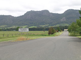
Richlands is a locality in the Upper Lachlan Shire, New South Wales, Australia. It lies about 5 km north of Taralga and about 95 km south of Oberon on the road from Goulburn to Oberon and Bathurst. At the 2016 census, it had a population of 34. It had a school from June 1868 to August 1879, which was designated as a "provisional school" for eight months and then as a "half-time" school. It also had a school from 1884 to 1915 and from 1918 to 1953, classified most commonly as a "provisional school", but for periods as a "house to house", "half-time" or "public" school. It was called Abercrombie school until 1894.

<span class="mw-page-title-main">Jenolan Caves Road</span> Road in New South Wales, Australia

Jenolan Caves Road is a rural road in New South Wales, Australia, linking Great Western Highway at Hartley to Edith Road at Jenolan.

References

  1. 1 2 Google (25 August 2022). "Goulburn-Oberon Road" (Map). Google Maps . Google. Retrieved 25 August 2022.
  2. 1 2 "Main Roads Act, 1924-1927". Government Gazette of the State of New South Wales. No. 110. National Library of Australia. 17 August 1928. pp. 3814–20. Archived from the original on 3 August 2022. Retrieved 1 August 2022.
  3. "SIX maps". NSW Government . Retrieved 25 August 2022.
  4. 1 2 http://upperlachlan.local-e.nsw.gov.au/files/5194/File/2007-2008ManagementPlan.pdf Archived 2 September 2007 at the Wayback Machine Upper Lachlan Shire Council 2007-2008 Management plan
  5. Oberon Council
  6. State of New South Wales, An Act to provide for the better construction, maintenance, and financing of main roads; to provide for developmental roads; to constitute a Main Roads Board Archived 11 August 2022 at the Wayback Machine 10 November 1924
  7. State of New South Wales, An Act to amend the Main Roads Act, 1924-1927; to confer certain further powers upon the Main Roads Board; to amend the Local Government Act, 1919, and certain other Acts; to validate certain payments and other matters; and for purposes connected therewith. Archived 12 August 2022 at the Wayback Machine 8 April 1929
  8. "Main Roads Act, 1924-1931". Government Gazette of the State of New South Wales. No. 33. National Library of Australia. 23 February 1934. p. 873. Archived from the original on 16 June 2023. Retrieved 29 November 2022.
  9. State of New South Wales, An Act to make provision with respect to the roads of New South Wales; to repeal the State Roads Act 1986, the Crown and Other Roads Act 1990 and certain other enactments; and for other purposes. Archived 11 August 2022 at the Wayback Machine 10 November 1924
  10. Transport for NSW (August 2022). "Schedule of Classified Roads and Unclassified Regional Roads" (PDF). Government of New South Wales. Archived from the original (PDF) on 25 August 2022. Retrieved 1 August 2022.