
Pacific Highway is a 790-kilometre-long (491 mi) national highway and major transport route along the central east coast of Australia, with the majority of it being part of Australia's Highway 1. The highway and its adjoining Pacific Motorway between Brisbane and Brunswick Heads and Pacific Motorway between Sydney and Newcastle links the state capitals of Sydney in New South Wales with Brisbane in Queensland, approximately paralleling the Tasman Sea and the Coral Sea of the South Pacific Ocean coast, via regional cities and towns like Gosford, Newcastle, Taree, Port Macquarie, Kempsey, Coffs Harbour, Grafton, Ballina, Byron Bay, Tweed Heads and the Gold Coast, which is part of Queensland. Additionally, between Brunswick Heads and Port Macquarie, the road is also signed as Pacific Motorway, but has not been legally gazetted as such.
Gwydir Highway is a 568-kilometre (353 mi) state highway in northern New South Wales, Australia. The highway was named after the Gwydir River, which in turn was named after a locale in Wales.

The Macleay River is a river that spans the Northern Tablelands and Mid North Coast districts of New South Wales, Australia.

Summerland Way is a 199–kilometre state route, designated B91, in New South Wales. It runs generally north from Grafton to the state border with Queensland just west of Mount Lindesay, and continues from there into Queensland as Mount Lindesay Highway. It was named as the region in runs through is a popular tourist area for people during summer.

Kempsey is a town in the Mid North Coast region of New South Wales, Australia and is the council seat for Kempsey Shire. It is located roughly 16.5 kilometres inland from the coast of the Pacific Ocean, on the Macleay Valley Way near where the Pacific Highway and the North Coast railway line cross the Macleay River. It is roughly 430 kilometres north of Sydney. As of June 2018 Kempsey had a population of 15,309 (2018).

The Pacific Motorway is a motorway in Australia between Brisbane, Queensland, and Brunswick Heads, New South Wales, through the New South Wales–Queensland border at Tweed Heads.
The Grafton bus crash killed 21 people and injured 22 on the Pacific Highway on the North Coast of New South Wales near Grafton. This crash was one of several on the Pacific Highway involving buses during a relatively brief period. At the time, this crash was the worst in Australian road transport history in terms of number of deaths. Less than five months previously, another bus had run off the road, with no fatalities; only two months later, on 22 December 1989, the Kempsey bus crash involving two buses killed 35 passengers. Finally, in 2020, the area of the crash was upgraded and bypassed as part of the Pacific Highway upgrades.

The Pacific Motorway is a 127-kilometre motorway linking Sydney to Newcastle via the Central Coast and Hunter regions of New South Wales. Formerly known but still commonly referred to by both the public and the government as the F3 Freeway, Sydney–Newcastle Freeway, and Sydney–Newcastle Expressway, it is part of the AusLink road corridor between Sydney and Brisbane. The name "F3 Freeway" reflects its former route allocation before it was decommissioned and replaced by the rollout of alphanumeric signposts.

U.S. Route 101 (US 101) is a major north–south United States Numbered Highway, stretching from Los Angeles, California, to Tumwater, Washington. The California portion of US 101 is one of the last remaining and longest U.S. Routes still active in the state, and the longest highway of any kind in California. US 101 was also one of the original national routes established in 1926. Significant portions of US 101 between the Los Angeles area and the San Francisco Bay Area follow El Camino Real, the commemorative route connecting the former Alta California's 21 missions.
The Kempsey bus crash occurred in Australia on 22 December 1989 when two full Denning Landseer tourist coaches, each travelling at 100 km/h, collided head-on on the Pacific Highway at Clybucca Flat, 12 kilometres (7.5 mi) north of Kempsey, New South Wales. It remains the worst road accident in Australia; 35 people died, including both drivers, and another 41 were injured.

Gold Coast Highway links the coastal suburbs of the Gold Coast in south eastern Queensland such as Miami, Mermaid Beach, Tugun, Bilinga to the Tweed Heads suburb of Tweed Heads West in New South Wales. At 39.6 kilometres (24.6 mi) in length, the highway runs just west of Pacific Motorway at Pacific Pines to Pacific Motorway at Tweed Heads West. It passes through the numerous popular tourist areas including Surfers Paradise and Broadbeach, a commercial centre at Southport, residential areas, shopping centres and the Gold Coast (Coolangatta) Airport.
Woodbine Avenue is a north–south arterial road consisting of two sections in Toronto and York Region in Ontario, Canada.
The Camden Valley Way is a 24-kilometre (15 mi) arterial road between Sydney and the historic town of Camden.
The Macleay Valley Bridge is a road bridge over the Macleay River and its floodplain near the settlement of Frederickton, New South Wales, Australia. The bridge is part of the Pacific Highway (A1) new alignment which bypasses Kempsey and Frederickton. At the time of its official opening in 2013, the bridge was the longest road bridge in Australia.

Several special routes of U.S. Route 19 exist. In order from south to north they are as follows.

U.S. Route 209 (US 209) is a 211.74-mile (340.76 km) long U.S. Highway in the states of Pennsylvania and New York. Although the route is a spur of US 9, US 209 never intersects US 9, coming within five miles of the route and making the short connection via New York State Route 199 (NY 199). The southern terminus of the route is at Pennsylvania Route 147 (PA 147) in Millersburg, Pennsylvania. The northern terminus is at US 9W north of Kingston in Ulster, New York, where the road continues east as NY 199.
Frederickton is a town on the Macleay River, New South Wales. Located about 6 km NE by N of Kempsey and about 7 km W by S of Smithtown. It is roughly 436 kilometres north of Sydney. The Macleay Valley Bridge, the longest bridge on the Pacific Highway commences just to the East of town.
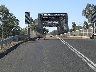
Big River Way is a road in the Northern Rivers region of New South Wales that connects the Pacific Highway to the city of Grafton. It runs along a former section of the Pacific Highway that was bypassed by a newer alignment in 2020.
Giinagay Way is a road in the Mid North Coast region of New South Wales linking the towns of Warrell Creek, Macksville, Nambucca Heads and Urunga to Pacific Highway. It runs along a former section of the highway between Eungai Creek and Raleigh that was bypassed by a new parallel alignment between 2016 and 2018.
Solitary Islands Way is a road in the Mid North Coast region of New South Wales, located north of the city of Coffs Harbour. It links the towns of Woolgoolga and Corindi Beach to the Pacific Highway. It consists of a mix of newly constructed roads, pre-existing Council-owned roads and former sections of the highway that were bypassed by new alignments in 2013 and 2017.

