
The Hume Highway, inclusive of the sections now known as the Hume Freeway and Hume Motorway, is one of Australia's major inter-city national highways, running for 840 kilometres (520 mi) between Melbourne in the southwest and Sydney in the northeast. Upgrading of the route from Sydney's outskirts to Melbourne's outskirts to dual carriageway was completed on 7 August 2013.

The Princes Highway is a major road in Australia, extending from Sydney to Adelaide via the coast through the states of New South Wales, Victoria and South Australia. It has a length of 1,941 kilometres (1,206 mi) or 1,898 kilometres (1,179 mi) via the former alignments of the highway, although these routes are slower and connections to the bypassed sections of the original route are poor in many cases.

Pacific Highway is a 780-kilometre-long (485 mi) national highway and major transport route along the central east coast of Australia, with the majority of it being part of Australia's Highway 1. The highway and its adjoining Pacific Motorway between Brisbane and Brunswick Heads and Pacific Motorway between Sydney and Newcastle links the state capitals of Sydney in New South Wales with Brisbane in Queensland, approximately paralleling the Tasman Sea of the South Pacific Ocean coast, via Gosford, Newcastle, Taree, Port Macquarie, Kempsey, Coffs Harbour, Grafton, and Ballina. Additionally, between Brunswick Heads and Port Macquarie, the road is also signed as Pacific Motorway, but has not been legally gazetted as such.
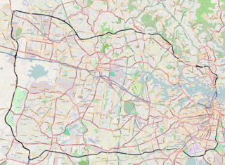
The Sydney Orbital Network is a 110 kilometre motorway standard ring road around and through Sydney, the capital of New South Wales in Australia. It runs north from Sydney Airport, underneath the CBD to the North Shore, west to the Hills District, south to Prestons and then east to connect with the airport. Much of the road is privately owned and financed by tolls.

The Princes Motorway is a 62-kilometre (39 mi) predominantly dual carriage untolled motorway that links Sydney to Wollongong and further south through the Illawarra region to Albion Park Rail. Part of the Australian Highway 1 network, the motorway is designated with the route number M1.

King's Highway 416, commonly referred to as Highway 416 and as the Veterans Memorial Highway, is a 400-series highway in the Canadian province of Ontario that connects the Trans-Canada Highway (Highway 417) in Ottawa with Highway 401 between Brockville and Cornwall. The 76.4-kilometre-long (47.5 mi) freeway acts as an important trade corridor from Interstate 81 between New York and Eastern Ontario via Highway 401, as well as the fastest link between Ottawa and Toronto. Highway 416 passes through a largely rural area, except near its northern terminus where it enters the suburbs of Ottawa. The freeway also serves several communities along its length, notably Spencerville and Kemptville.

The Roads & Traffic Authority (RTA) was an agency of the New South Wales Government responsible for major road infrastructure, licensing of drivers, and registration of motor vehicles. The RTA directly managed state roads and provided funding to local councils for regional and local roads. In addition, with assistance from the federal government, the RTA also managed the NSW national highway system. The agency was abolished in 2011 and replaced by New South Wales Roads and Maritime Services.
The Kwinana Freeway is a 72-kilometre (45 mi) freeway in and beyond the southern suburbs of Perth, Western Australia, linking central Perth with Mandurah to the south. It is the central section of State Route 2, which continues north as Mitchell Freeway to Clarkson, and south as Forrest Highway towards Bunbury. A 4-kilometre (2.5 mi) section between Canning and Leach highways is also part of National Route 1. Along its route are interchanges with several major roads, including Roe Highway and Mandjoogoordap Drive. The northern terminus of the Kwinana Freeway is at the Narrows Bridge, which crosses the Swan River, and the southern terminus is at Pinjarra Road, east of Mandurah.

The Pacific Motorway is a motorway in Australia between Brisbane, Queensland, and Brunswick Heads, New South Wales, through the New South Wales–Queensland border at Tweed Heads.

The Pacific Motorway, signposted M1, is a 127 km (79 mi) stretch of motorway linking Sydney to the Central Coast, Newcastle and Hunter regions of New South Wales. It is also known by its former names F3 Freeway, Sydney–Newcastle Freeway, and Sydney–Newcastle Expressway. It is part of the AusLink road corridor between Sydney and Brisbane. The name "F3 Freeway" reflects its former route allocation, but is commonly used by both the public and the government to refer to the roadway long after the route allocation itself was no longer in use.
The Eastern Distributor is a 4.7-kilometre-long (2.9 mi) motorway in Sydney, New South Wales, Australia. Part of the M1, the motorway links the Sydney central business district with Sydney Airport. The centre-piece is a 1.7 km (1.1 mi) tunnel running from Woolloomooloo to Surry Hills. Built as a build-own-operate-transfer project, it is 75.1% owned by Transurban.

The Warringah Freeway is a 3-kilometre (1.9 mi) divided freeway located in Sydney, New South Wales, Australia. The freeway forms part of the M1, the Sydney Orbital Network, and the Highway 1 network. The primary function of the freeway is to provide an alternative high-grade route from the Sydney Harbour Tunnel and the Bradfield Highway at Milsons Point to the A8 and the Gore Hill Freeway. The freeway reduces traffic demands on the Pacific Highway throughout Sydney's Lower North Shore, bypassing North Sydney and Crows Nest. Completed in a series of stages between June 1968 and August 1992, the Warringah Freeway provides a vital link to access most of the suburbs in Sydney and is also a major route to the north, south, east and west of the central business district.

The Cahill Expressway is an urban freeway in Sydney and was the first freeway constructed in Australia, opening to traffic in 1958. It starts from the Eastern Distributor and Cross City Tunnel in Woolloomooloo, and runs through a series of sunken cuttings and tunnels between the Royal Botanic Garden and The Domain. It then runs on an elevated section across the northern edge of the Sydney CBD at Circular Quay, and then across the Sydney Harbour Bridge to North Sydney. It connects there to the Warringah Freeway.

The M4 Motorway is a 50.2-kilometre-long (31.2 mi) dual carriageway partially tolled motorway in Sydney, New South Wales, Australia that is designated as the M4 route. The M4 designation is part of the wider A4 and M4 route designation, the M4 runs parallel/below ground to the Great Western Highway and Parramatta Road (A44).

The M5 Motorway is a 29-kilometre-long (18 mi) motorway located in Sydney, New South Wales, Australia that is designated with the M5 route and forms part of the Sydney Orbital Network. The M5 route number comprises two connected parts, separately owned and operated:

The Hunter Expressway is a 39.5-kilometre (24.5 mi) long controlled-access highway in New South Wales, Australia. It was previously known as the F3 to Branxton link or Kurri Kurri Corridor during the planning stage. It has two lanes in each direction, running generally north west from the Pacific Motorway at the Newcastle Link Road interchange to the eastern end of the Belford Bends Deviation on the New England Highway north of Branxton. The road allows traffic to bypass the Maitland area, Lochinvar, Greta and Branxton. The expressway opened on 22 March 2014.
The Camden Valley Way is a 24-kilometre (15 mi) arterial road between Sydney and the historic town of Camden.
Stage 1 of the M6 Motorway, previously known as the F6 extension during preliminary planning stages, is an under-construction motorway consisting of twin, 4-kilometre long tunnels linking the M8 Motorway at Arncliffe to President Avenue at Kogarah. Stage 1 started major construction in November 2021 and is expected to open by late 2025. The possibility of future extensions to the south will be accommodated by providing stub tunnels in the project.