The City Circle is a mostly-underground railway line located in the Sydney central business district and Haymarket, in New South Wales, Australia, that forms the core of Sydney's passenger rail network. The lines are owned by the Transport Asset Holding Entity, a State government agency, and operated under Transport for NSW's Sydney Trains brand. Despite its name, the City Circle is of a horseshoe shape, with trains operating in a U-shaped pattern. The constituent stations of the Circle are (clockwise): Central, Town Hall, Wynyard, Circular Quay, St James, Museum and back to Central.

Hornsby is a suburb on the Upper North Shore of Sydney in the state of New South Wales, Australia, approximately 23 kilometres (14 mi) north-west of the Sydney central business district. It is the administrative centre of the local government area of Hornsby Shire.

Parkes is a town in the Central West region of New South Wales, Australia. It is the main settlement in the local government area of Parkes Shire. Parkes had a population of 9,832 at the 2021 census.

Oberon is a town located within the Oberon Council local government area, in the central tablelands region of New South Wales, Australia. The main industries are farming, forestry and wood products. The town usually receives snowfall during the winter months, owing to its high elevation. At the 2021 census, Oberon had a population of 3,319 people.

Tocumwal is a town in the southern Riverina region of New South Wales, Australia, in the Berrigan Shire local government area. The town, 270 kilometres (170 mi) north of the city of Melbourne, lies on the northern bank of the Murray River, which forms the border with Victoria.

Museum railway station is a heritage-listed underground commuter rail station that is located on the City Circle route at the southern end of Hyde Park in the Sydney central business district of New South Wales, Australia. The station is served by Sydney Trains' T2 Inner West & Leppington Line, T3 Bankstown Line and T8 Airport & South Line. The station is named after the nearby Australian Museum. It was added to the New South Wales State Heritage Register on 2 April 1999.

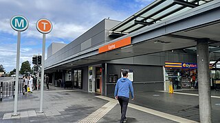
Epping railway station is a heritage-listed railway station in Epping, in the northern region of Sydney. It is served by Sydney Trains' T9 Northern Line, NSW TrainLink's Central Coast & Newcastle Line, and Sydney Metro's North West & Bankstown Line services.

The Australian state of New South Wales has an extensive network of railways, which were integral to the growth and development of the state. The vast majority of railway lines were government built and operated, but there were also several private railways, some of which operate to this day.

Quirindi is a small town on the North West Slopes region of New South Wales, Australia, in Liverpool Plains Shire. At the 2021 census, Quirindi had a population of 2,602. It is the nearest link to Gunnedah to the northwest and Tamworth to the north. The local economy is based on agriculture, with broadacre farming dominant on the black soil plains to the west and livestock grazing in the hilly eastern part of the district.

The Lapstone Zig Zag was a zig zag railway built between Emu Plains and Blaxland stations on the Main Western Line of New South Wales in Australia. Constructed between 1863 and 1865 to overcome an otherwise insurmountable climb up the eastern side of the Blue Mountains, the zig zag and associated Knapsack Viaduct, a sandstone arch viaduct, were designed by John Whitton, Engineer-in-Charge of New South Wales Government Railways, and were built by William Watkins. The zig zag was listed on the Blue Mountains local government heritage register on 27 December 1991; while the adjacent Knapsack Viaduct was listed on the New South Wales Heritage Database on 2 April 1999. The Lapstone Zig Zag was the world-first Zig Zag constructed on any main-line railway.

The North Coast railway line is the primary rail route in the Mid North Coast and Northern Rivers regions of New South Wales, Australia, and forms a major part of the Sydney–Brisbane rail corridor.

Ben Lomond is a village on the Northern Tablelands in the New England region of New South Wales, Australia. The village is situated 6 km off the New England Highway between Armidale and Glen Innes. It was located in the Guyra Shire local government area until that council was amalgamated into the Armidale Regional Council on 12 May 2016, with parts of the surrounding district in Glen Innes Severn Shire and Inverell Shire. It is primarily a farming area, with most of the residents involved in sheep, cattle and grain farming.

Bombo is a suburb of the Municipality of Kiama, in the Illawarra region of New South Wales, Australia. It is located 2 kilometres (1.2 mi) north of Kiama.

Bethungra is a locality in Junee Shire in the South West Slopes region of New South Wales, Australia situated on the Olympic Highway about 13 kilometres northeast of Illabo and 24 kilometres southwest of Cootamundra.

The Ardglen Tunnel, also called the Liverpool Range tunnel, is a heritage-listed summit rail tunnel located on the Main North railway between the village of Ardglen and Murrurundi in New South Wales, Australia. The tunnel crosses under the Liverpool Range near its east end, below Nowlands Gap, the crossing used by the New England Highway, and provides a vital link between Newcastle and Werris Creek. The tunnel was completed in 1877 and is owned by the Transport Asset Holding Entity, a state-owned corporation of the Government of New South Wales. It was added to the New South Wales State Heritage Register on 2 April 1999.

Jennings is a town on the Northern Tablelands region of New South Wales, Australia. The town is located in the Tenterfield Shire local government area, 718 kilometres (446 mi) from the state capital, Sydney and 256 kilometres (159 mi) from Brisbane. It is separated by the state border from its neighbouring town of Wallangarra in Queensland. At the 2011 census, Jennings had a population of 211. The New England Highway and the Main North railway line cross the state border at Jennings. The town was named for Sir Patrick Jennings, the first Roman Catholic Premier of New South Wales.

Murrurundi railway station is a heritage-listed railway station located on the Main Northern line in Murrurundi in the Upper Hunter Shire local government area of New South Wales, Australia. It was built between 1872 and 1917. It is also known as Murrurundi Railway Station group. The station serves the town of Murrurundi and opened on 4 April 1872. The station served as the terminus of the line until it was extended to Quirindi on 13 August 1877. The station was added to the New South Wales State Heritage Register on 2 April 1999.

Willow Tree railway station is located on the Main Northern line in New South Wales, Australia. It serves the village of Willow Tree, opening on 13 August 1877 as Warrah when the line was extended from Murrururundi to Quirindi. It was renamed Willow Tree in 1879.
Whittingham is a locality in the Singleton Council region of New South Wales, Australia. It had a population of 364 as of the 2016 census.


