Buckland County

Last updated

Map all coordinates using: OpenStreetMap  
Download coordinates as: KML  ·  GPX
Buckland
New South Wales
Buckland NSW.PNG
Location in New South Wales
Lands administrative divisions around Buckland:
Pottinger Nandewar Darling
Pottinger Buckland Parry
Bligh Brisbane Brisbane

Buckland County is one of the 141 Cadastral divisions of New South Wales. It is situated between a small part of the Namoi River in the north to the Liverpool Range in the south. The Mooki River is the boundary to the west. It includes Quirindi.

Namoi River

The Namoi River, a major perennial river that is part of the Barwon catchment of the Murray–Darling basin, is located in the Northern Tablelands and North West Slopes districts of New South Wales, Australia.

Liverpool Range component range of Great Dividing Range, New South Wales, Australia

The Liverpool Range is a mountain range and a lava-field province in New South Wales, Australia.

Mooki River river in New South Wales, Australia

Mooki River, a perennial stream that is part of the Namoi catchment within the Murray–Darling basin, is located in the Northern Tablelands district of New South Wales, Australia.

Buckland County was proclaimed as a county on December 30, 1848 as one of 15 counties then proclaimed Description:-'County of Buckland, containing about 1,484 square miles (3,840 km2). Whilst no official record of naming of the county has been found and there can be no certainty as to the person after whom it was named it is considered possible that the county was named in honour of the Reverend Dr. Buckland. [1]

Parishes within this county

A full list of parishes found within this county; their current LGA and mapping coordinates to the approximate centre of each location is as follows:

Local government in Australia

Local government in Australia is the third tier of government in Australia administered by the states and territories, which in turn are beneath the federal tier. Local government is not mentioned in the Constitution of Australia and two referenda in the 1970s and 1980s to alter the Constitution relating to local government were unsuccessful. Every state government recognises local government in their respective constitutions. Unlike Canada or the United States, there is only one level of local government in each state, with no distinction such as cities and counties.

ParishLGACoordinates
Babbinboon Gunnedah Shire Council 31°02′54″S150°33′04″E / 31.04833°S 150.55111°E / -31.04833; 150.55111 (Babbinboon)
Borambil Liverpool Plains Shire Council 31°18′54″S150°36′04″E / 31.31500°S 150.60111°E / -31.31500; 150.60111 (Borambil)
Carroll Gunnedah Shire Council 30°59′54″S150°29′04″E / 30.99833°S 150.48444°E / -30.99833; 150.48444 (Carroll)
Clift Tamworth Regional Council 31°17′54″S150°37′04″E / 31.29833°S 150.61778°E / -31.29833; 150.61778 (Clift)
Coeypolly Liverpool Plains Shire Council 31°25′54″S150°46′04″E / 31.43167°S 150.76778°E / -31.43167; 150.76778 (Coeypolly)
Cooridoon Gunnedah Shire Council 30°59′54″S150°20′04″E / 30.99833°S 150.33444°E / -30.99833; 150.33444 (Cooridoon)
Currabubula Liverpool Plains Shire Council 31°16′54″S150°43′04″E / 31.28167°S 150.71778°E / -31.28167; 150.71778 (Currabubula)
Denver Gunnedah Shire Council 31°10′54″S150°30′04″E / 31.18167°S 150.50111°E / -31.18167; 150.50111 (Denver)
Dight Gunnedah Shire Council 31°03′54″S150°27′04″E / 31.06500°S 150.45111°E / -31.06500; 150.45111 (Dight)
Evan Liverpool Plains Shire Council 31°21′54″S150°48′04″E / 31.36500°S 150.80111°E / -31.36500; 150.80111 (Evan)
Ferrier Gunnedah Shire Council 31°18′54″S150°31′04″E / 31.31500°S 150.51778°E / -31.31500; 150.51778 (Ferrier)
Gregson Liverpool Plains Shire Council 31°43′54″S150°37′04″E / 31.73167°S 150.61778°E / -31.73167; 150.61778 (Gregson)
Grenfell Tamworth Regional Council 31°23′54″S150°36′04″E / 31.39833°S 150.60111°E / -31.39833; 150.60111 (Grenfell)
Gunnadilly Liverpool Plains Shire Council 31°27′54″S150°31′04″E / 31.46500°S 150.51778°E / -31.46500; 150.51778 (Gunnadilly)
Hudson Liverpool Plains Shire Council 31°41′54″S150°20′04″E / 31.69833°S 150.33444°E / -31.69833; 150.33444 (Hudson)
Loder Liverpool Plains Shire Council 31°36′54″S150°52′04″E / 31.61500°S 150.86778°E / -31.61500; 150.86778 (Loder)
Moan Liverpool Plains Shire Council 31°42′54″S150°12′04″E / 31.71500°S 150.20111°E / -31.71500; 150.20111 (Moan)
Mooki Gunnedah Shire Council 31°12′54″S150°29′04″E / 31.21500°S 150.48444°E / -31.21500; 150.48444 (Mooki)
Parnell Liverpool Plains Shire Council 31°29′54″S150°54′04″E / 31.49833°S 150.90111°E / -31.49833; 150.90111 (Parnell)
Parsons Hill Liverpool Plains Shire Council 31°36′54″S150°30′04″E / 31.61500°S 150.50111°E / -31.61500; 150.50111 (Parsons Hill)
Piallaway Tamworth Regional Council 31°09′54″S150°38′04″E / 31.16500°S 150.63444°E / -31.16500; 150.63444 (Piallaway)
Quirindi Liverpool Plains Shire Council 31°29′54″S150°43′04″E / 31.49833°S 150.71778°E / -31.49833; 150.71778 (Quirindi)
Telford Liverpool Plains Shire Council 31°32′54″S150°25′04″E / 31.54833°S 150.41778°E / -31.54833; 150.41778 (Telford)
Temi Liverpool Plains Shire Council 31°41′54″S150°49′04″E / 31.69833°S 150.81778°E / -31.69833; 150.81778 (Temi)
Texas Gunnedah Shire Council 31°08′54″S150°28′04″E / 31.14833°S 150.46778°E / -31.14833; 150.46778 (Texas)
Towarri Liverpool Plains Shire Council 31°49′54″S150°37′04″E / 31.83167°S 150.61778°E / -31.83167; 150.61778 (Towarri)
Wallabadah Liverpool Plains Shire Council 31°28′54″S150°48′04″E / 31.48167°S 150.80111°E / -31.48167; 150.80111 (Wallabadah)
Wallala Gunnedah Shire Council 31°22′54″S150°29′04″E / 31.38167°S 150.48444°E / -31.38167; 150.48444 (Wallala)
Warrah Liverpool Plains Shire Council 31°33′54″S150°37′04″E / 31.56500°S 150.61778°E / -31.56500; 150.61778 (Warrah)
Werrie Tamworth Regional Council 31°19′54″S150°42′04″E / 31.33167°S 150.70111°E / -31.33167; 150.70111 (Werrie)
Willow Tree Liverpool Plains Shire Council 31°39′54″S150°44′04″E / 31.66500°S 150.73444°E / -31.66500; 150.73444 (Willow Tree)
Windy Liverpool Plains Shire Council 31°35′54″S150°21′04″E / 31.59833°S 150.35111°E / -31.59833; 150.35111 (Windy)
Yarrimanbah Liverpool Plains Shire Council 31°47′54″S150°26′04″E / 31.79833°S 150.43444°E / -31.79833; 150.43444 (Yarrimanbah)

Related Research Articles

Bigga, New South Wales Town in New South Wales, Australia

Bigga is a village in the Southern Tablelands of New South Wales, Australia, in Upper Lachlan Shire. It is in the Parish of Bigga, County of Georgiana. At the 2016 census, Bigga and the surrounding area had a population of 245. The name Bigga is thought to originate as a shortened version of the Biggs Grant. Bigga is on the western side of the Abercrombie Mountains. It is 91 km northwest of Goulburn and 52 km southeast of Cowra. Nearby towns are: Abercrombie River, Binda, Greenmantle, Grabine, Reids Flat, and Tuena. Nearby places are: Blanket Flat and Crooked Corner. These places were once towns.

Goobang Creek river in New South Wales, Australia

The Goobang Creek, a perennial stream of the Lachlan sub–catchment, part of the Murrumbidgee catchment of the Murray-Darling basin, is located in the Central West region of New South Wales, Australia.

Lands administrative divisions of New South Wales Wikimedia list article

The lands administrative divisions of New South Wales refers to the 141 counties within the Colony of New South Wales, that later became the Australian state of New South Wales.

Gloucester County, New South Wales Cadastral in New South Wales, Australia

Gloucester County was one of the original Nineteen Counties in New South Wales, and is now one of the 141 cadastral divisions of New South Wales. It includes the area around Port Stephens. It is bounded on the north and west by the Manning River, and on the south-west by the Williams River.
Camden County, New South Wales Cadastral in New South Wales, Australia

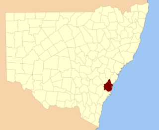
Camden County was one of the original Nineteen Counties in New South Wales and is now one of the 141 Cadastral divisions of New South Wales. It included the coastal area near Wollongong south to the Shoalhaven River, and also inland encompassing Berrima and Picton. Its western boundary was the Wollondilly River. The first settlement in the area was Camden Park, established by John Macarthur in 1806, just across the Nepean River from Cumberland County. It was the first land across the Nepean to be settled. Camden is a present-day suburb of Sydney in the same area, although parts of it are in Cumberland.

St Vincent County Cadastral in Australian Capital Territory

St Vincent County was one of the original Nineteen Counties in New South Wales and is now one of the 141 Cadastral divisions of New South Wales. It included the south coast area encompassing Batemans Bay, Ulladulla, Jervis Bay and inland to Braidwood. The Shoalhaven River is the boundary to the north and west, and the Deua River the boundary to the south.

Hunter County Cadastral in New South Wales, Australia

Hunter County was one of the original Nineteen Counties in New South Wales and is now one of the 141 Cadastral divisions of New South Wales. It lies between the Hunter River in the north, and the Colo River in the south, including much of Wollemi National Park. Macdonald River lies to the east.
King County, New South Wales Cadastral in New South Wales, Australia

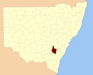
King County was one of the original Nineteen Counties in New South Wales and is now one of the 141 Cadastral divisions of New South Wales. It is in the area to the east of Yass. The northern part of it lies between the Lachlan River and the Boorowa River, including the locations of Frogmore, Taylors Flat, Gunnary, Rugby and Rye Park. The Crookwell River is also part of the northern boundary. The Yass River is the southern boundary.

Roxburgh County Cadastral in New South Wales, Australia

Roxburgh County was one of the original Nineteen Counties in New South Wales and is now one of the 141 Cadastral divisions of New South Wales. It includes the area to the north east of Bathurst, lying to the north and east of the Fish River to the junction of the Turon River. It includes Sofala. The Gudgegong River is the border to the north.

Brisbane County Cadastral in New South Wales, Australia

Brisbane County was one of the original Nineteen Counties in New South Wales and is now one of the 141 Cadastral divisions of New South Wales. It includes Scone, Merriwa and Murrurundi. The Goulburn River is the boundary to the south and the Hunter River the boundary to the south-east. The Liverpool Range area is the boundary to the north, and the Krui River the boundary to the west.

Bligh County Cadastral in New South Wales, Australia

Bligh County was one of the original Nineteen Counties in New South Wales and is now one of the 141 Cadastral divisions of New South Wales. The Cudgegong River and the Goulburn River are its southern boundaries; the Krui River is the eastern boundary, and the Burragundy River the northern boundary. It includes the villages of Cassilis and Dunedoo.

Buccleuch County Cadastral in New South Wales, Australia

Buccleuch County is one of the 141 Cadastral divisions of New South Wales. It contains the locality of Adjungbilly. The Murrumbidgee River is at the northern boundary, with the Goodradigbee River on the eastern boundary, and the Tumut River on the western boundary. It includes the northern part of the Kosciuszko National Park.

Cowper County Cadastral in New South Wales, Australia

Cowper County, New South Wales is one of the 141 Cadastral divisions of New South Wales.
Ewenmar County Cadastral in New South Wales, Australia

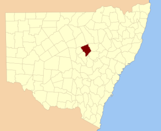
Ewenmar County is one of the 141 Cadastral divisions of New South Wales. It is located between the Macquarie River on the west, and the Castlereagh River on the east. This is the area between Warren and Gilgandra.

Fitzroy County Cadastral in New South Wales, Australia

Fitzroy County is one of the 141 Cadastral divisions of New South Wales. It lies south of the Orara River, and north of the Bellinger River, and includes Coffs Harbour.

Gowen County Cadastral in New South Wales, Australia

Gowen County is one of the 141 Cadastral divisions of New South Wales. It is located to the east of the Castlereagh River in the area to the east of Gilgandra, to Coonabarabran in the north-east. This includes land on both sides of the Newell Highway.

Irrara County Cadastral in New South Wales, Australia

Irrara County is one of the 141 Cadastral divisions of New South Wales. It is located south of the border with Queensland, east of the Paroo River, and west of the Warrego River.
Kennedy County Cadastral in New South Wales, Australia

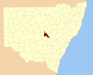
Kennedy County is one of the 141 Cadastral divisions of New South Wales. It is located to the west of the Bogan River in the area around Tottenham and Tullamore.

Oxley County Cadastral in New South Wales, Australia

Oxley County, New South Wales is one of the 141 Cadastral divisions of New South Wales. It is located between the Bogan River on the west, and the Macquarie River on the east. This is the area approximately between Warren and Nyngan.

Bendoc River

The Bendoc River is a perennial river of the Snowy River catchment, located in the Alpine regions of the states of Victoria and New South Wales, Australia.

References

  1. "Buckland County". Geographical Names Register (GNR) of NSW. Geographical Names Board of New South Wales. OOjs UI icon edit-ltr-progressive.svg