The Summit, Queensland

Last updated

Map all coordinates using: OpenStreetMap  
Download coordinates as: KML
The Summit
Queensland
Granite Belt Drive (main street), The Summit, 2015 02.JPG
Granite Belt Drive (main street), The Summit, 2015
Australia Queensland location map.svg
Red pog.svg
The Summit
Coordinates 28°34′32″S151°57′03″E / 28.5755°S 151.9508°E / -28.5755; 151.9508 (The Summit (town centre)) Coordinates: 28°34′32″S151°57′03″E / 28.5755°S 151.9508°E / -28.5755; 151.9508 (The Summit (town centre))
Population409 (2016 census) [1]
 • Density24.79/km2 (64.20/sq mi)
Postcode(s) 4377
Elevation923.5 m (3,030 ft)
Area16.5 km2 (6.4 sq mi)
Time zone AEST (UTC+10:00)
Location
LGA(s) Southern Downs Region
State electorate(s) Southern Downs
Federal division(s) Maranoa
Localities around The Summit:
Pozieres Thulimbah Maryland (NSW)
Pozieres The Summit Glen Niven
Cannon Creek Applethorpe Applethorpe

The Summit is a rural town and locality in the Southern Downs Region, Queensland, Australia. [2] [3] In the 2016 census, the locality of The Summit had a population of 409 people. [1]

Contents

The locality borders New South Wales. [4]

Geography

The Summit is predominantly farmland with some urban development surrounding the railway station. The New England Highway passes north-south through the town, running close to and parallel with the Southern railway line. Originally the highway was the main street of the town, but now the highway bypasses the town to the east. Cannon Creek forms the south-western border of the locality. [4]

History

Information board, The Summit, 2015 Information board, The Summit, 2015.JPG
Information board, The Summit, 2015

The town takes its name from The Summit railway station, which was so named because it was the highest point (923.5 metres (3,030 ft)) on the Southern railway line from Warwick to Wallangarra. [5]

The Summit State School opened on 29 August 1921. [6] [7]

The Summit Methodist Church opened on Wednesday 18 August 1915. [8] Following the amalgamation of the Methodist Church into the Uniting Church in Australia in 1977, it became The Summit Uniting Church. It closed on 18 November 2017. It was at 9 Church Road ( 28°34′38″S151°56′57″E / 28.5773°S 151.9491°E / -28.5773; 151.9491 (The Summit Methodist Church (former)) ). The church building is still extant, but has been converted into a house. [9] [10] [11]

On Sunday 28 November 1926, St John's Anglican Church was officially opened and dedicated by Reverend Canon David Garland. [12] [13]

The Seventh-Day Adventist Church opened in 1989. [14]

In the 2011 census, the locality of The Summit had a population of 484 people. [15]

In the 2016 census, the locality of The Summit had a population of 409 people. [1]

Education

The Summit State School, 2021 The Summit State School, 2021.jpg
The Summit State School, 2021

The Summit State School is a government primary (Prep-6) school for boys and girls at Taggart's Road ( 28°34′44″S151°57′19″E / 28.5790°S 151.9552°E / -28.5790; 151.9552 (The Summit State School) ). [16] [17] In 2018, the school had an enrolment of 31 students with 3 teachers (2 full-time equivalent) and 7 non-teaching staff (3 full-time equivalent). [18]

There is no secondary school in The Summit. The nearest government secondary school is Stanthorpe State High School in Stanthorpe to the south. [4]

Amenities

The Summit Public Hall, 2015 The Summit Public Hall, 2015.JPG
The Summit Public Hall, 2015

The Summit Public Hall is at 101 Granite Belt Drive ( 28°34′28″S151°56′56″E / 28.5745°S 151.9490°E / -28.5745; 151.9490 (The Summit Public Hall) ) opposite the railway station. [19]

St John's Anglican Church is at 7 Teale Road ( 28°34′27″S151°56′54″E / 28.5741°S 151.9484°E / -28.5741; 151.9484 (St John's Anglican Church) ). It is part of the Stanthorpe Parish within the Anglican Diocese of Brisbane. [20] [21] [22]

The Summit Seventh Day Adventist Church is at 25 Church Road ( 28°34′38″S151°56′51″E / 28.5773°S 151.9475°E / -28.5773; 151.9475 (Seventh Day Adventist Church) ). [23] [14] [24]

Related Research Articles

Stanthorpe, Queensland Town in Queensland, Australia

Stanthorpe is a rural town and locality in the Southern Downs Region, Queensland, Australia. In the 2016 census, Stanthorpe had a population of 5,406 people.

Wallangarra, Queensland Town in Queensland, Australia

Wallangarra is a rural town and locality in the Southern Downs Region, Queensland, Australia. In the 2016 census the locality of Wallangarra had a population of 468 people.

Glenvale, Queensland Suburb of Toowoomba, Queensland, Australia

Glenvale is a rural locality in the Toowoomba Region, Queensland, Australia. It is a suburb of Toowoomba. In the 2016 census, Glenvale had a population of 6,353 people.

Cecil Plains, Queensland Town in Queensland, Australia

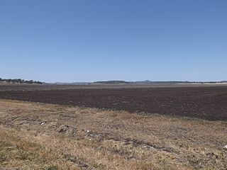
Cecil Plains is a rural town and locality in the Toowoomba Region, Queensland, Australia. In the 2016 census, Cecil Plains had a population of 429 people.

Cambooya, Queensland Town in Queensland, Australia

Cambooya is a rural town and locality in the Toowoomba Region, Queensland, Australia. In the 2016 census the locality of Cambooya had a population of 1,584 people.

Leyburn, Queensland Town in Queensland, Australia

Leyburn is a rural town in the Southern Downs Region and a locality split between the South Downs Region and the Toowoomba Region in Queensland, Australia. In the 2016 census, Leyburn had a population of 476 people.

Kingsthorpe, Queensland Town in Queensland, Australia

Kingsthorpe is a rural town and locality in the Toowoomba Region, Queensland, Australia. In the 2016 census, the locality of Kingsthorpe had a population of 1,867 people.

Applethorpe, Queensland Town in Queensland, Australia

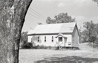
Applethorpe is a rural town and locality in the Southern Downs Region, Queensland, Australia. In the 2016 census the locality of Applethorpe had a population of 511 people.

Amiens, Queensland Town in Queensland, Australia

Amiens is a rural locality in the Southern Downs Region, Queensland, Australia. In the 2016 census, Amiens had a population of 293 people.

Ballandean, Queensland Town in Queensland, Australia

Ballandean is a rural town and locality in the Southern Downs Region, Queensland, Australia. In the 2016 census the locality of Ballandean had a population of 338 people.

Dalveen, Queensland Town in Queensland, Australia

Dalveen is a town and a locality in the Southern Downs Region, Queensland, Australia. It borders New South Wales. In the 2016 census, Dalveen had a population of 335 people.

Boodua, Queensland Suburb of Toowoomba Region, Queensland, Australia

Boodua is a rural locality in the Toowoomba Region, Queensland, Australia. In the 2016 census Boodua had a population of 93 people.

Eukey Suburb of Southern Downs Region, Queensland, Australia

Eukey is a rural locality in the Southern Downs Region, Queensland, Australia. It is on the border with New South Wales. In the 2016 census Eukey had a population of 134 people.

Tannymorel, Queensland Town in Queensland, Australia

Tannymorel is a rural town and locality in the Southern Downs Region, Queensland, Australia. In the 2016 census, the locality of Tannymorel had a population of 161 people.

Limevale, Queensland Suburb of Goondiwindi Region, Queensland, Australia

Limevale is a rural locality in the Goondiwindi Region, Queensland, Australia. In the 2016 census, Limevale had a population of 64 people.

Severnlea, Queensland Suburb of Southern Downs Region, Queensland, Australia

Severnlea is a locality in the Southern Downs Region, Queensland, Australia. In the 2016 census, Severnlea had a population of 350 people.

Glen Aplin, Queensland Suburb of Southern Downs Region, Queensland, Australia

Glen Aplin is a rural locality in the Southern Downs Region, Queensland, Australia. In the 2016 census, Glen Aplin had a population of 503 people.

Dalcouth, Queensland Suburb of Southern Downs Region, Queensland, Australia

Dalcouth is a locality in the Southern Downs Region, Queensland, Australia. It is on the border with New South Wales. In the 2016 census, Dalcouth had a population of 165 people.

Ducklo, Queensland Suburb of Western Downs Region, Queensland, Australia

Ducklo is a locality in the Western Downs Region, Queensland, Australia. In the 2016 census, Ducklo had a population of 333 people.

Thane, Queensland Town in Queensland, Australia

Thane is a rural town and locality in the Southern Downs Region, Queensland, Australia. In the 2016 census, Thane had a population of 27 people.

References

  1. 1 2 3 Australian Bureau of Statistics (27 June 2017). "The Summit (SSC)". 2016 Census QuickStats. Retrieved 20 October 2018. OOjs UI icon edit-ltr-progressive.svg
  2. "The Summit – town in Southern Downs Region (entry 34150)". Queensland Place Names. Queensland Government . Retrieved 29 December 2020.
  3. "The Summit – locality in Southern Downs Region (entry 45992)". Queensland Place Names. Queensland Government . Retrieved 29 December 2020.
  4. 1 2 3 "Queensland Globe". State of Queensland . Retrieved 25 January 2022.
  5. "The Summit – railway station in the Southern Downs Region (entry 34151)". Queensland Place Names. Queensland Government . Retrieved 25 January 2022.
  6. "Opening and closing dates of Queensland Schools". Queensland Government . Retrieved 10 June 2015.
  7. "Agency ID 11258, The Summit State School". Queensland State Archives . Retrieved 11 June 2015.
  8. "COUNTRY TELEGRAMS". The Brisbane Courier . No. 17, 977. Queensland, Australia. 28 August 1915. p. 16. Archived from the original on 25 January 2022. Retrieved 25 January 2022 via National Library of Australia.
  9. "The Summit Uniting Church - Former". Churches Australia. Archived from the original on 25 January 2022. Retrieved 25 January 2022.
  10. Google (25 January 2022). "The Summit Methodist Church (former)" (Map). Google Maps . Google. Retrieved 25 January 2022.
  11. Blake, Thom. "The Summit Methodist Church". Queensland religious places database. Archived from the original on 25 January 2022. Retrieved 25 January 2022.
  12. "CHURCH OF ENGLAND". Warwick Daily News . No. 2417. Queensland, Australia. 30 November 1926. p. 3. Archived from the original on 25 January 2022. Retrieved 25 January 2022 via National Library of Australia.
  13. Blake, Thom. "St John's Anglican Church". Queensland religious places database. Archived from the original on 25 January 2022. Retrieved 25 January 2022.
  14. 1 2 Blake, Thom. "Seventh Day Adventist Church". Queensland religious places database. Archived from the original on 25 January 2022. Retrieved 25 January 2022.
  15. Australian Bureau of Statistics (31 October 2012). "The Summit (SSC)". 2011 Census QuickStats. Retrieved 11 June 2015. OOjs UI icon edit-ltr-progressive.svg
  16. "State and non-state school details". Queensland Government. 9 July 2018. Archived from the original on 21 November 2018. Retrieved 21 November 2018.
  17. "The Summit State School". The Summit State School. 3 April 2020. Archived from the original on 13 March 2021. Retrieved 25 January 2022.
  18. "ACARA School Profile 2018". Australian Curriculum, Assessment and Reporting Authority. Archived from the original on 27 August 2020. Retrieved 28 January 2020.
  19. Google (25 January 2022). "The Summit Public Hall" (Map). Google Maps . Google. Retrieved 25 January 2022.
  20. "Contact Us | Stanthorpe Anglican Parish | Queensland". Stanthorpe Anglican. Archived from the original on 16 April 2021. Retrieved 25 January 2022.
  21. Google (25 January 2022). "St John's Anglican Church" (Map). Google Maps . Google. Retrieved 25 January 2022.
  22. "St John's Anglican Church". Churches Australia. Archived from the original on 25 January 2022. Retrieved 25 January 2022.
  23. "The Summit Adventist Church". The Summit Adventist Church. Archived from the original on 5 March 2021. Retrieved 25 January 2022.
  24. "The Summit, Seventh-Day Adventist Church". Churches Australia. Archived from the original on 27 October 2020. Retrieved 25 January 2022.

Further reading