Severnlea, Queensland

Last updated

Severnlea
Queensland
Severnlea State School with snow.jpg
Severnlea State School with snow
Australia Queensland location map.svg
Red pog.svg
Severnlea
Coordinates 28°42′15″S151°54′57″E / 28.7041°S 151.9158°E / -28.7041; 151.9158 (Severnlea (centre of locality))
Population382 (SAL 2021) [1]
Postcode(s) 4352
Elevation777 m (2,549 ft)
Area27.5 km2 (10.6 sq mi)
Time zone AEST (UTC+10:00)
Location
LGA(s) Southern Downs Region
State electorate(s) Southern Downs
Federal division(s) Maranoa
Suburbs around Severnlea:
Broadwater Stanthorpe Stanthorpe
Thorndale Severnlea Mount Tully
Glen Aplin Mount Tully Mount Tully

Severnlea is a semi-rural locality in the Southern Downs Region, Queensland, Australia. [2] In the 2021 census, Severnlea had a population of 382 people. [3]

Contents

Geography

Severnlea is immediately south of the town of Stanthorpe. [4]

The New England Highway and the Southern railway line pass through the locality from north (Stanthorpe) to south (Glen Alpin). [5] The locality was historically served by the now-abandoned Severnlea railway station ( 28°42′09″S151°54′24″E / 28.7024°S 151.9066°E / -28.7024; 151.9066 (Severnlea railway station) ). [4]

The Severn River also flows from north to south to the west of the highway and railway. [5]

The land use is a mixture of rural residential housing, grazing on native vegetation, and crop growing. [5]

History

The locality presumably takes its name from the Severn River.

Beverley State School opened on 30 October 1918. On 15 November 1922, it was renamed Severnlea State School. [6]

Severnlea Methodist Church opened in 1948. When the Methodist Church amalgamated into the Uniting Church in Australia in 1977, it became Severnlea Uniting Church. [7]

Mount Tully Community School opened on 23 February 1985 and closed on 31 December 1994. [6]

Demographics

In the 2016 census, Severnlea had a population of 350 people. [8]

In the 2021 census, Severnlea had a population of 382 people. [3]

Education

Severnlea State School is a government primary (Prep-6) school for boys and girls at 14 Turner Road ( 28°42′08″S151°54′31″E / 28.7023°S 151.9087°E / -28.7023; 151.9087 (Severnlea State School) ). [9] [10] In 2017, the school had an enrolment of 61 students with 4 teachers (3 full-time equivalent) and 5 non-teaching staff (3 full-time equivalent). [11] In 2018, the school had an enrolment of 63 students with 5 teachers (4 full-time equivalent) and 5 non-teaching staff (3 full-time equivalent). [12]

There are no secondary schools in Severnlea. The nearest government secondary school is Stanthorpe State High School in neighbouring Stanthorpe to the north. [13]

Amenities

Severnlea Uniting Church is at 440 Whiskey Gully Road ( 28°42′54″S151°55′25″E / 28.7151°S 151.9237°E / -28.7151; 151.9237 (Severnlea Uniting Church) ). [14]

Related Research Articles

<span class="mw-page-title-main">Stanthorpe, Queensland</span> Town in Queensland, Australia

Stanthorpe is a rural town and locality in the Southern Downs Region, Queensland, Australia. In the 2016 census, Stanthorpe had a population of 5,406 people.

<span class="mw-page-title-main">Wallangarra, Queensland</span> Town in Queensland, Australia

Wallangarra is a rural town and locality in the Southern Downs Region, Queensland, Australia on the border with New South Wales. In the 2016 census, the locality of Wallangarra had a population of 468 people.

<span class="mw-page-title-main">Palmwoods, Queensland</span> Town in Queensland, Australia

Palmwoods is a rural town and locality in the Sunshine Coast Region, Queensland, Australia. In the 2021 census, the locality of Palmwoods had a population of 6,357 people.

<span class="mw-page-title-main">Glass House Mountains, Queensland</span> Town in Queensland, Australia

Glass House Mountains is a rural hinterland town and locality in the Sunshine Coast Region, Queensland, Australia. In the 2016 census, the locality of Glass House Mountains had a population of 5,065 people.

Glenvale is a semi-rural residential locality in the Toowoomba Region, Queensland, Australia. It is a suburb of Toowoomba. In the 2016 census, Glenvale had a population of 6,353 people.

<span class="mw-page-title-main">Murgon</span> Town in Queensland, Australia

Murgon is a rural town and locality in the South Burnett Region, Queensland, Australia. In the 2016 census, the locality of Murgon had a population of 2,378 people.

<span class="mw-page-title-main">Wowan, Queensland</span> Town in Queensland, Australia

Wowan is a rural town and locality in the Shire of Banana, Queensland, Australia. In the 2016 census, the locality of Wowan had a population of 216 people.

<span class="mw-page-title-main">Wellcamp, Queensland</span> Suburb of Toowoomba Region, Queensland, Australia

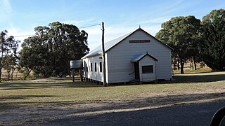
Wellcamp is a rural locality in the Toowoomba Region, Queensland, Australia. In the 2016 census, Wellcamp had a population of 295 people.

<span class="mw-page-title-main">Applethorpe, Queensland</span> Town in Queensland, Australia

Applethorpe is a rural town and locality in the Southern Downs Region, Queensland, Australia. It is on Queensland's border with New South Wales. It is well known for the production of apples. It often records the lowest temperatures in Queensland.

<span class="mw-page-title-main">Amiens, Queensland</span> Town in Queensland, Australia

Amiens is a rural locality in the Southern Downs Region, Queensland, Australia. In the 2016 census, Amiens had a population of 293 people.

<span class="mw-page-title-main">Ballandean, Queensland</span> Town in Queensland, Australia

Ballandean is a rural town and locality in the Southern Downs Region, Queensland, Australia. In the 2021 census, the locality of Ballandean had a population of 316 people.

<span class="mw-page-title-main">Dalveen, Queensland</span> Town in Queensland, Australia

Dalveen is a town and a locality in the Southern Downs Region, Queensland, Australia. It borders New South Wales. In the 2016 census, Dalveen had a population of 335 people.

<span class="mw-page-title-main">The Summit, Queensland</span> Town in Queensland, Australia

The Summit is a rural town and locality in the Southern Downs Region, Queensland, Australia. In the 2016 census, the locality of The Summit had a population of 409 people.

<span class="mw-page-title-main">Eukey</span> Suburb of Southern Downs Region, Queensland, Australia

Eukey is a rural locality in the Southern Downs Region, Queensland, Australia. It is on the border with New South Wales. In the 2016 census Eukey had a population of 134 people.

Glen Aplin is a rural locality in the Southern Downs Region, Queensland, Australia. In the 2016 census, Glen Aplin had a population of 503 people.

Greenlands is a rural locality in the Southern Downs Region, Queensland, Australia. In the 2016 census Greenlands had a population of 250 people.

Coolabunia is a rural locality in the South Burnett Region, Queensland, Australia.

<span class="mw-page-title-main">Crawford, Queensland</span> Suburb of South Burnett Region, Queensland, Australia

Crawford is a locality in the South Burnett Region, Queensland, Australia.

Walkervale is a suburb of Bundaberg in the Bundaberg Region, Queensland, Australia. In the 2021 census, Walkervale had a population of 2,981 people.

Mount Tully is a rural locality in the Southern Downs Region, Queensland, Australia. In the 2021 census, Mount Tully had a population of 117 people.

References

  1. Australian Bureau of Statistics (28 June 2022). "Severnlea (suburb and locality)". Australian Census 2021 QuickStats. Retrieved 28 June 2022.  OOjs UI icon edit-ltr-progressive.svg
  2. "Severnlea – locality in Southern Downs Region (entry 45973)". Queensland Place Names. Queensland Government . Retrieved 11 June 2019.
  3. 1 2 Australian Bureau of Statistics (28 June 2022). "Severnlea (SAL)". 2021 Census QuickStats. Retrieved 28 February 2023. OOjs UI icon edit-ltr-progressive.svg
  4. 1 2 "Railway stations and sidings - Queensland". Queensland Open Data. Queensland Government. 2 October 2020. Archived from the original on 5 October 2020. Retrieved 5 October 2020.
  5. 1 2 3 "Queensland Globe". State of Queensland . Retrieved 4 January 2024.
  6. 1 2 Queensland Family History Society (2010), Queensland schools past and present (Version 1.01 ed.), Queensland Family History Society, ISBN   978-1-921171-26-0
  7. Blake, Thom. "Severnlea Methodist Church". Queensland religious places database. Archived from the original on 24 January 2022. Retrieved 24 January 2022.
  8. Australian Bureau of Statistics (27 June 2017). "Severnlea (SSC)". 2016 Census QuickStats. Retrieved 20 October 2018. OOjs UI icon edit-ltr-progressive.svg
  9. "State and non-state school details". Queensland Government. 9 July 2018. Archived from the original on 21 November 2018. Retrieved 21 November 2018.
  10. "Severnlea State School". Archived from the original on 12 March 2021. Retrieved 28 September 2023.
  11. "ACARA School Profile 2017". Archived from the original on 22 November 2018. Retrieved 22 November 2018.
  12. "ACARA School Profile 2018". Australian Curriculum, Assessment and Reporting Authority. Archived from the original on 27 August 2020. Retrieved 28 January 2020.
  13. "Layers: Locality; Schools and school catchments". Queensland Globe. Queensland Government. Archived from the original on 19 December 2017. Retrieved 2 January 2024.
  14. "Severnlea Uniting Church". Churches Australia. Archived from the original on 24 January 2022. Retrieved 24 January 2022.

Further reading