
Queensland is a state in north-eastern Australia, the second-largest and third-most populous of the Australian states. It is bordered by the Northern Territory, South Australia and New South Wales to the west, south-west and south respectively. To the east, Queensland is bordered by the Coral Sea and the Pacific Ocean; to its north is the Torres Strait, separating the Australian mainland from Papua New Guinea, and the Gulf of Carpentaria to the north-west. With an area of 1,729,742 square kilometres (667,857 sq mi), Queensland is the world's sixth-largest sub-national entity; it is larger than all but 16 countries. Due to its size, Queensland's geographical features and climates are diverse, including tropical rainforests, rivers, coral reefs, mountain ranges and sandy beaches in its tropical and sub-tropical coastal regions, as well as deserts and savanna in the semi-arid and desert climatic regions of its interior.
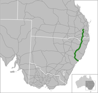
New England Highway is an 883-kilometre (549 mi) long highway in Australia running from Yarraman, north of Toowoomba, Queensland, at its northern end to Hexham at Newcastle, New South Wales, at its southern end. It is part of Australia's National Highway system, and forms part of the inland route between Brisbane and Sydney.

Stanthorpe is a rural town and locality in the Southern Downs Region, Queensland, Australia. In the 2021 census, the locality of Stanthorpe had a population of 5,286 people.

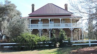
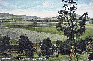
Warwick is a town and locality in southeast Queensland, Australia, lying 130 kilometres (81 mi) south-west of Brisbane. It is the administrative centre of the Southern Downs Region local government area. The surrounding Darling Downs have fostered a strong agricultural industry for which Warwick, together with the larger city of Toowoomba, serve as convenient service centres. The town had an urban population of 15,380 as at June 2018, having declined slightly at an average annual rate of –0.15% year-on-year over the preceding five years.
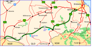
The Cunningham Highway is a 327-kilometre (203 mi) national highway located in south-eastern Queensland, Australia. The highway links the Darling Downs region with the urbanised outskirts of Ipswich via Cunninghams Gap.

Allora is a rural town and locality in the Southern Downs Region, Queensland, Australia. In the 2016 census, the locality of Allora had a population of 1,223 people.
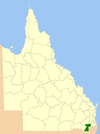
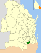
The Southern Downs Region is a local government area in the Darling Downs region of Queensland, Australia, along the state's boundary with New South Wales. It was created in 2008 from a merger of the Shire of Warwick and the Shire of Stanthorpe.
Warwick Airport may refer to:

Leyburn is a rural town in the Southern Downs Region and a locality split between the South Downs Region and the Toowoomba Region in Queensland, Australia. In the 2016 census, Leyburn had a population of 476 people.
The Shire of Glengallan was a local government area south and east of the regional centre of Warwick in the Darling Downs region of Queensland. The shire, administered from Warwick, covered an area of 1,699.6 square kilometres (656.2 sq mi), and existed as a local government entity from 1879 until 1994, when it was dissolved and amalgamated with City of Warwick, Shire of Rosenthal and Shire of Allora to form the Shire of Warwick.

The City of Warwick was a local government area administering the regional centre of Warwick in the Darling Downs region of Queensland. The City covered an area of 25.1 square kilometres (9.7 sq mi), and existed as a local government entity from 1861 until 1994, when it was dissolved and amalgamated with Shire of Allora, Shire of Rosenthal and Shire of Glengallan to form the Shire of Warwick.

Southern Downs is an electoral district of the Legislative Assembly in the Australian state of Queensland. It was created in 2001 as a replacement for Warwick.
Swan Creek is a rural locality in the Southern Downs Region, Queensland, Australia. In the 2021 census, Swan Creek had a population of 161 people.
Willowvale is a rural locality in the Southern Downs Region, Queensland, Australia. In the 2016 census Willowvale had a population of 94 people.
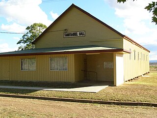
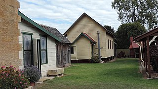
Tannymorel is a rural town and locality in the Southern Downs Region, Queensland, Australia. In the 2016 census, the locality of Tannymorel had a population of 161 people.
Freestone is a rural town and locality in the Southern Downs Region, Queensland, Australia. In the 2016 census, Freestone had a population of 217 people.

Junabee is a rural locality in the Southern Downs Region, Queensland, Australia. In the 2016 census, Junabee had a population of 213 people.

Massie is a rural locality in the Southern Downs Region, Queensland, Australia. In the 2021 census, Massie had a population of 113 people.
Rosenthal Heights is a mixed-use locality in the Southern Downs Region, Queensland, Australia. In the 2021 census, Rosenthal Heights had a population of 2,664 people.
