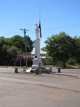
Aramac is a rural town and locality in the Barcaldine Region, Queensland, Australia. In the 2016 census, Aramac had a population of 299 people.

Muttaburra is an outback town and locality in the Barcaldine Region, Queensland, Australia. Muttaburra was the discovery site of the Muttaburrasaurus, one of Australia's most famous dinosaurs.

The Shire of Aramac was a local government area located in central Queensland about 1,100 kilometres (684 mi) north west of the state capital, Brisbane, between the towns of Barcaldine and Winton. It covered an area of 23,364.1 square kilometres (9,020.9 sq mi), and existed as a local government entity from 1879 until 2008, when it amalgamated with the Shires of Barcaldine and Jericho to form the Barcaldine Region.

The Barcaldine Region is a local government area in Central West Queensland, Australia. Established in 2008, it was preceded by three previous local government areas which had existed for over a century.

Central West Queensland is a remote region in the Australian state of Queensland which covers 396,650.2 km2. The region lies to the north of South West Queensland and south of the Gulf Country. It has a population of approximately 12,387 people.

Cornish Creek is a former rural locality in the Barcaldine Region, Queensland, Australia. In the 2016 census, Cornish Creek had a population of 16 people.
Bangall is a former rural locality in the Barcaldine Region, Queensland, Australia. In the 2016 census, Bangall had a population of 4 people.
Upper Cornish Creek is a former rural locality in the Barcaldine Region, Queensland, Australia. In the 2016 census, Upper Cornish Creek had a population of 43 people.
Upland is a former rural locality in the Barcaldine Region, Queensland, Australia. In the 2016 census, Upland had a population of 12 people.
Ingberry is a former rural locality in the Barcaldine Region, Queensland, Australia. In the 2016 census, Ingberry had a population of 11 people.
Ibis is a former rural locality in the Barcaldine Region, Queensland, Australia. In the 2016 census, Ibis had a population of 4 people.
Pelican Creek is a former rural locality in the Barcaldine Region, Queensland, Australia. In the 2016 census, Pelican Creek had a population of 20 people.
Sardine is a former rural locality in the Barcaldine Region, Queensland, Australia. In the 2016 census, Sardine had a population of 5 people.
Home Creek is a former rural locality in the Barcaldine Region, Queensland, Australia. In the 2016 census, Home Creek had a population of 24 people.
Moombria is a former rural locality in the Barcaldine Region, Queensland, Australia. In the 2016 census, Moombria had a population of 0 people.
Narbethong was a rural locality in the Barcaldine Region, Queensland, Australia. In the 2016 census, Narbethong had a population of 0 people.
Patrick is a former rural locality in the Barcaldine Region, Queensland, Australia. In the 2016 census, Patrick had a population of 26 people.
Tara Station is a former rural locality in the Barcaldine Region, Queensland, Australia. In the 2016 census, Tara Station had a population of 10 people.
Dunrobin is a former rural locality in the Barcaldine Region, Queensland, Australia. In the 2016 census, Dunrobin had a population of 14 people.
Garfield is a former rural locality in the Barcaldine Region, Queensland, Australia. In the 2016 census, Garfield had a population of 37 people.


