
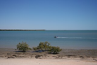
Weipa is a coastal mining town in the local government area of Weipa Town in Queensland. It is the largest town on the Cape York Peninsula. It exists because of the enormous bauxite deposits along the coast. The Port of Weipa is mainly involved in exports of bauxite. There are also shipments of live cattle from the port.
Karumba is a town and a coastal locality in the Shire of Carpentaria, Queensland, Australia. In the 2016 census, the locality of Karumba had a population of 531 people.
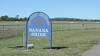
Thangool Airport is an airport at 42 Aerodrome Road, Thangool, Shire of Banana, Queensland, Australia. It is also known as Thangool Aerodrome. It is operated by the Banana Shire Council.

Birdsville Airport is an airport serving Birdsville, Queensland, Australia. During the Birdsville Races weekend each September, as many as 200 light aircraft visit the airport, with aviators permitted to camp under the wings of their planes. The Channel Mail Run, the world's longest mail run operates between Port Augusta, South Australia and Birdsville, stopping in the town to collect mail for the remote Queensland cattle stations of Glengyle and Durrie.
Quilpie Airport is an airport serving Quilpie, Queensland, Australia. It is located 1 nautical mile west of Quilpie and operated by the Quilpie Shire Council. The airport received $242,666 for security upgrades from the Australian Government in 2006.
Richmond Airport is 2 miles northwest of Richmond, Queensland, Australia. It is operated by the Richmond Shire Council.
Windorah Airport is an airport serving Windorah, Queensland, Australia. It is operated by the Barcoo Shire Council. The airport received $183,578 in funds for security upgrades from the Australian Government in 2006.

Winton Airport is an airport serving Winton, Queensland, Australia. It is located 3 nautical miles northeast of Winton and operated by the Winton Shire Council.
Chinchilla Airport is an airport serving Chinchilla, Queensland, Australia.

Whitsunday Airport (Shute Harbour) (IATA: WSY, ICAO: YSHR) is located in Flametree in the Whitsunday Region, Queensland, Australia. It is located between the popular tourist destinations of Airlie Beach, Shute Harbour and the Whitsunday Islands.

Cooktown is a coastal town and locality in the Shire of Cook, Queensland, Australia. Cooktown is at the mouth of the Endeavour River, on Cape York Peninsula in Far North Queensland where James Cook beached his ship, the Endeavour, for repairs in 1770. Both the town and Mount Cook which rises up behind the town were named after James Cook.
Dirranbandi Airport is an airport serving Dirranbandi, Queensland, Australia.
Abingdon Airport, also known as Abingdon Downs Airport, is an airport in Abingdon Downs, Shire of Etheridge, Queensland, Australia.
Arrabury Airport is an airport at Arrabury pastoral station in Tanbar, Shire of Barcoo, Queensland, Australia.

Weipa Town is a local government area in Far North Queensland, Australia. It covers the town of Weipa on the western coast of the Cape York Peninsula, including the localities of Rocky Point, Trunding, Nanum, Evans Landing, and Weipa Airport. It is an unusual local government area as it is not governed and managed by a council elected by residents but rather by the company Rio Tinto Aluminium through a governing body called the Weipa Town Authority. In June 2018, Weipa Town had a population of 4,240.
Mission River is a coastal rural locality split between the Shire of Cook and the Aboriginal Shire of Napranum in Queensland, Australia. In the 2016 census, Mission River had a population of 987 people.

Lizard is an offshore locality consisting of a number of islands in the Great Barrier Reef area of the Coral Sea within the Shire of Cook, Queensland, Australia. It includes Lizard Island. In the 2021 census, Lizard had a population of 65 people.
