
Texas is a rural town and locality in the Goondiwindi Region of Queensland, Australia. It is on the Queensland border with New South Wales. In the 2021 census, the locality of Texas had a population of 790 people.

Hebel is a rural town and locality in the Shire of Balonne, Queensland, Australia. It is on the border of Queensland and New South Wales. In the 2016 census, Hebel had a population of 67 people.
Dirranbandi is a rural town and locality in the Shire of Balonne, Queensland, Australia. The locality is on the border of Queensland with New South Wales. In the 2021 census, the locality of Dirranbandi had a population of 610 people.
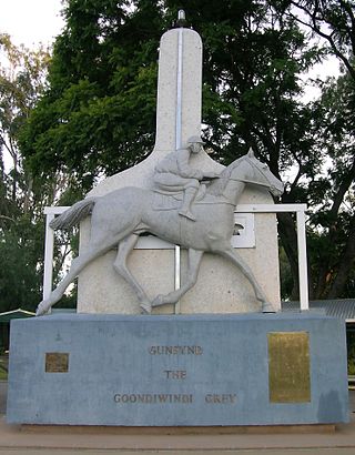
Goondiwindi is a rural town and locality in the Goondiwindi Region, Queensland, Australia. It is on the border of Queensland and New South Wales. In the 2016 census, Goondiwindi had a population of 6,355 people.

Mungindi is a town and locality on the border of New South Wales (NSW) and Queensland, Australia. The town is within Moree Plains Shire in New South Wales. Within Queensland, the locality is split between the Shire of Balonne and the Goondiwindi Region with the town in the Shire of Balonne. It possesses a New South Wales postcode. Mungindi sits on the Carnarvon Highway and straddles the Barwon River which is the border between New South Wales and Queensland. At the 2016 census, Mungindi had a population of 601 on the New South Wales side, while the population on the Queensland side was 146.

Collarenebri is a town in north western New South Wales, Australia. The town is in the Walgett Shire Local Government Area and is situated on the Barwon River approximately 75 kilometres (47 mi) northeast of Walgett and south west of Mungindi on the Gwydir Highway. It is 16 km (9.9 mi) from Pokataroo which was the nearest railway town prior to closure of the rail service there. The town is 150 metres (490 ft) above sea level. Collarenebri is one of three towns ending in 'BRI' in Northern New South Wales.
Boomi is a town in north western New South Wales, Australia. The town is in the Moree Plains Shire local government area, 728 kilometres (452 mi) north west of the state capital, Sydney, on the border on the New South Wales side of the MacIntyre River. Boomi is west of the Queensland town of Goondiwindi and north of Moree in New South Wales. At the 2016 census, Boomi and the surrounding farming area had a population of approximately 200.

The Shire of Balonne is a local government area in South West Queensland, Australia, over 500 kilometres (310 mi) from the state capital, Brisbane. It covers an area of 31,104 square kilometres (12,009.3 sq mi), and has existed as a local government entity since 1879. It is headquartered in its main town, St George.

Toobeah, pronounced 'two beer', is a rural town and locality in the Goondiwindi Region, Queensland, Australia. The locality is on the border of Queensland and New South Wales. In the 2016 census, Toobeah had a population of 191 people.
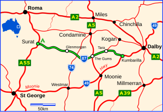
The Surat Developmental Road is a sealed road in the Western Downs Region, Queensland, Australia. It is a state-controlled district road, rated as a local road of regional significance (LRRS).
Daymar is a rural town and locality in the Goondiwindi Region, Queensland, Australia. In the 2016 census, the locality of Daymar had a population of 37 people.
Goodar is a rural locality in the Goondiwindi Region, Queensland, Australia. In the 2021 census, Goodar had a population of 101 people.
Kioma is a rural locality in the Goondiwindi Region, Queensland, Australia. In the 2021 census, Kioma had a population of 32 people.
Kurumbul is a rural town and locality in the Goondiwindi Region, Queensland, Australia. It is on the border of Queensland and New South Wales. In the 2016 census, Kurumbul had a population of 46 people.
Lundavra is a rural locality in the Goondiwindi Region, Queensland, Australia. In the 2021 census, Lundavra had a population of 56 people.
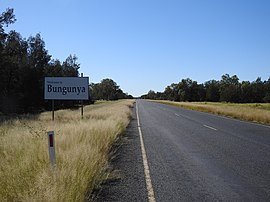
North Bungunya is a rural locality in the Goondiwindi Region, Queensland, Australia. In the 2021 census, North Bungunya had a population of 35 people.

North Talwood is a rural locality in the Goondiwindi Region, Queensland, Australia. In the 2021 census, North Talwood had a population of 113 people.
South Talwood is a rural locality in the Goondiwindi Region, Queensland, Australia. It is on the border of Queensland and New South Wales. It is 107 kilometres (66 mi) west of Goondiwindi. In the 2021 census, South Talwood had a population of 101 people.

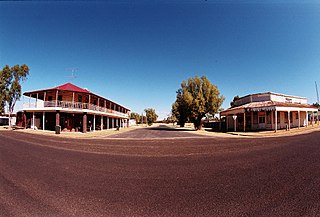
Talwood is a town in the rural locality of North Talwood in Goondiwindi Region, Queensland, Australia.
Tarawera is a rural locality in the Goondiwindi Region, Queensland, Australia. In the 2021 census, Tarawera had a population of 69 people.


