
Texas is a rural town and locality in the Goondiwindi Region of Queensland, Australia. It is on the Queensland border with New South Wales. In the 2021 census, the locality of Texas had a population of 790 people.
Inglewood is a rural town and locality in the Goondiwindi Region, Queensland, Australia. In the 2021 census, the locality of Inglewood had a population of 936 people.
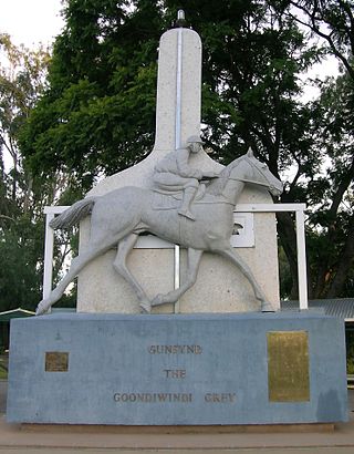
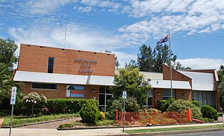
Goondiwindi is a rural town and locality in the Goondiwindi Region, Queensland, Australia. It is on the border of Queensland and New South Wales. In the 2021 census, the locality of Goondiwindi had a population of 6,230 people.

Yelarbon is a rural town and locality in the Goondiwindi Region, Queensland, Australia. It is on the border of Queensland and New South Wales. In the 2021 census, the locality of Yelarbon had a population of 313 people.

Moonie is a rural town in the Western Downs Region and a locality split between the Western Downs Region and the Goondiwindi Region in Queensland, Australia. In the 2021 census, the locality of Moonie had a population of 182 people.

Wowan is a rural town and locality in the Shire of Banana, Queensland, Australia. In the 2021 census, the locality of Wowan had a population of 170 people.
The Gums is a rural town and locality in the Western Downs Region, Queensland, Australia. In the 2021 census, the locality of The Gums had a population of 165 people.
Goombi is a rural locality in the Western Downs Region, Queensland, Australia. In the 2021 census, Goombi had a population of 56 people.
Billa Billa is a rural locality in the Goondiwindi Region, Queensland, Australia. In the 2021 census, Billa Billa had a population of 111 people.

Mount Chalmers is a rural town and locality in the Livingstone Shire, Queensland, Australia. In the 2021 census, the locality of Mount Chalmers had a population of 226 people.
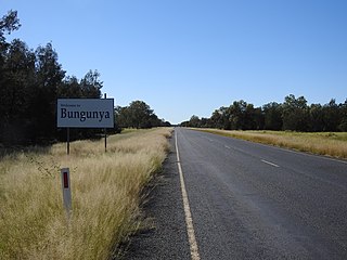
Bungunya is a rural town and locality in the Goondiwindi Region, Queensland, Australia. The locality is on the border of Queensland and New South Wales. In the 2021 census, the locality of Bungunya had a population of 62 people.

Beebo is a rural locality in the Goondiwindi Region, Queensland, Australia. It is on the Queensland border with New South Wales. In the 2021 census, Beebo had a population of 50 people.

Coolmunda is a rural locality in the Goondiwindi Region, Queensland, Australia. In the 2021 census, Coolmunda had a population of 212 people.
Daymar is a rural town and locality in the Goondiwindi Region, Queensland, Australia. In the 2021 census, the locality of Daymar had a population of 41 people.
Glenarbon is a rural locality in the Goondiwindi Region, Queensland, Australia. It is on the border of Queensland and New South Wales. In the 2021 census, Glenarbon had a population of 33 people.
Goodar is a rural locality in the Goondiwindi Region, Queensland, Australia. In the 2021 census, Goodar had a population of 101 people.
Kioma is a rural locality in the Goondiwindi Region, Queensland, Australia. In the 2021 census, Kioma had a population of 32 people.
South Talwood was a rural locality in the Goondiwindi Region, Queensland, Australia. It was on the border of Queensland and New South Wales. It was 107 kilometres (66 mi) west of Goondiwindi. In the 2021 census, South Talwood had a population of 101 people.

Talwood is a rural town and locality in Goondiwindi Region, Queensland, Australia.
Callide is a rural town and locality in the Shire of Banana, Queensland, Australia. In the 2021 census, the locality of Callide had a population of 80 people.
