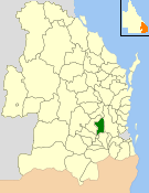
Hampton, Queensland

Last updated

Hampton
Queensland
New England Highway Hampton.jpg
New England Highway at Hampton, 2014
Australia Queensland location map.svg
Red pog.svg
Hampton
Coordinates 27°21′22″S152°04′09″E / 27.3561°S 152.0691°E / -27.3561; 152.0691 (Hampton (town centre)) Coordinates: 27°21′22″S152°04′09″E / 27.3561°S 152.0691°E / -27.3561; 152.0691 (Hampton (town centre))
Population356 (2016 census) [1]
 • Density13.59/km2 (35.19/sq mi)
Postcode(s) 4352
Area26.2 km2 (10.1 sq mi)
Time zone AEST (UTC+10:00)
Location
LGA(s) Toowoomba Region
County Cavendish
Parish Crows Nest
State electorate(s) Condamine
Federal division(s)
Localities around Hampton:
Pechey Grapetree Perseverance
Merritts Creek Hampton Perseverance
Mount Luke Fifteen Mile Palmtree
White Mountain

Hampton is a rural town and locality in the Toowoomba Region, Queensland, Australia. [2] [3] In the 2016 census, the locality of Hampton had a population of 356 people. [1]

Contents

Geography

Hampton is on the Darling Downs, 147 kilometres (91 mi) west of the state capital, Brisbane. [4] Situated at the top of an escarpment on the Great Dividing Range, Hampton is one of the small town located along the New England Highway between Toowoomba, (29 kilometres away) and Crows Nest (12 kilometres).

There are three local dams that supply water to the surrounding area, all within a short distance of Hampton. These are Cooby Dam, Perseverance Dam and Cressbrook Dam. Recreational activities are available on some of the dams.

Climate

Hampton has moderate summer temperatures with high temperatures around 27 °C (80.6 °F). The summer low temperature is around 16 °C (60.8 °F). Hampton also has mild winters with temperature highs close to 17 °C (62.6 °F), and low temperatures around 6 °C (42.8 °F). The local flora and fauna are abundant to include many species of birds and mammals. Eucalypt and pine forests as well as grass land are present in this area.

History

The town was named after its former railway station, which in turn was named after Hampton then in Middlesex, England. [2] [5] [6]

In 1886, the Crows Nest railway line reached the town.

Hampton Post Office opened on 19 May 1913 (a receiving office had been open from 1887) and closed in 1977. [7]

Hampton State School opened on 22 August 1938. It closed in 1959. [8]

In the 2011 census, Hampton had a population of 345 people. [4]

In the 2016 census, the locality of Hampton had a population of 356 people. [1]

Education

There are no schools in Hampton. The nearest government primary schools are Geham State School in Geham to the south-west and Murphys Creek State School in Murphys Creek to the south. The nearest government secondary schools are Crows Nest State School (to Year 10) in Crows Nest to the north and Highfields State Secondary College (to Year 12) in Highfields, Toowoomba, to the south-west. [9]

Attractions

Hampton is known for the antique shop and gift stores as well as local produce, including citrus and avocados grown on the many farms located around the district. The Hampton Information Centre is located on the New England Highway at the junction of the Esk–Hampton Road. The road provides access to Ravensbourne National Park and connects Hampton to Esk. Ravensbourne National Park features short bushwalking tracks, a scenic lookout and picnic facilities. In May the park surrounding the Visitor Information Center plays host to the Hampton High Country Food and Art Festival. The festival gives local producers from all over the Darling Downs a chance to showcase their produce.

Related Research Articles

Shire of Crows Nest Local government area in Queensland, Australia

The Shire of Crows Nest was a local government area in the Darling Downs region of Queensland, Australia, immediately northeast of the regional city of Toowoomba. The shire, administered from the town of Crows Nest, covered an area of 1,629.9 square kilometres (629.3 sq mi), and existed as a local government entity from 1913 until 2008, when it amalgamated with several other councils in the Toowoomba area to form the Toowoomba Region. Its growth in later years has been fuelled by the expansion of Toowoomba, particularly the suburbs of Highfields and Blue Mountain Heights which, with a combined population of 7,333 in 2006, were home to over half the shire's population.

Highfields, Queensland Town in Queensland, Australia

Highfields is a rural town and locality in the Toowoomba Region, Queensland, Australia. In the 2016 census, the locality of Highfields had a population of 8,131 people. In 2017, it was the fastest growing area in Toowoomba. At 30 June 2019, the estimated resident population for the Highfields was 14,298.

City of Toowoomba Local government area in Queensland, Australia

The City of Toowoomba was a local government area in the Darling Downs region of Queensland, Australia, encompassing the centre and inner suburbs of the regional city of Toowoomba. The City covered an area of 116.5 square kilometres (45.0 sq mi), and existed as a local government entity in various forms from 1860 until 2008, when it amalgamated with several other councils in the surrounding area to form the Toowoomba Region.

Gowrie Junction is a rural locality in the Toowoomba Region, Queensland, Australia. It is north-west of Toowoomba. In the 2016 census, Gowrie Junction had a population of 2,120 people. The town of Gowrie is in the eastern part of the locality.

Crows Nest, Queensland Town in Queensland, Australia

Crows Nest is a rural town and locality in the Toowoomba Region, Queensland, Australia. The town is located in the Darling Downs on the New England Highway, 158 kilometres (98 mi) from the state capital, Brisbane and 43 kilometres (27 mi) from the nearby city of Toowoomba. In the 2016 census, Crows Nest had a population of 2160 people.

Esk–Hampton Road

The Esk–Hampton Road is a state highway in Queensland. It leaves the Brisbane Valley Highway at Esk and travels in a westerly direction for 45.7 km (28 mi) until it reaches the New England Highway at Hampton, where it ends. This road is part of State Route 85, which extends for over 570 km (354 mi) from Bribie Island to Nindigully, duplexing with the Brisbane Valley Highway from the D'Aguilar Highway to Esk, the New England Highway from Hampton to Toowoomba, the Gore Highway from Toowoomba to the Leichhardt Highway, and the southern 19 km (12 mi) section of the Leichhardt Highway to Goondiwindi.

Cabarlah, Queensland Town in Queensland, Australia

Cabarlah is a rural town and locality in the Toowoomba Region, Queensland, Australia. In the 2016 census the locality of Cabarlah had a population of 1,075 people.
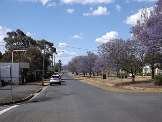
Goombungee, Queensland Town in Queensland, Australia

Goombungee is a rural town and locality in the Toowoomba Region, Queensland, Australia. In the 2016 census the locality of Goombungee had a population of 1,026 people.

Crows Nest Branch Railway was originally surveyed as a direct line from Toowoomba north to Crows Nest in Queensland, Australia. The branch eventually took a more circuitous route to cover the maximum amount of farming country. The first stage struck out from Pengarry Junction a short distance west of Toowoomba and continued via Birnan, Cawdor, Shirley, Woolmer, Meringandan and Kleinton to terminate at Cabarlah. It opened on 17 September 1883. Shortly after opening, a daily service was provided to Cabarlah.

Mount Kynoch, Queensland Suburb of Toowoomba, Queensland, Australia

Mount Kynoch is a rural locality in the Toowoomba Region, Queensland, Australia. In the 2016 census, Mount Kynoch had a population of 237 people.

Haden is a rural town and locality in the Toowoomba Region, Queensland, Australia. In the 2016 census, the locality of Haden had a population of 195 people.

Shire of Highfields

The Shire of Highfields is a former local government area on the Darling Downs in Queensland, Australia. It existed between 1879 and 1949.

Ravensbourne, Queensland Suburb of Toowoomba Region, Queensland, Australia

Ravensbourne is a rural locality in the Toowoomba Region, Queensland, Australia. In the 2016 census, Ravensbourne had a population of 248 people.
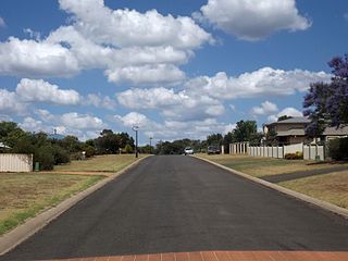
Kleinton, Queensland Suburb of Toowoomba Region, Queensland, Australia

Kleinton is a rural locality in the Toowoomba Region, Queensland, Australia. In the 2016 census, Kleinton had a population of 1,617 people.

Groomsville, Queensland Suburb of Toowoomba Region, Queensland, Australia

Groomsville is a rural locality in the Toowoomba Region on the Darling Downs, Queensland, Australia. In the 2016 census, Groomsville had a population of 113 people.
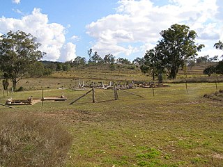
<span class="mw-page-title-main">Bergen, Queensland</span> Suburb of Toowoomba Region, Queensland, Australia

Bergen is a rural locality in the Toowoomba Region, Queensland, Australia. In the 2016 census, Bergen had a population of 68 people.

Pinelands is a rural locality in the Toowoomba Region, Queensland, Australia. In the 2016 census, Pinelands had a population of 86 people.

<span class="mw-page-title-main">Biarra, Queensland</span> Suburb of Somerset Region, Queensland, Australia

Biarra is a rural locality in the Somerset Region, Queensland, Australia. In the 2016 census, Biarra had a population of 257 people.

Glenaven is a rural locality in the Toowoomba Region, Queensland, Australia. In the 2016 census, Glenaven had a population of 79 people.

Upper Pinelands is a rural locality in the Toowoomba Region, Queensland, Australia. In the 2016 census, Upper Pinelands had a population of 33 people.

References

  1. 1 2 3 Australian Bureau of Statistics (27 June 2017). "Hampton (SSC)". 2016 Census QuickStats. Retrieved 20 October 2018. OOjs UI icon edit-ltr-progressive.svg
  2. 1 2 "Hampton – town in Toowoomba Region (entry 15307)". Queensland Place Names. Queensland Government . Retrieved 14 August 2022.
  3. "Hampton – locality in Toowoomba Region (entry 49253)". Queensland Place Names. Queensland Government . Retrieved 14 August 2022.
  4. 1 2 Australian Bureau of Statistics (31 October 2012). "Hampton (State Suburb)". 2011 Census QuickStats. Retrieved 1 July 2013. OOjs UI icon edit-ltr-progressive.svg
  5. "SKETCHER". The Queenslander . No. 2455. Queensland, Australia. 4 April 1914. p. 8. Archived from the original on 13 September 2021. Retrieved 17 November 2019 via National Library of Australia.
  6. "NOMENCLATURE OF QUEENSLAND.—145". The Courier-mail . No. 795. Queensland, Australia. 17 March 1936. p. 12. Archived from the original on 26 August 2022. Retrieved 17 November 2019 via National Library of Australia.
  7. Phoenix Auctions History. "Post Office List". Phoenix Auctions. Archived from the original on 26 August 2022. Retrieved 23 February 2021.
  8. Queensland Family History Society (2010), Queensland schools past and present (Version 1.01 ed.), Queensland Family History Society, ISBN   978-1-921171-26-0
  9. "Queensland Globe". State of Queensland . Retrieved 25 August 2022.