
Mount Kynoch is a rural locality in the Toowoomba Region, Queensland, Australia. In the 2021 census, Mount Kynoch had a population of 271 people.
Westbrook is a rural town and locality in the Toowoomba Region, Queensland, Australia. In the 2021 census, the locality of Westbrook had a population of 4,408 people.
Mount Tyson is a rural town and locality in the Toowoomba Region, Queensland, Australia. In the 2021 census, the locality of Mount Tyson had a population of 280 people.

Pampas is a rural locality in the Toowoomba Region, Queensland, Australia. In the 2021 census, Pampas had a population of 78 people.

East Greenmount is a rural town and locality in the Toowoomba Region, Queensland, Australia. In the 2021 census, the locality of East Greenmount had a population of 351 people.

Felton is a rural locality in the Toowoomba Region, Queensland, Australia. In the 2021 census, Felton had a population of 267 people.

Linthorpe is a rural locality in the Toowoomba Region, Queensland, Australia. In the 2021 census, Linthorpe had a population of 416 people.

Mount Irving is a rural locality in the Toowoomba Region, Queensland, Australia. In the 2021 census, Mount Irving had a population of 34 people.
Captains Mountain is a locality in the Toowoomba Region, Queensland, Australia. In the 2021 census, Captains Mountain had a population of 74 people.
Ramsay is a rural locality in the Toowoomba Region, Queensland, Australia. In the 2021 census, Ramsay had a population of 369 people.

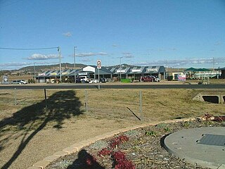
Brookstead is a rural town and locality in the Toowoomba Region, Queensland, Australia. In the 2021 census, the locality of Brookstead had a population of 182 people.

Bongeen is a rural locality in the Toowoomba Region, Queensland, Australia. In the 2021 census, Bongeen had a population of 71 people.
Irongate is a rural locality in the Toowoomba Region, Queensland, Australia. In the 2021 census, Irongate had a population of 135 people.
Mount Emlyn is a rural locality in the Toowoomba Region of Queensland, Australia. In the 2021 census, Mount Emlyn had "no people or a very low population".
North Branch is a locality in the Toowoomba Region, Queensland, Australia. In the 2021 census, North Branch had a population of 48 people.
Norwin is a rural locality in the Toowoomba Region, Queensland, Australia. In the 2021 census, Norwin had a population of 100 people.

Yarranlea is a rural locality in the Toowoomba Region, Queensland, Australia. In the 2021 census, Yarranlea had a population of 82 people.
Stoneleigh is a rural locality in the Toowoomba Region, Queensland, Australia. In the 2021 census, Stoneleigh had a population of 124 people.
Turallin is a rural town and locality in the Toowoomba Region, Queensland, Australia. In the 2021 census, the locality of Turallin had a population of 64 people.
Mount Molar is a rural locality in the Toowoomba Region, Queensland, Australia. In the 2021 census, Mount Molar had a population of 117 people.
