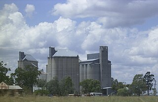
Millmerran, known as Domville between 1 June 1889 and 16 November 1894, is a town and a locality in the Toowoomba Region, Queensland, Australia. In the 2016 census, Millmerran had a population of 1,563 people.
Wyreema is a town and a locality in the Toowoomba Region, Queensland, Australia. At the 2016 census, Wyreema had a population of 1,834.
Cranley is a rural locality in the Toowoomba Region, Queensland, Australia. In the 2016 census Cranley had a population of 1,446 people.

Redwood is a rural locality on the outskirts of Toowoomba in the Toowoomba Region, Queensland, Australia. In the 2016 census, Redwood had a population of 170 people.

Athol is a rural locality in the Toowoomba Region, Queensland, Australia. In the 2016 census, Athol had a population of 134 people.

West Haldon is a locality split between Toowoomba Region and Lockyer Valley Region in Queensland, Australia. In the 2016 census, West Haldon had a population of 62 people.
Domville is a rural locality in the Toowoomba Region, Queensland, Australia, about 6.6 kilometres (4.1 mi) south of Milmerran.

Spring Creek is a rural locality split between the Toowoomba Region and the Southern Downs Region, Queensland, Australia. In the 2016 census, Spring Creek had a population of 194 people.

Brookstead is a rural town and locality in the Toowoomba Region, Queensland, Australia. In the 2016 census, Brookstead had a population of 217 people.
Evergreen is a rural town and locality in the Toowoomba Region, Queensland, Australia. In the 2016 census the locality of Evergreen had a population of 45 people.
Bongeen is a rural locality in the Toowoomba Region, Queensland, Australia. In the 2016 census, Bongeen had a population of 75 people.
Bringalily is a rural locality in the Toowoomba Region, Queensland, Australia. In the 2016 census Bringalily had a population of 83 people.
Millwood is a rural locality in the Toowoomba Region, Queensland, Australia. In the 2016 census Millwood had a population of 23 people.
Nangwee is a rural town and locality in the Toowoomba Region, Queensland, Australia. In the 2016 census the locality of Nangwee had a population of 52 people.
Pinelands is a rural locality in the Toowoomba Region, Queensland, Australia. In the 2016 census Pinelands had a population of 86 people.
Thornville is a rural locality in the Toowoomba Region, Queensland, Australia. In the 2016 census Thornville had a population of 26 people.
Tipton is a rural locality in the Toowoomba Region, Queensland, Australia. In the 2016 census Tipton had a population of 39 people.
Sabine is a rural locality in the Toowoomba Region, Queensland, Australia. In the 2016 census, Sabine had a population of 9 people.
Condamine Plains is a rural locality in the Toowoomba Region, Queensland, Australia. In the 2016 census, Condamine Plains had a population of 103 people.
Kurrowah is a rural locality in the Toowoomba Region, Queensland, Australia. In the 2016 census, Kurrowah had a population of 25 people.


