Purrawunda, Queensland

Last updated

Purrawunda
Queensland
Silos at Purrawunda.jpg
Grain silos at the Beef City feedlot, 2014
Australia Queensland location map.svg
Red pog.svg
Purrawunda
Coordinates 27°30′57″S151°36′51″E / 27.5158°S 151.6141°E / -27.5158; 151.6141 (Purrawunda (centre of locality))
Population12 (SAL 2021) [1]
Postcode(s) 4356
Area5.6 km2 (2.2 sq mi)
Time zone AEST (UTC+10:00)
Location
LGA(s) Toowoomba Region
State electorate(s) Condamine
Federal division(s) Groom
Suburbs around Purrawunda:
Yargullen Yargullen Aubigny
Mount Irving Purrawunda Aubigny
Mount Tyson Motley Motley

Purrawunda is a rural locality in the Toowoomba Region, Queensland, Australia. [2] In the 2021 census, Purrawunda had a population of 12 people. [3]

Contents

Geography

Purrawunda is on the Darling Downs. The Toowoomba–Cecil Plains Road runs along the southern boundary. [4] [5]

Soils in the area feature dark, medium clays which are fertile and well drained. [6] The land use is predominantly crop growng. There is also some grazing on native vegetation and intensive animal husbandry (a feedlot). [5]

History

The name Purrawunda means big fight in the local Jagera language. [7]

Demographics

In the 2016 census, Purrawunda had a population of 6 people. [8]

In the 2021 census, Purrawunda had a population of 12 people. [3]

Economy

JBS Australia, a subsidiary of JBS S.A. owns Beef City at Purrawunda ( 27°31′36″S151°37′09″E / 27.5266°S 151.6192°E / -27.5266; 151.6192 (abattoir) ). [9] The beef abattoir is co-located with a feedlot so that meat quality and animal welfare can be maintained. [10]

Australia's largest birdseed manufacturer, Avigrain, has a mill at Purrawunda and processes and stores grain at the old Purrawunda Grainco silos. [11]

Education

There are no schools in Purrawunda. The nearest government primary schools are Mount Tyson State School in neighbouring Mount Tyson to the south-west and Biddeston State School in Biddeston to the south-east. The nearest government secondary school is Oakey State High School in Oakey to the north-east. [12]

Related Research Articles

<span class="mw-page-title-main">Oakey, Queensland</span> Town in Queensland, Australia

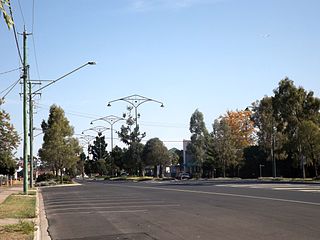
Oakey is a rural town and locality in the Toowoomba Region, Queensland, Australia. The Museum of Army Aviation is located at Oakey Airport.

<span class="mw-page-title-main">Cecil Plains, Queensland</span> Town in Queensland, Australia

Cecil Plains is a rural town and locality in the Toowoomba Region, Queensland, Australia. In the 2016 census, the locality of Cecil Plains had a population of 429 people.

<span class="mw-page-title-main">Wellcamp, Queensland</span> Suburb of Toowoomba Region, Queensland, Australia

Wellcamp is a rural locality in the Toowoomba Region, Queensland, Australia. In the 2016 census, Wellcamp had a population of 295 people.

<span class="mw-page-title-main">Mount Tyson, Queensland</span> Town in Queensland, Australia

Mount Tyson is a rural town and locality in the Toowoomba Region, Queensland, Australia. In the 2016 census, the locality of Mount Tyson had a population of 285 people.

<span class="mw-page-title-main">Aubigny, Queensland</span> Town in Queensland, Australia

Aubigny is a rural town and locality in the Toowoomba Region, Queensland, Australia. In the 2016 census, the locality of Aubigny had a population of 254 people.

<span class="mw-page-title-main">Biddeston, Queensland</span> Town in Queensland, Australia

Biddeston is a rural town and locality in the Toowoomba Region, Queensland, Australia. In the 2016 census the locality of Biddeston had a population of 284 people.

<span class="mw-page-title-main">Linthorpe, Queensland</span> Suburb of Toowoomba Region, Queensland, Australia

Linthorpe is a rural locality in the Toowoomba Region, Queensland, Australia. In the 2021 census, Linthorpe had a population of 416 people.

<span class="mw-page-title-main">Mount Irving, Queensland</span> Suburb of Toowoomba Region, Queensland, Australia

Mount Irving is a rural locality in the Toowoomba Region, Queensland, Australia. In the 2021 census, Mount Irving had a population of 34 people.

<span class="mw-page-title-main">Gowrie Little Plain, Queensland</span> Suburb of Toowoomba Region, Queensland, Australia

Gowrie Little Plain is a rural locality in the Toowoomba Region, Queensland, Australia. In the 2021 census, Gowrie Little Plain had a population of 79 people.

Evergreen is a rural town and locality in the Toowoomba Region, Queensland, Australia. In the 2016 census, the locality of Evergreen had a population of 45 people.

<span class="mw-page-title-main">Bongeen, Queensland</span> Suburb of Toowoomba Region, Queensland, Australia

Bongeen is a rural locality in the Toowoomba Region, Queensland, Australia. In the 2016 census, Bongeen had a population of 75 people.

Kelvinhaugh is a rural locality in the Toowoomba Region, Queensland, Australia. In the 2016 census, Kelvinhaugh had a population of 44 people.

Nangwee is a rural town and locality in the Toowoomba Region, Queensland, Australia. In the 2016 census the locality of Nangwee had a population of 52 people.

Muniganeen is a rural locality in the Toowoomba Region, Queensland, Australia. In the 2021 census, Muniganeen had a population of 40 people.

Dunmore is a rural locality in the Toowoomba Region, Queensland, Australia. In the 2021 census, Dunmore had a population of 39 people.

Highland Plains is a rural locality in the Toowoomba Region, Queensland, Australia. In the 2021 census, Highland Plains had a population of 60 people.

Cutella is a rural locality in the Toowoomba Region, Queensland, Australia. In the 2021 census, Cutella had a population of 45 people.

Grassdale is a rural locality in the Toowoomba Region, Queensland, Australia. In the 2021 census, Grassdale had a population of 5 people.

Narko is a rural locality in the Toowoomba Region, Queensland, Australia. In the 2021 census, Narko had a population of 16 people.

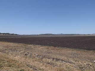
Toowoomba–Cecil Plains Road is a continuous 78.6 kilometres (48.8 mi) road route in the Toowoomba region of Queensland, Australia. Most of the road is not signed with any route number, but a short section near Cecil Plains is part of State Route 82. Toowoomba–Cecil Plains Road is a state-controlled district road, part of which is rated as a local road of regional significance (LRRS).

References

  1. Australian Bureau of Statistics (28 June 2022). "Purrawunda (suburb and locality)". Australian Census 2021 QuickStats. Retrieved 28 June 2022.  OOjs UI icon edit-ltr-progressive.svg
  2. "Purrawunda – locality in Toowoomba Region (entry 48045)". Queensland Place Names. Queensland Government . Retrieved 17 November 2019.
  3. 1 2 Australian Bureau of Statistics (28 June 2022). "Purrawunda (SAL)". 2021 Census QuickStats. Retrieved 28 February 2023. OOjs UI icon edit-ltr-progressive.svg
  4. Google (10 February 2022). "Purrawunda" (Map). Google Maps . Google. Retrieved 10 February 2022.
  5. 1 2 "Queensland Globe". State of Queensland . Retrieved 29 December 2023.
  6. "Vegetable production in South East Queensland". Department of Agriculture, Fisheries and Forestry. 15 April 2014. Archived from the original on 24 March 2015. Retrieved 4 November 2014.
  7. "Branch Of The Week - CECIL PLAINS". Railpage. Retrieved 5 June 2017.
  8. Australian Bureau of Statistics (27 June 2017). "Purrawunda (SSC)". 2016 Census QuickStats. Retrieved 20 October 2018. OOjs UI icon edit-ltr-progressive.svg
  9. "Landmark Areas - Queensland". Queensland Open Data. Queensland Government. 18 November 2020. Archived from the original on 21 November 2020. Retrieved 21 October 2020.
  10. "Our Facilities". JBS Australia. Archived from the original on 27 October 2014. Retrieved 27 October 2014.
  11. "About Us – Avigrain". Archived from the original on 27 October 2023. Retrieved 29 December 2023.
  12. "Layers: Locality; Schools and school catchments". Queensland Globe. Queensland Government. Archived from the original on 19 December 2017. Retrieved 29 December 2023.