South Toowoomba Toowoomba, Queensland | |||||||||||||||
---|---|---|---|---|---|---|---|---|---|---|---|---|---|---|---|
Coordinates | 27°34′34″S151°57′14″E / 27.5761°S 151.9538°E Coordinates: 27°34′34″S151°57′14″E / 27.5761°S 151.9538°E | ||||||||||||||
Population | 5,224 (2016 census) [1] | ||||||||||||||
• Density | 1,412/km2 (3,660/sq mi) | ||||||||||||||
Postcode(s) | 4350 | ||||||||||||||
Area | 3.7 km2 (1.4 sq mi) | ||||||||||||||
Time zone | AEST (UTC+10:00) | ||||||||||||||
Location | 2 km (1 mi) S of Toowoomba | ||||||||||||||
LGA(s) | Toowoomba Region | ||||||||||||||
State electorate(s) | Toowoomba South | ||||||||||||||
Federal Division(s) | Groom | ||||||||||||||
|
South Toowoomba is an urban locality in Toowoomba in the Toowoomba Region, Queensland, Australia. [2] In the 2016 census, South Toowoomba had a population of 5,224 people. [1]
South Toowoomba is located immediately south of the Toowoomba city centre. [3]
Giabal is an Australian Aboriginal language. The Giabal (Paiamba,Gomaingguru) language region includes the landscape within the local government boundaries of the Toowoomba Regional Council, particularly Toowoomba south to Allora and west to Millmerran. [4]
St Patrick's Catholic Primary School opened in 1863 at St Patrick's Catholic Church with lay teachers but from 1873 was operated by the Sisters of Mercy. St Patrick's Secondary School for Girls opened in 1914 and was renamed The Cathedral School in 1938. In 1959 the two schools were renamed St Saviour's Primary School and St Saviour's Secondary School. [5] Subsequently[ when? ] the secondary school was renamed St Saviour's College. From 1989 the secondary school came under lay administration. [6] In 1994 the primary school also came under lay administration. [7]
Toowoomba South State School opened in 1865. It was divided into Toowoomba South Girls and Infants School and Toowoomba South Boys School in 1869. On 1 April 1878 the Girls and Infants School split into Toowoomba Middle Girls State School No and Toowoomba Middle Infants State Schoo, but on 1 March 1880 they were merged to create Toowoomba Middle Girls and Infants State School. On 22 January 1883 the school was split again into Toowoomba South Girls State School and Toowoomba South Infants State School, being merged back on 1 October 1900 into Toowoomba South Girls and Infants School. In 1983 the Girls and Infants School and the Boys School were merged to re-establish Toowoomba South State School. [5] The school closed on 31 December 2013. [8]
In the 2016 census, South Toowoomba had a population of 5,224 people. [1]
St Saviour's Primary School is a Catholic primary (Prep-6) school for boys and girls at 14 Lawrence Street ( 27°34′15″S151°57′11″E / 27.5708°S 151.9530°E . [11] [12] In 2017, the school had an enrolment of 409 students with 25 teachers (21 full-time equivalent) and 19 non-teaching staff (9 full-time equivalent). [13]
St Saviour's College is a Catholic secondary (7-12) school for girls at Neil Street ( 27°34′20″S151°57′13″E / 27.5721°S 151.9535°E ). [11] [14] In 2017, the school had an enrolment of 158 students with 24 teachers (21 full-time equivalent) and 15 non-teaching staff (11 full-time equivalent). [13]
The University of Queensland Medical School is located at Toowoomba Hospital.
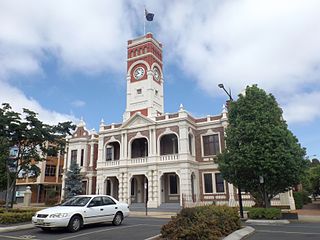
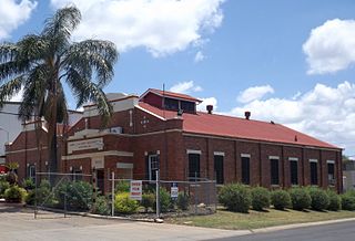
South Toowoomba has a number of heritage-listed sites, including:
Dalby is a town and locality in the Darling Downs region of Queensland, Australia. Dalby is within and is the administrative centre of the Western Downs Region. At the 2016 census, Dalby had a population of 12,719.
Inglewood is a rural town and locality in the Goondiwindi Region, Queensland, Australia. In the 2016 census, Inglewood had a population of 954 people. Inglewood is the second largest town in the Goondiwindi Region.
Fortitude Valley is an inner suburb of the City of Brisbane, the state capital of Queensland, Australia. In the 2016 census, Fortitude Valley had a population of 6,978 people.
Clifton is a rural town and locality in the Toowoomba Region, Queensland, Australia. In the 2016 census, Clifton had a population of 1,456 people.
Laidley is a rural town and locality in the Lockyer Valley Region, Queensland, Australia. In the 2016 census, Laidley had a population of 3,808 people.
Allora is a rural town and locality in the Southern Downs Region, Queensland, Australia. In the 2016 census, Allora had a population of 1,223 people.
Greenmount is a rural town and locality in the Toowoomba Region, Queensland, Australia. In the 2016 census the locality of Greenmount had a population of 699 people.
The Roman Catholic Diocese of Toowoomba is a Latin Rite suffragan diocese of the Archdiocese of Brisbane, established in 1929, covering the Darling Downs and south west regions of Queensland, Australia.
Millmerran, known as Domville between 1 June 1889 and 16 November 1894, is a town and a locality in the Toowoomba Region, Queensland, Australia. In the 2016 census, Millmerran had a population of 1,563 people.
Ipswich is the central suburb of the City of Ipswich, Queensland, Australia. It is also known as Ipswich CBD. In the 2016 census, the suburb had a population of 2,459 people.
Goombungee is a rural town and locality in the Toowoomba Region, Queensland, Australia. In the 2016 census the locality of Goombungee had a population of 1,026 people.
Centenary Heights is a residential locality in Toowoomba within the Toowoomba Region, Queensland, Australia. In the 2016 census, Centenary Heights had a population of 6,063 people.
Toowoomba City is an urban locality in the Toowoomba Region, Queensland, Australia. It is the central suburb of Toowoomba, containing its central business district. In the 2016 census, Toowoomba City had a population of 2,088 people.
East Toowoomba is a locality in the Toowoomba Region, Queensland, Australia. At the 2016 Australian Census East Toowoomba recorded a population of 5,244.
Harlaxton is a locality in the Toowoomba Region, Queensland, Australia. In the 2016 census, Harlaxton had a population of 2,547 people. Traditionally a rural area, most of the locality is now residential.
Harristown is a residential locality in Toowoomba in the Toowoomba Region, Queensland, Australia. In the 2016 census, Harristown had a population of 8,555 people.
Newtown is a residential locality in Toowoomba in the Toowoomba Region, Queensland, Australia. In the 2016 census, Newtown had a population of 9,596 people.
North Toowoomba is an urban locality in Toowoomba in the Toowoomba Region, Queensland, Australia. In the 2016 census, North Toowoomba had a population of 2,953 people.
Rangeville is a residential locality in Toowoomba in the Toowoomba Region, Queensland, Australia. In the 2016 census, Rangeville had a population of 8,312 people.
Haden is a rural town and locality in the Toowoomba Region, Queensland, Australia. In the 2016 census, Haden had a population of 195 people.
Wikimedia Commons has media related to South Toowoomba, Queensland . |