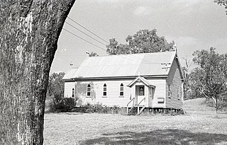
West Prairie, Queensland

Last updated

West Prairie
Queensland
Australia Queensland location map.svg
Red pog.svg
West Prairie
Coordinates 27°26′36″S151°24′32″E / 27.4433°S 151.4088°E / -27.4433; 151.4088 (West Prairie (centre of locality))
Population78 (2021 census) [1]
 • Density0.545/km2 (1.411/sq mi)
Postcode(s) 4403
Area143.2 km2 (55.3 sq mi)
Time zone AEST (UTC+10:00)
LGA(s) Toowoomba Region
State electorate(s) Condamine
Federal division(s) Groom
Suburbs around West Prairie:
St Ruth Formartin Jondaryan
Tipton West Prairie Jondaryan
Nangwee Norwin Bongeen
Mount Moriah

West Prairie is a rural locality in the Toowoomba Region, Queensland, Australia. [2] In the 2021 census, West Prairie had a population of 78 people. [1]

Contents

History

The locality takes its name from the Prairie pastoral run operated by Henry Stuart Russell in 1855. On Buxton's Map of the Darling Downs, 1864, the run is shown in the hands of Russell and Taylor. [2]

In 1877, 6,500 acres (2,600 ha) of land was resumed from the West Prairie pastoral run to establish smaller farms. The land was offered for selection on 24 April 1877. [3]

West Prairie Provisional School opened on 19 January 1885. On 1 January 1909 it became West Prairie State School. In 1918 it became a half-time provisional school in conjunction with St Ruth Provisional School (meaning the two schools shared a single teacher) and then it closed in early 1919. It reopened on 25 August 1925 but closed permanently in 1929. [4]

Demographics

In the 2016 census, West Prairie had a population of 79 people. [5]

In the 2021 census, West Prairie had a population of 78 people. [1]

Related Research Articles

<span class="mw-page-title-main">Cecil Plains, Queensland</span> Town in Queensland, Australia

Cecil Plains is a rural town and locality in the Toowoomba Region, Queensland, Australia. In the 2021 census, the locality of Cecil Plains had a population of 380 people.

<span class="mw-page-title-main">Pilton, Queensland</span> Town in Queensland, Australia

Pilton is a rural town and locality in the Toowoomba Region, Queensland, Australia. It is south of the city of Toowoomba. In the 2021 census, the locality of Pilton had a population of 71 people.

Hodgson Vale is a rural locality in the Toowoomba Region, Queensland, Australia. In the 2021 census, Hodgson Vale had a population of 1,444 people.

Yandilla is a rural locality in the Toowoomba Region, Queensland, Australia. In the 2021 census, Yandilla had a population of 50 people.

<span class="mw-page-title-main">Ascot, Queensland (Toowoomba Region)</span> Suburb of Toowoomba Region, Queensland, Australia

Ascot is a rural locality in the Toowoomba Region, Queensland, Australia. In the 2021 census, Ascot had a population of 106 people.

<span class="mw-page-title-main">Felton, Queensland</span> Suburb of Toowoomba Region, Queensland, Australia

Felton is a rural locality in the Toowoomba Region, Queensland, Australia. In the 2021 census, Felton had a population of 267 people.

Stonehenge is a rural locality in the Toowoomba Region, Queensland, Australia. In the 2021 census, Stonehenge had a population of 20 people.

Brush Creek is a rural locality in the Goondiwindi Region, Queensland, Australia. In the 2021 census, Brush Creek had a population of 39 people.

Canning Creek is a rural locality split between the Goondiwindi Region and the Toowoomba Region in Queensland, Australia. In the 2021 census, Canning Creek had a population of 21 people.

Devon Park is a rural locality in the Toowoomba Region, Queensland, Australia. In the 2021 census, Devon Park had a population of 55 people.
<span class="mw-page-title-main">North Branch, Queensland (Toowoomba Region)</span> Suburb of Toowoomba Region, Queensland, Australia

North Branch is a locality in the Toowoomba Region, Queensland, Australia. In the 2021 census, North Branch had a population of 48 people.

Rangemore is a rural locality in the Toowoomba Region, Queensland, Australia. In the 2021 census, Rangemore had "no people or a very low population".

St Ruth is a locality split between the Western Downs Region and the Toowoomba Region in Queensland, Australia. In the 2021 census, St Ruth had a population of 165 people.

Irvingdale is a locality split between the Toowoomba Region and the Western Downs Region, both in Queensland, Australia. In the 2021 census, Irvingdale had a population of 163 people.

Kolonga is a rural locality in the Bundaberg Region, Queensland, Australia. In the 2021 census, Kolonga had a population of 33 people.

Rosenthal Heights is a mixed-use locality in the Southern Downs Region, Queensland, Australia. In the 2021 census, Rosenthal Heights had a population of 2,664 people.

Felton South is a rural locality in the Toowoomba Region, Queensland, Australia. In the 2021 census, Felton South had a population of 78 people.

Dunmore is a rural locality in the Toowoomba Region, Queensland, Australia. In the 2021 census, Dunmore had a population of 39 people.

Rosalie Plains is a rural locality in the Toowoomba Region, Queensland, Australia. In the 2021 census, Rosalie Plains had a population of 54 people.

Emu Creek is a rural locality in the Toowoomba Region, Queensland, Australia. In the 2021 census, Emu Creek had a population of 113 people.

References

  1. 1 2 3 Australian Bureau of Statistics (28 June 2022). "West Prairie (SAL)". 2021 Census QuickStats. Retrieved 28 February 2023. OOjs UI icon edit-ltr-progressive.svg
  2. 1 2 "West Prairie – locality in Toowoomba Region (entry 49185)". Queensland Place Names. Queensland Government . Retrieved 29 December 2020.
  3. "Proclamations under the New Land Acts". The Brisbane Courier . Queensland, Australia. 2 March 1877. p. 3. Archived from the original on 27 August 2020. Retrieved 19 February 2020 via Trove.
  4. Queensland Family History Society (2010), Queensland schools past and present (Version 1.01 ed.), Queensland Family History Society, ISBN   978-1-921171-26-0
  5. Australian Bureau of Statistics (27 June 2017). "West Prairie (SSC)". 2016 Census QuickStats. Retrieved 20 October 2018. OOjs UI icon edit-ltr-progressive.svg