Kilbirnie, Queensland

Last updated

Kilbirnie
Queensland
Australia Queensland location map.svg
Red pog.svg
Kilbirnie
Coordinates 27°13′56″S151°49′26″E / 27.2322°S 151.8238°E / -27.2322; 151.8238 (Kilbirnie (centre of locality))
Population68 (2021 census) [1]
 • Density2.132/km2 (5.52/sq mi)
Postcode(s) 4354
Area31.9 km2 (12.3 sq mi)
Time zone AEST (UTC+10:00)
LGA(s) Toowoomba Region
State electorate(s) Condamine
Federal division(s) Groom
Suburbs around Kilbirnie:
Mount Darry Doctor Creek Haden
Highland Plains Kilbirnie Haden
Highland Plains Goombungee Goombungee

Kilbirnie is a rural locality in the Toowoomba Region, Queensland, Australia. [2] In the 2021 census, Kilbirnie had a population of 68 people. [1]

Contents

History

Mount Darry Provisional School opened on 28 August 1899. On 1 January 1909 it became Mount Darry State School. In 1915 it was renamed Zahley State School and in 1925 it was renamed Kilbirnie State School. It closed on 31 December 1961. [3] It was located at 752 Goombungee Kilburnie Road ( 27°13′22″S151°49′45″E / 27.2229°S 151.8293°E / -27.2229; 151.8293 (Mount Darry / Zahley / Kilburnie State School (former)) ). [4]

Demographics

In the 2016 census Kilbirnie had a population of 60 people. [5]

In the 2021 census, Kilbirnie had a population of 68 people. [1]

Related Research Articles

<span class="mw-page-title-main">Kingsthorpe, Queensland</span> Town in Queensland, Australia

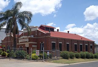
Kingsthorpe is a rural town and locality in the Toowoomba Region, Queensland, Australia. In the 2021 census, the locality of Kingsthorpe had a population of 2,159 people.

<span class="mw-page-title-main">Goombungee, Queensland</span> Town in Queensland, Australia

Goombungee is a rural town and locality in the Toowoomba Region, Queensland, Australia. In the 2016 census the locality of Goombungee had a population of 1,026 people.

<span class="mw-page-title-main">North Toowoomba, Queensland</span> Suburb of Toowoomba, Queensland, Australia

North Toowoomba is a suburban locality in Toowoomba in the Toowoomba Region, Queensland, Australia. In the 2021 census, North Toowoomba had a population of 3,332 people.

<span class="mw-page-title-main">South Toowoomba, Queensland</span> Suburb of Toowoomba, Queensland, Australia

South Toowoomba is an suburban locality in Toowoomba in the Toowoomba Region, Queensland, Australia. In the 2021 census, South Toowoomba had a population of 5,512 people.

<span class="mw-page-title-main">Ascot, Queensland (Toowoomba Region)</span> Suburb of Toowoomba Region, Queensland, Australia

Ascot is a rural locality in the Toowoomba Region, Queensland, Australia. In the 2021 census, Ascot had a population of 106 people.

<span class="mw-page-title-main">Linthorpe, Queensland</span> Suburb of Toowoomba Region, Queensland, Australia

Linthorpe is a rural locality in the Toowoomba Region, Queensland, Australia. In the 2021 census, Linthorpe had a population of 416 people.

<span class="mw-page-title-main">Purrawunda, Queensland</span> Suburb of Toowoomba Region, Queensland, Australia

Purrawunda is a rural locality in the Toowoomba Region, Queensland, Australia. In the 2021 census, Purrawunda had a population of 12 people.

<span class="mw-page-title-main">Mount Irving, Queensland</span> Suburb of Toowoomba Region, Queensland, Australia

Mount Irving is a rural locality in the Toowoomba Region, Queensland, Australia. In the 2021 census, Mount Irving had a population of 34 people.

<span class="mw-page-title-main">Groomsville, Queensland</span> Suburb of Toowoomba Region, Queensland, Australia

Groomsville is a rural locality in the Toowoomba Region on the Darling Downs, Queensland, Australia. In the 2021 census, Groomsville had a population of 132 people.

<span class="mw-page-title-main">Boodua, Queensland</span> Suburb of Toowoomba Region, Queensland, Australia

Boodua is a rural locality in the Toowoomba Region, Queensland, Australia. In the 2021 census, Boodua had a population of 95 people.

<span class="mw-page-title-main">Bergen, Queensland</span> Suburb of Toowoomba Region, Queensland, Australia

Bergen is a rural locality in the Toowoomba Region, Queensland, Australia. In the 2021 census, Bergen had a population of 85 people.

Greenwood is a rural locality in the Toowoomba Region, Queensland, Australia. In the 2021 census, Greenwood had a population of 34 people.

Mount Emlyn is a rural locality in the Toowoomba Region, Queensland, Australia. In the 2016 census Mount Emlyn had a population of 16 people.

<span class="mw-page-title-main">Umbiram, Queensland</span> Suburb of Toowoomba Region, Queensland, Australia

Umbiram is a rural locality in the Toowoomba Region, Queensland, Australia. In the 2021 census, Umbiram had a population of 146 people.

<span class="mw-page-title-main">Douglas, Queensland (Toowoomba Region)</span> Suburb of Toowoomba Region, Queensland, Australia

Douglas is a rural locality in the Toowoomba Region, Queensland, Australia. In the 2021 census, Douglas had a population of 152 people.

Turallin is a rural town and locality in the Toowoomba Region, Queensland, Australia. In the 2021 census, the locality of Turallin had a population of 64 people.

<span class="mw-page-title-main">Highland Plains, Queensland (Toowoomba Region)</span> Suburb of Toowoomba Region, Queensland, Australia

Highland Plains is a rural locality in the Toowoomba Region, Queensland, Australia. In the 2021 census, Highland Plains had a population of 60 people.

Cutella is a rural locality in the Toowoomba Region, Queensland, Australia. In the 2021 census, Cutella had a population of 45 people.

Mount Darry is a rural locality in the Toowoomba Region, Queensland, Australia. In the 2016 census Mount Darry had a population of 35 people.

Glenaven is a rural locality in the Toowoomba Region, Queensland, Australia. In the 2021 census, Glenaven had a population of 68 people.

References

  1. 1 2 3 Australian Bureau of Statistics (28 June 2022). "Kilbirnie (SAL)". 2021 Census QuickStats. Retrieved 28 February 2023. OOjs UI icon edit-ltr-progressive.svg
  2. "Kilbirnie – locality in Toowoomba Region (entry 47978)". Queensland Place Names. Queensland Government . Retrieved 29 December 2020.
  3. Queensland Family History Society (2010), Queensland schools past and present (Version 1.01 ed.), Queensland Family History Society, ISBN   978-1-921171-26-0
  4. "Parish of Goombungee" (Map). Queensland Government. 1947. Archived from the original on 16 December 2020. Retrieved 16 December 2020.
  5. Australian Bureau of Statistics (27 June 2017). "Kilbirnie (SSC)". 2016 Census QuickStats. Retrieved 20 October 2018. OOjs UI icon edit-ltr-progressive.svg