
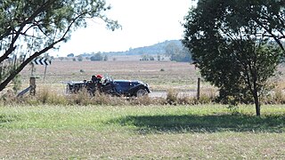
Nobby is a rural town and locality on the Darling Downs in the Toowoomba Region, Queensland, Australia. It is located halfway between Toowoomba and Warwick. It is known for its association with Steele Rudd (author) and Sister Elizabeth Kenny.

Ballard is a rural locality in the Lockyer Valley Region, Queensland, Australia. In the 2021 census, Ballard had a population of 167 people.

West Haldon is a locality split between Toowoomba Region and Lockyer Valley Region in Queensland, Australia. In the 2021 census, West Haldon had a population of 63 people.

East Greenmount is a rural town and locality in the Toowoomba Region, Queensland, Australia. In the 2021 census, the locality of East Greenmount had a population of 351 people.

Ascot is a rural locality in the Toowoomba Region, Queensland, Australia. In the 2021 census, Ascot had a population of 106 people.

Felton is a rural locality in the Toowoomba Region, Queensland, Australia. In the 2021 census, Felton had a population of 267 people.

Linthorpe is a rural locality in the Toowoomba Region, Queensland, Australia. In the 2021 census, Linthorpe had a population of 416 people.

Mount Irving is a rural locality in the Toowoomba Region, Queensland, Australia. In the 2021 census, Mount Irving had a population of 34 people.
Ryeford is a rural locality in the Toowoomba Region, Queensland, Australia. In the 2021 census, Ryeford had a population of 54 people.
Djuan is a rural locality in the Toowoomba Region, Queensland, Australia. In the 2021 census, Djuan had a population of 93 people.

Headington Hill is a rural locality in the Toowoomba Region, Queensland, Australia. In the 2021 census, Headington Hill had a population of 87 people.
North Branch is a locality in the Toowoomba Region, Queensland, Australia. In the 2021 census, North Branch had a population of 48 people.

Umbiram is a rural locality in the Toowoomba Region, Queensland, Australia. In the 2021 census, Umbiram had a population of 146 people.
Elphinstone is a rural locality in the Toowoomba Region, Queensland, Australia. In the 2021 census, Elphinstone had a population of 60 people.
Victoria Hill is a rural locality spit between the Southern Downs Region and the Toowoomba Region, both in Queensland, Australia. In the 2021 census, Victoria Hill had a population of 48 people.
Muniganeen is a rural locality in the Toowoomba Region, Queensland, Australia. In the 2021 census, Muniganeen had a population of 40 people.
Woondul is a rural locality in the Toowoomba Region, Queensland, Australia.
Scrubby Mountain is a rural locality in the Toowoomba Region, Queensland, Australia. In the 2021 census, Scrubby Mountain had a population of 203 people.
Kings Creek is a rural locality in the Toowoomba Region, Queensland, Australia. In the 2021 census, Kings Creek had a population of 55 people.
Mount Maria is a rural locality in the Gladstone Region, Queensland, Australia. In the 2021 census, Mount Maria had a population of 225 people.
