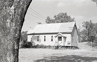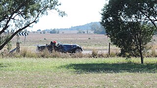
Millmerran, known as Domville between 1 June 1889 and 16 November 1894, is a town and a locality in the Toowoomba Region, Queensland, Australia. In the 2021 census, the locality of Millmerran had a population of 1,545 people.

Cecil Plains is a rural town and locality in the Toowoomba Region, Queensland, Australia. In the 2021 census, the locality of Cecil Plains had a population of 380 people.
Lemontree is a rural locality in the Toowoomba Region, Queensland, Australia. In the 2021 census, Lemontree had a population of 27 people.

Pampas is a rural locality in the Toowoomba Region, Queensland, Australia. In the 2021 census, Pampas had a population of 78 people.

Domville is a rural locality in the Toowoomba Region, Queensland, Australia. In the 2021 census, Domville had "no people or a very low population".
Clontarf is a rural locality in the Toowoomba Region, Queensland, Australia. In the 2021 census, Clontarf had a population of 28 people.
Ellangowan is a rural locality in the Toowoomba Region, Queensland, Australia. In the 2021 census, Ellangowan had a population of 95 people.

Bongeen is a rural locality in the Toowoomba Region, Queensland, Australia. In the 2021 census, Bongeen had a population of 71 people.

North Branch is a locality in the Toowoomba Region, Queensland, Australia. In the 2021 census, North Branch had a population of 48 people.
Turallin is a rural town and locality in the Toowoomba Region, Queensland, Australia. In the 2021 census, the locality of Turallin had a population of 64 people.

Western Creek is a locality in the Toowoomba Region, Queensland, Australia. In the 2021 census, Western Creek had "no people or a very low population".
Millmerran Woods is a rural locality in the Toowoomba Region, Queensland, Australia. In the 2021 census, Millmerran Woods had a population of 152 people.
Millmerran Downs is a rural locality in the Toowoomba Region, Queensland, Australia. In the 2021 census, Millmerran Downs had a population of 103 people.
Cypress Gardens is a rural residential locality in the Toowoomba Region, Queensland, Australia. In the 2021 census, Cypress Gardens had a population of 94 people.
Condamine Farms is a rural locality in the Toowoomba Region, Queensland, Australia. In the 2021 census, Condamine Farms had a population of 28 people.
Felton South is a rural locality in the Toowoomba Region, Queensland, Australia. In the 2021 census, Felton South had a population of 78 people.
Condamine Plains is a rural locality in the Toowoomba Region, Queensland, Australia. In the 2021 census, Condamine Plains had a population of 101 people.
Dunmore is a rural locality in the Toowoomba Region, Queensland, Australia. In the 2021 census, Dunmore had a population of 39 people.
Grays Gate is a rural locality in the Toowoomba Region, Queensland, Australia. In the 2021 census, Grays Gate had a population of 28 people.
There are two state-controlled roads linking Millmerran and Cecil Plains in the Toowoomba region of Queensland, Australia. They are Millmerran–Cecil Plains Road, which runs to the west of the Condamine River, and Pampas–Horrane Road, which runs east of the river.


