
Macalister is a rural town and locality in the Western Downs Region, Queensland, Australia. In the 2021 census, the locality of Macalister had a population of 156 people.
Moola is a rural locality in the Western Downs Region, Queensland, Australia. In the 2021 census, Moola had a population of 218 people.

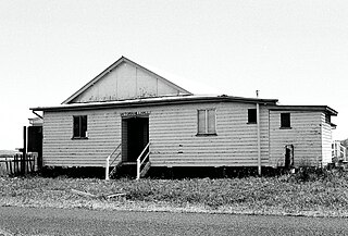
Boonarga is a rural locality in the Western Downs Region, Queensland, Australia. In the 2021 census, Boonarga had a population of 37 people.

Burra Burri is a locality in the Western Downs Region, Queensland, Australia. In the 2021 census, Burra Burri had a population of 32 people.
Baking Board is a rural locality in the Western Downs Region, Queensland, Australia. In the 2021 census, Baking Board had a population of 114 people.
Burncluith is a rural locality in the Western Downs Region, Queensland, Australia. In the 2021 census, Burncluith had a population of 137 people.
Canaga is a rural locality in the Western Downs Region, Queensland, Australia. In the 2021 census, Canaga had a population of 85 people.
Darr Creek is a rural locality in the Western Downs Region, Queensland, Australia. In the 2021 census, Darr Creek had a population of 13 people.
Fairyland is a rural locality in the Western Downs Region, Queensland, Australia. In the 2021 census, Fairyland had a population of 90 people.
Greenswamp is a rural locality in the Western Downs Region, Queensland, Australia. In the 2021 census, Greenswamp had a population of 77 people.
Tuckerang is a rural locality in the Western Downs Region, Queensland, Australia. In the 2021 census, Tuckerang had a population of 111 people.
Langlands is a rural locality in the Western Downs Region, Queensland, Australia. In the 2021 census, Langlands had a population of 30 people.
Pelican is a rural locality in the Western Downs Region, Queensland, Australia. In the 2021 census, Pelican had a population of 40 people.
Jinghi is a rural locality in the Western Downs Region, Queensland, Australia. In the 2021 census, Jinghi had a population of 70 people.
Victoria Hill is a rural locality spit between the Southern Downs Region and the Toowoomba Region, both in Queensland, Australia. In the 2021 census, Victoria Hill had a population of 48 people.
Hookswood is a locality in the Western Downs Region, Queensland, Australia. In the 2021 census, Hookswood had a population of 58 people.
Blackswamp is a rural locality in the Western Downs Region, Queensland, Australia. In the 2021 census, Blackswamp had a population of 54 people.
Cameby is a rural locality in the Western Downs Region, Queensland, Australia. In the 2021 census, Cameby had a population of 53 people.
Crossroads is a rural locality in the Western Downs Region, Queensland, Australia. In the 2021 census, Crossroads had a population of 127 people.
Chances Plain is a rural locality in the Western Downs Region, Queensland, Australia. In the 2021 census, Chances Plain had a population of 158 people.
