Withcott

Last updated

Withcott
Queensland
Withcott Hotel in Withcott Qld.jpg
Withcott Hotel
Australia Queensland location map.svg
Red pog.svg
Withcott
Coordinates 27°33′13″S152°01′26″E / 27.5536°S 152.0238°E / -27.5536; 152.0238 (Withcott (town centre))
Population2,067 (2021 census) [1]
 • Density67.33/km2 (174.4/sq mi)
Postcode(s) 4352
Area30.7 km2 (11.9 sq mi)
Time zone AEST (UTC+10:00)
Location
LGA(s) Lockyer Valley Region
State electorate(s) Lockyer
Federal division(s) Wright
Localities around Withcott:
Ballard Murphys Creek Lockyer
Mount Lofty
Prince Henry Heights
Withcott Postmans Ridge
Redwood Rangeville Blanchview

Withcott is a rural town and locality in the Lockyer Valley Region, Queensland, Australia. [2] [3] In the 2021 census, the locality of Withcott had a population of 2,067 people. [1]

Contents

Geography

Withcott is located in the Lockyer Valley at the foot of the Toowoomba range on the Toowoomba Connection Road, formerly part of the Warrego Highway, 116 kilometres (72 mi) west of the state capital, Brisbane and 10 kilometres (6.2 mi) east of the regional centre of Toowoomba.

History

Withcott Methodist Church was built in 1900 from timber at a cost of £90. It could seat 100 people. It has closed and been demolished. [4]

Withcott State School opened in September 1912 on the Toowoomba Commonage with headmaster Mr M. F. Ryan. When its enrolment fell to 8 students, it was closed on 30 April 1971 and the land sold. The school was at 159 Roches Road (corner of Little Oakey Creek Road, 27°32′30″S152°01′10″E / 27.5416°S 152.0195°E / -27.5416; 152.0195 (Withcott State School (original site)) ). [5] Due to increased population, Withcott State School was reopened on 31 January 1984 in a new location in Biggs Road with principal Lance Wilson. [6] [7]

Holy Family Catholic Church was built in 1990 from brick. [8]

Withcott Church of Christ was built in 1990 from brick. [9]

In 1969, the Upper Lockyer Withcott branch of the Queensland Country Women's Association built a hall at 4 Biggs Road, adjoining to the Warrego Highway. ( 27°33′16″S152°01′24″E / 27.55443°S 152.02333°E / -27.55443; 152.02333 (Withcott CWA Hall (former)) ). [10] It was demolished in late 2018 and has since been turned into a public day use facility, containing a bathroom and undercover dining & seating area. [11]

During the 2010–2011 Queensland floods, Withcott suffered extensive damage when a flash flood hit the town on 10 January 2011. [12]

Demographics

In the 2006 census, the town of Withcott had a population of 1,000 people. [13]

In the 2016 census, the locality of Withcott had a population of 1,844 people. [14]

In the 2021 census, the locality of Withcott had a population of 2,067 people. [1]

Education

Withcott State School Withcott State School, 2023 05.jpg
Withcott State School

Withcott State School is a government primary (Prep-6) school for boys and girls at 26 Biggs Road ( 27°33′34″S152°01′25″E / 27.5594°S 152.0237°E / -27.5594; 152.0237 (Withcott State School) ). [15] [16] In 2017, the school had an enrolment of 198 students with 17 teachers (13 full-time equivalent) and 17 non-teaching staff (9 full-time equivalent). [17] In 2022, the school had 239 students with 21 teachers (18 full-time equivalent) and 16 non-teaching staff (10 full-time equivalent). [18]

There are no secondary schools in Withcott. The nearest government secondary schools are Centenary Heights State High School in Centenary Heights to the south-west and Toowoomba State High School in Mount Lofty to the west, both in Toowoomba. [19]

Amenities

Holy Family Catholic Church is at 16 Rutherford Road ( 27°33′11″S152°01′47″E / 27.553179°S 152.0298°E / -27.553179; 152.0298 (Holy Family Catholic Church) ). [8] [20]

Withcott Church of Christ is at 42 Biggs Road ( 27°33′38″S152°01′32″E / 27.560499°S 152.0255°E / -27.560499; 152.0255 (Withcott Church of Christ) ). [21] [22]

Related Research Articles

<span class="mw-page-title-main">Gatton, Queensland</span> Town in Queensland, Australia

Gatton is a rural town and locality in the Lockyer Valley Region, Queensland, Australia. In the 2021 census, the locality of Gatton had a population of 7,851 people.

<span class="mw-page-title-main">Laidley, Queensland</span> Town in Queensland, Australia

Laidley is a rural town and locality in the Lockyer Valley Region, Queensland, Australia. In the 2021 census, the locality of Laidley had a population of 3,809 people.

<span class="mw-page-title-main">Grantham, Queensland</span> Town in Queensland, Australia

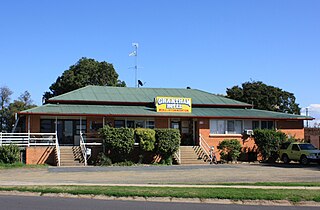
Grantham is a rural town and locality in the Lockyer Valley Region, Queensland, Australia. The town is located 100 kilometres (62 mi) west of the state capital, Brisbane. In the 2021 census, the locality of Grantham had a population of 796 people.

<span class="mw-page-title-main">Theebine</span> Town in Queensland, Australia

Theebine is a rural town and locality split between the Gympie Region and the Fraser Coast Region, both in Queensland, Australia.

<span class="mw-page-title-main">Forest Hill, Queensland</span> Town in Queensland, Australia

Forest Hill is a rural town and locality in the Lockyer Valley Region, Queensland, Australia. In the 2021 census, the locality of Forest Hill had a population of 935 people.

<span class="mw-page-title-main">Warrill View, Queensland</span> Town in Queensland, Australia

Warrill View is a rural town and locality in the Scenic Rim Region, Queensland, Australia. In the 2021 census, the locality of Warrill View had a population of 203 people.

<span class="mw-page-title-main">Geham</span> Suburb of Toowoomba Region, Queensland, Australia

Geham is a rural locality in the Toowoomba Region, Queensland, Australia. In the 2021 census, Geham had a population of 470 people.

<span class="mw-page-title-main">Mount Walker, Queensland</span> Suburb of Scenic Rim Region, Queensland, Australia

Mount Walker is a rural locality in the Scenic Rim Region, Queensland, Australia. In the 2021 census, Mount Walker had a population of 129 people.

Blanchview is a rural locality in the Lockyer Valley Region, Queensland, Australia. In the 2021 census, Blanchview had a population of 202 people.

<span class="mw-page-title-main">Mount Tyson, Queensland</span> Town in Queensland, Australia

Mount Tyson is a rural town and locality in the Toowoomba Region, Queensland, Australia. In the 2021 census, the locality of Mount Tyson had a population of 280 people.

<span class="mw-page-title-main">West Haldon, Queensland</span> Suburb of Toowoomba Region, Queensland, Australia

West Haldon is a locality split between Toowoomba Region and Lockyer Valley Region in Queensland, Australia. In the 2021 census, West Haldon had a population of 63 people.

<span class="mw-page-title-main">Teviotville, Queensland</span> Town in Queensland, Australia

Teviotville is a rural locality in the Scenic Rim Region, Queensland, Australia. In the 2021 census, Teviotville had a population of 114 people.

<span class="mw-page-title-main">Mount Sylvia, Queensland</span> Suburb of Lockyer Valley Region, Queensland, Australia

Mount Sylvia is a rural locality in the Lockyer Valley Region, Queensland, Australia. In the 2021 census, Mount Sylvia had a population of 70 people.

<span class="mw-page-title-main">Caffey, Queensland</span> Suburb of Lockyer Valley Region, Queensland, Australia

Caffey is a rural locality in the Lockyer Valley Region, Queensland, Australia. In the 2021 census, Caffey had a population of 45 people.

Cannon Creek is a rural locality in the Scenic Rim Region, Queensland, Australia. In the 2021 census, Cannon Creek had a population of 75 people.

Upper Lockyer is a rural locality in the Lockyer Valley Region, Queensland, Australia. In the 2021 census, Upper Lockyer had a population of 542 people.

Rockmount is a rural locality in the Lockyer Valley Region, Queensland, Australia. In the 2021 census, Rockmount had a population of 82 people.

<span class="mw-page-title-main">Upper Tenthill, Queensland</span> Suburb of Lockyer Valley Region, Queensland, Australia

Upper Tenthill is a rural locality in the Lockyer Valley Region, Queensland, Australia. In the 2021 census, Upper Tenthill had a population of 273 people.

<span class="mw-page-title-main">Bongeen, Queensland</span> Suburb of Toowoomba Region, Queensland, Australia

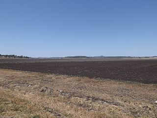
Bongeen is a rural locality in the Toowoomba Region, Queensland, Australia. In the 2021 census, Bongeen had a population of 71 people.

Pinelands is a rural locality in the Toowoomba Region, Queensland, Australia. In the 2021 census, Pinelands had a population of 81 people.

References

  1. 1 2 3 Australian Bureau of Statistics (28 June 2022). "Withcott (SAL)". 2021 Census QuickStats. Retrieved 28 February 2023. OOjs UI icon edit-ltr-progressive.svg
  2. "Withcott – town in Lockyer Valley Region (entry 37773)". Queensland Place Names. Queensland Government . Retrieved 16 November 2019.
  3. "Withcott – locality in Lockyer Valley Region (entry 45019)". Queensland Place Names. Queensland Government . Retrieved 16 November 2019.
  4. Blake, Thom. "Withcott Methodist Church". Queensland Religious Places. Archived from the original on 25 July 2023. Retrieved 23 June 2023.
  5. "Parish of Taylor". Queensland Government. 1940. Retrieved 26 July 2023.
  6. Queensland Family History Society (2010), Queensland schools past and present (Version 1.01 ed.), Queensland Family History Society, ISBN   978-1-921171-26-0
  7. "History". Withcott State School. 12 May 2020. Archived from the original on 2 March 2023. Retrieved 25 July 2023.
  8. 1 2 Blake, Thom. "Holy Family Catholic Church". Queensland Religious Places. Archived from the original on 25 July 2023. Retrieved 23 June 2023.
  9. Blake, Thom. "Withcott Church of Christ". Queensland Religious Places. Archived from the original on 25 July 2023. Retrieved 23 June 2023.
  10. "Withcott". Queensland Places. University of Queensland. Archived from the original on 11 March 2023. Retrieved 25 July 2023.
  11. "Branch Locations". Queensland Country Women's Association. Archived from the original on 26 December 2018. Retrieved 26 December 2018.
  12. Johnson, Callum (10 January 2010). "Withcott evacuated". Toowoomba Chronicle. Archived from the original on 13 January 2011. Retrieved 11 January 2011.
  13. Australian Bureau of Statistics (25 October 2007). "Withcott (L) (Urban Centre/Locality)". 2006 Census QuickStats. Retrieved 11 January 2011.
  14. Australian Bureau of Statistics (27 June 2017). "Withcott (SSC)". 2016 Census QuickStats. Retrieved 20 October 2018. OOjs UI icon edit-ltr-progressive.svg
  15. "State and non-state school details". Queensland Government. 9 July 2018. Archived from the original on 21 November 2018. Retrieved 21 November 2018.
  16. "Withcott State School". Withcott State School. 29 November 2020. Archived from the original on 2 March 2023. Retrieved 25 July 2023.
  17. "ACARA School Profile 2017". Archived from the original on 22 November 2018. Retrieved 22 November 2018.
  18. "School annual report 2022" (PDF). Withcott State School. Archived (PDF) from the original on 25 July 2023. Retrieved 25 July 2023.
  19. "Queensland Globe". State of Queensland . Retrieved 25 July 2023.
  20. "Holy Family Church, Withcott". Roman Catholic Diocese of Toowoomba. Archived from the original on 4 March 2023. Retrieved 25 July 2023.
  21. Blake, Thom. "Withcott Church of Christ". Queensland Religious Places. Archived from the original on 25 July 2023. Retrieved 23 June 2023.
  22. "Home". Withcott Church. Archived from the original on 9 June 2023. Retrieved 25 July 2023.