Kensington Grove, Queensland

Last updated

Kensington Grove
Queensland
Australia Queensland location map.svg
Red pog.svg
Kensington Grove
Coordinates 27°31′55″S152°28′18″E / 27.5319°S 152.4716°E / -27.5319; 152.4716 (Kensington Grove (centre of locality))
Population2,050 (2021 census) [1]
 • Density188.1/km2 (487/sq mi)
Postcode(s) 4341
Area10.9 km2 (4.2 sq mi)
Location
LGA(s) Lockyer Valley Region
State electorate(s) Lockyer
Federal division(s) Wright
Suburbs around Kensington Grove:
Brightview Brightview Brightview
Regency Downs Kensington Grove Prenzlau
Hatton Vale Hatton Vale Hatton Vale

Kensington Grove is a rural residential locality in the Lockyer Valley Region, Queensland, Australia. [2] In the 2021 census, Kensington Grove had a population of 2,050 people. [1]

Contents

Geography

The land use is predominantly rural residential with some grazing on native vegetation in the east and north-west of the locality. [3]

History

A war memorial was unveiled on Wednesday 8 November 1995, commemorating the 50th anniversary of the end of World War II by remembering thel residents of Laidley Shire who served in Australia and overseas during the war. [4] It is located in the Memorial Park on Thallon Road ( 27°32′28″S152°27′53″E / 27.54116°S 152.46467°E / -27.54116; 152.46467 (Laidley Shire war memorial) ). [5] [6]

Demographics

In the 2016 census, Kensington Grove had a population of 1,717 people. [7]

In the 2021 census, Kensington Grove had a population of 2,050 people. [1]

Education

There are no schools in Kensington Grove. The nearest government primary school is Hatton Vale State School in neighbouring Hatton Vale to the south. The nearest government secondary schools are Lowood State High School in Lowood to the north-east and Laidley State High School in Laidley to the south-west. [8]

Amenities

There are a number of parks in the area:

Related Research Articles

<span class="mw-page-title-main">Laidley, Queensland</span> Town in Queensland, Australia

Laidley is a rural town and locality in the Lockyer Valley Region, Queensland, Australia. In the 2021 census, the locality of Laidley had a population of 3,809 people.
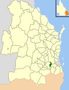
<span class="mw-page-title-main">Shire of Laidley</span> Local government area in Queensland, Australia

The Shire of Laidley was a local government area located in the Lockyer Valley region between the cities of Toowoomba and Ipswich, and about 70 kilometres (43 mi) west of Brisbane, the state capital of Queensland, Australia. The shire covered an area of 700.6 square kilometres (270.5 sq mi), and existed from 1888 until its merger with the Shire of Gatton to form the Lockyer Valley Region on 15 March 2008.

Glamorgan Vale is a rural town and locality in the Somerset Region, Queensland, Australia. In the 2021 census, the locality of Glamorgan Vale had a population of 384 people.
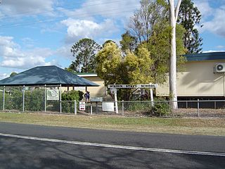
<span class="mw-page-title-main">Minden, Queensland</span> Town in Queensland, Australia

Minden is a rural town and locality in the Somerset Region, Queensland, Australia. The town is 64 kilometres (40 mi) west of the state capital, Brisbane. In the 2021 census, the locality of Minden had a population of 1,227 people.
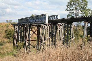
<span class="mw-page-title-main">Clarendon, Queensland</span> Suburb of Somerset Region, Queensland, Australia

Clarendon is a rural locality in the Somerset Region, Queensland, Australia. In the 2021 census, Clarendon had a population of 232 people.

<span class="mw-page-title-main">Forest Hill, Queensland</span> Town in Queensland, Australia

Forest Hill is a rural town and locality in the Lockyer Valley Region, Queensland, Australia. In the 2021 census, the locality of Forest Hill had a population of 935 people.
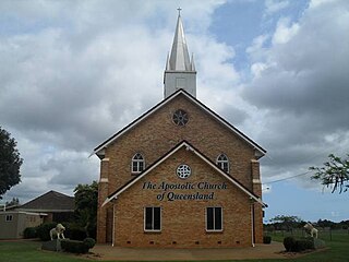
<span class="mw-page-title-main">Hatton Vale</span> Suburb of Lockyer Valley Region, Queensland, Australia

Hatton Vale is a rural locality in the Lockyer Valley Region, Queensland, Australia. In the 2021 census, Hatton Vale had a population of 1,555 people.

<span class="mw-page-title-main">Lockrose</span> Suburb of Lockyer Valley Region, Queensland, Australia

Lockrose is a rural locality split between the Lockyer Valley Region and Somerset Region of Queensland, Australia. In the 2021 census, Lockrose had a population of 564 people.

<span class="mw-page-title-main">College View, Queensland</span> Suburb of Lockyer Valley Region, Queensland, Australia

College View is a rural locality in the Lockyer Valley Region, Queensland, Australia. In the 2021 census, College View had a population of 72 people.

Morton Vale is a rural locality in the Lockyer Valley Region, Queensland, Australia. In the 2021 census, Morton Vale had a population of 114 people.

<span class="mw-page-title-main">Mount Berryman, Queensland</span> Suburb of Lockyer Valley Region, Queensland, Australia

Mount Berryman is a rural locality in the Lockyer Valley Region, Queensland, Australia. In the 2021 census, Mount Berryman had a population of 96 people.

Summerholm is a rural locality in the Lockyer Valley Region, Queensland, Australia. In the 2021 census, Summerholm had a population of 646 people.

Townson is a rural locality in the Lockyer Valley Region, Queensland, Australia. In the 2021 census, Townson had a population of 52 people.

<span class="mw-page-title-main">Brightview, Queensland</span> Suburb of Somerset Region, Queensland, Australia

Brightview is a locality split between the Lockyer Valley Region and Somerset Region, Queensland, Australia. In the 2021 census, Brightview had a population of 911 people.

Laidley Creek West is a rural locality in the Lockyer Valley Region, Queensland, Australia. In the 2021 census, Laidley Creek West had a population of 143 people.

<span class="mw-page-title-main">Laidley Heights, Queensland</span> Suburb of Lockyer Valley Region, Queensland, Australia

Laidley Heights is a rural residential locality on the outskirts of the town of Laidley in the Lockyer Valley Region, Queensland, Australia. In the 2021 census, Laidley Heights had a population of 1,429 people.

Laidley South is a rural locality in the Lockyer Valley Region, Queensland, Australia. In the 2021 census, Laidley South had a population of 293 people.

<span class="mw-page-title-main">Lockyer Waters, Queensland</span> Suburb of Lockyer Valley Region, Queensland, Australia

Lockyer Waters is a rural locality in the Lockyer Valley Region, Queensland, Australia. In the 2021 census, Lockyer Waters had a population of 538 people.

Regency Downs is a mixed-use locality in the Lockyer Valley Region, Queensland, Australia. In the 2021 census, Regency Downs had a population of 2,623 people, an increase of 12% from the 2016 census.

References

  1. 1 2 3 Australian Bureau of Statistics (28 June 2022). "Kensington Grove (SAL)". 2021 Census QuickStats. Retrieved 28 February 2023. OOjs UI icon edit-ltr-progressive.svg
  2. "Kensington Grove – locality in Lockyer Valley Region (entry 45005)". Queensland Place Names. Queensland Government . Retrieved 12 November 2018.
  3. "Layers: Locality; Protected areas and forests; Land use". Queensland Globe. Queensland Government. Archived from the original on 19 December 2017. Retrieved 31 August 2024.
  4. "Australia Remembers Memorial". Monument Australia. Retrieved 31 August 2024.
  5. "Australia Remembers Memorial". Monument Australia. Archived from the original on 22 November 2023. Retrieved 1 September 2024.
  6. "Hatton Vale War Memorial". Anzac Square & Memorial Galleries. Retrieved 1 September 2024.
  7. Australian Bureau of Statistics (27 June 2017). "Kensington Grove (SSC)". 2016 Census QuickStats. Retrieved 20 October 2018. OOjs UI icon edit-ltr-progressive.svg
  8. "Layers: Locality; Schools and school catchments". Queensland Globe. Queensland Government. Archived from the original on 19 December 2017. Retrieved 31 August 2024.
  9. 1 2 "Land for public recreation - Queensland". Queensland Open Data. Queensland Government. 20 November 2020. Archived from the original on 22 November 2020. Retrieved 22 November 2020.